Category:Maps of rivers in Arkansas
Jump to navigation
Jump to search
States of the United States: Alabama · Alaska · Arizona · Arkansas · California · Colorado · Connecticut · Delaware · Florida · Georgia · Idaho · Illinois · Indiana · Iowa · Kansas · Kentucky · Louisiana · Maine · Maryland · Massachusetts · Michigan · Minnesota · Mississippi · Missouri · Montana · Nebraska · Nevada · New Hampshire · New Jersey · New Mexico · New York · North Carolina · North Dakota · Ohio · Oklahoma · Oregon · Pennsylvania · Rhode Island · South Carolina · South Dakota · Tennessee · Texas · Utah · Vermont · Virginia · Washington · West Virginia · Wisconsin · Wyoming – Washington, D.C.
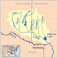
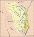
- English: Maps of the Rivers in Arkansas.
Subcategories
This category has the following 2 subcategories, out of 2 total.
A
- Maps of the Arkansas River (19 F)
B
Media in category "Maps of rivers in Arkansas"
The following 17 files are in this category, out of 17 total.
-
Arkansasrivermap.jpg 771 × 533; 259 KB
-
Boeufrivermap.png 465 × 500; 223 KB
-
Bradley County Arkansas Rivers & Creeks.svg 423 × 430; 145 KB
-
Bulletin of the U.S. Department of Agriculture (1913-1923.) (19876233584).jpg 3,828 × 2,355; 1.41 MB
-
Bulletin of the U.S. Department of Agriculture (1913-1923.) (19877983043).jpg 3,814 × 2,272; 1.21 MB
-
Cacherivermap.png 500 × 500; 145 KB
-
Little red rivermap.png 500 × 500; 124 KB
-
Littlemorivermap.png 465 × 500; 217 KB
-
Neoshorivermap.png 500 × 500; 129 KB
-
Ouachita watershed.png 288 × 336; 80 KB
-
Red watershed.png 250 × 188; 23 KB
-
Redrivermap.jpg 856 × 532; 262 KB
-
Redrivermap1.jpg 837 × 524; 255 KB
-
Salinerivermap.png 465 × 500; 223 KB
-
Stfrancisrivermap.png 500 × 749; 222 KB
-
Tensasrivermap.png 465 × 500; 221 KB
-
White River AR.png 550 × 534; 22 KB


