Category:Maps of rivers in Pennsylvania
Jump to navigation
Jump to search
States of the United States: Alabama · Alaska · Arizona · Arkansas · California · Colorado · Connecticut · Delaware · Florida · Georgia · Idaho · Illinois · Indiana · Iowa · Kansas · Kentucky · Louisiana · Maine · Maryland · Massachusetts · Michigan · Minnesota · Mississippi · Missouri · Montana · Nebraska · Nevada · New Hampshire · New Jersey · New Mexico · New York · North Carolina · North Dakota · Ohio · Oklahoma · Oregon · Pennsylvania · Rhode Island · South Carolina · South Dakota · Tennessee · Texas · Utah · Vermont · Virginia · Washington · West Virginia · Wisconsin · Wyoming – Washington, D.C.
Subcategories
This category has the following 5 subcategories, out of 5 total.
Media in category "Maps of rivers in Pennsylvania"
The following 36 files are in this category, out of 36 total.
-
1687HolmeMapProvRoad.jpg 312 × 586; 97 KB
-
1687ThoHolmeMapBrandywine.jpg 702 × 2,091; 426 KB
-
1687THolmeMapWissa.jpg 402 × 587; 105 KB
-
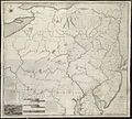
1795 Schuykill Navigation company Map for PA canals.jpg 2,047 × 1,494; 2.03 MB
-
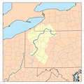
Alleghenyrivermap.png 500 × 500; 139 KB
-
Battle of Brandywine 1777.jpg 2,672 × 4,567; 9.84 MB
-
Beaverriverpamap.png 500 × 500; 98 KB
-
Monon-CheatRiver.png 387 × 466; 46 KB
-
Chesapeakewatershedmap.png 1,500 × 1,656; 2.79 MB
-
Christina brandywine.png 500 × 500; 29 KB
-
Course of Beatty Run (Sugar Creek tributary).jpg 1,056 × 816; 288 KB
-
Delaware river chart 1655.jpeg 3,329 × 1,408; 848 KB
-
DelawareRiverBasin-01.png 1,578 × 1,830; 2.63 MB
-
Delawarerivermap.png 1,000 × 1,005; 424 KB
-
Dock Creek.png 750 × 621; 984 KB
-
Fishingcreek susquehanna rivermap.png 1,000 × 1,006; 527 KB
-
Imboden's movements.png 909 × 663; 852 KB
-
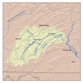
Juniatamap.png 500 × 500; 319 KB
-
Lackariversmap.png 500 × 500; 107 KB
-
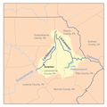
Lehighrivermap.png 300 × 300; 22 KB
-
Major Watersheds in Lycoming County Pennsylvania.png 823 × 558; 31 KB
-
Map of Youghiogheny River Watershed in Pennsylvania Maryland West Virginia.jpg 2,404 × 3,366; 823 KB
-
Monocacy.png 1,000 × 1,172; 544 KB
-
Monon CheatRiver.png 385 × 463; 48 KB
-
Monon YoughioghenyRiver.png 361 × 439; 52 KB
-
Monon-Monongahela.png 387 × 466; 48 KB
-
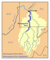
Monongahela River.png 361 × 439; 51 KB
-
NeshaminyCreek.jpg 1,742 × 1,293; 561 KB
-
Ohiorivermap.png 467 × 469; 76 KB
-
Schuylkillmap.png 600 × 603; 163 KB
-
Watershed of Lake Creek (Sugar Creek tributary).jpg 1,056 × 816; 132 KB
-
Wbsusquehannamap.jpg 1,008 × 628; 325 KB


