Category:Maps of the Susquehanna River
Jump to navigation
Jump to search
- English: Maps of the Susquehanna River — in the Eastern United States.
Media in category "Maps of the Susquehanna River"
The following 30 files are in this category, out of 30 total.
-
Susquehanna River watershed.png 1,000 × 1,005; 373 KB
-
Wbsusquehannamap.jpg 1,008 × 628; 325 KB
-
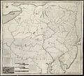
1756 Lotter Map of Eastern Pennsylvania, & New Jersey cropped from Geographicus-1756.jpg 3,600 × 2,700; 4.38 MB
-
1795 Schuykill Navigation company Map for PA canals.jpg 2,047 × 1,494; 2.03 MB
-
A Map Of The State Of Pennsylvania by Reading Howell, 1792 crop1.png 900 × 675; 1.15 MB
-
C&PD RR map 1895.jpg 593 × 712; 553 KB
-
Conowingo Map 1900.jpg 587 × 407; 157 KB
-
Map of Colonial Maryland.jpg 2,840 × 1,920; 713 KB
-
Sign for Lower Susquehanna Heritage Greenway Trail (2022).jpg 2,304 × 3,456; 3.2 MB
-
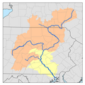
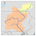
Sub-watersheds of the Susquehanna River.png 500 × 500; 139 KB
-
Susquehanna River to Schuylkill River, Chesapeake Bay to Delaware Bay. NYPL484199.tiff 4,991 × 4,117; 58.79 MB
-
Susquehanna watershed.png 1,153 × 833; 979 KB
-
The story of some French refugees and their "Azilum," 1793-1800 (1903) (14786911273).jpg 3,076 × 2,134; 495 KB
-
Susquehanna Boom Map Split.PNG 1,057 × 1,013; 71 KB
-
Susquehanna Boom Map Vertical.PNG 503 × 1,921; 68 KB
-
Susquehanna Boom Map.PNG 1,921 × 503; 65 KB


