Category:Maps of the Illinois River
Jump to navigation
Jump to search
Media in category "Maps of the Illinois River"
The following 25 files are in this category, out of 25 total.
-
 1721 Map of the new part of French Louisiana.jpg 8,104 × 6,291; 14.19 MB
-

-
 Approximate Geographic Extent of Havana Hopewell.pdf 1,275 × 1,650; 14.29 MB
-
 Bulletin (1901) (19806118103).jpg 4,030 × 1,402; 1.62 MB
-
 Bulletin (1918) (14598506339).jpg 3,428 × 1,682; 380 KB
-
 Bulletin (1918) (14598535278).jpg 2,622 × 1,442; 332 KB
-
 Bulletin (1918) (14598660577).jpg 2,636 × 1,458; 347 KB
-
 Bulletin (1918) (14782818754).jpg 2,616 × 1,454; 275 KB
-
 Bulletin (1918) (14785173185).jpg 2,632 × 1,438; 284 KB
-
 Bulletin (1918) (14805020483).jpg 2,642 × 1,434; 303 KB
-
 Bulletin (1918) (14805021673).jpg 2,634 × 1,450; 280 KB
-
 Bulletin of the Illinois State Laboratory of Natural History (1901) (14576813829).jpg 4,964 × 2,034; 1.27 MB
-
 Des Plaines River.png 1,000 × 1,555; 692 KB
-

-
 FMIB 37757 Diamond I-sland-.jpeg 839 × 590; 102 KB
-
 Illinois 1718.jpg 589 × 737; 232 KB
-
 Illinois-michigan-canal.png 626 × 531; 358 KB
-
 IllinoisRiver watershed.png 300 × 331; 100 KB
-
 Ohio archæological and historical quarterly (1887) (14578061279).jpg 1,972 × 1,428; 345 KB
-
 Pais des Illinois.jpg 780 × 570; 363 KB
-
 Plan du Fort des Sauvages Renards.jpg 6,091 × 2,942; 6.3 MB
-
 Sewage disposal (1919) (14779803815).jpg 1,544 × 2,392; 231 KB
-

-
 Starved Rock State Park.PNG 573 × 424; 45 KB
-
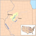 Spoonrivermap.png 500 × 500; 125 KB

_(14598506339).jpg)
_(14598535278).jpg)
_(14598660577).jpg)
_(14782818754).jpg)
_(14785173185).jpg)
_(14805020483).jpg)
_(14805021673).jpg)

_along_the_lower_Illinois_River_(1988)_(20965372542).jpg)


_(14578061279).jpg)


_(14779803815).jpg)


_(19175430298).jpg)
_(19806118103).jpg)
_(14576813829).jpg)