Category:Maps of counties of Ohio
Appearance
States of the United States: Alabama · Alaska · Arizona · Arkansas · California · Colorado · Connecticut · Delaware · Florida · Georgia · Hawaii · Idaho · Illinois · Indiana · Iowa · Kansas · Kentucky · Louisiana · Maine · Maryland · Massachusetts · Michigan · Minnesota · Mississippi · Missouri · Montana · Nebraska · Nevada · New Hampshire · New Jersey · New Mexico · New York · North Carolina · North Dakota · Ohio · Oklahoma · Oregon · Pennsylvania · Rhode Island · South Carolina · South Dakota · Tennessee · Texas · Utah · Vermont · Virginia · Washington · West Virginia · Wisconsin · Wyoming
Counties of Ohio: Adams · Allen · Ashland · Ashtabula · Athens · Auglaize · Belmont · Brown · Butler · Carroll · Champaign · Clark · Clermont · Clinton · Columbiana · Coshocton · Crawford · Cuyahoga · Darke · Defiance · Delaware · Erie · Fairfield · Fayette · Franklin · Fulton · Gallia · Geauga · Greene · Guernsey · Hamilton · Hancock · Hardin · Harrison · Henry · Highland · Hocking · Holmes · Huron · Jackson · Jefferson · Knox · Lake · Lawrence · Licking · Logan · Lorain · Lucas · Madison · Mahoning · Marion · Medina · Meigs · Mercer · Miami · Monroe · Montgomery · Morgan · Morrow · Muskingum · Noble · Ottawa · Paulding · Perry · Pickaway · Pike · Portage · Preble · Putnam · Richland · Ross · Sandusky · Scioto · Seneca · Shelby · Stark · Summit · Trumbull · Tuscarawas · Union · Van Wert · Vinton · Warren · Washington · Wayne · Williams · Wood · Wyandot
Subcategories
This category has the following 89 subcategories, out of 89 total.
*
A
B
C
D
E
F
G
H
J
K
L
M
N
O
P
R
S
T
U
V
W
Media in category "Maps of counties of Ohio"
The following 34 files are in this category, out of 34 total.
-
Amish in Ohio locator map.svg 512 × 545; 516 KB
-
Appalachian Ohio Counties.png 274 × 300; 12 KB
-
Blank county map of Ohio.png 274 × 300; 6 KB
-
Blank map subdivisions Ohio.svg 76 × 87; 36 KB
-
Extremenorthwestohio.PNG 199 × 222; 2 KB
-
Map Room.jpg 1,920 × 1,277; 431 KB
-
Mid Ohio Counties.svg 3,675 × 3,995; 154 KB
-
Mid-Ohio counties map.PNG 557 × 599; 184 KB
-
NE Ohio Counties.svg 3,675 × 3,995; 154 KB
-
NRHP Ohio Map.svg 1,056 × 816; 11.13 MB
-
NW Ohio Counties.svg 3,675 × 3,995; 154 KB
-
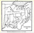
Ohio Counties 1802.png 649 × 621; 254 KB
-
Ohio counties by race.svg 230 × 260; 25 KB
-
Ohio counties cities and villages with domestic partnerships.svg 230 × 260; 54 KB
-
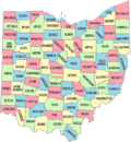
Ohio counties color map.png 733 × 793; 55 KB
-
Ohio Counties highlight Northwest Ohio.gif 1,176 × 1,442; 92 KB
-
Ohio Counties highlighting Extreme Northwest Ohio.gif 1,176 × 1,442; 94 KB
-
Ohio Counties Labeled White ja.svg 3,675 × 3,995; 150 KB
-
Ohio Counties Labeled White.svg 3,675 × 3,995; 154 KB
-
Ohio counties map.png 804 × 865; 53 KB
-
Ohio Counties.gif 1,176 × 1,442; 93 KB
-
Ohio county map, cb 500k.svg 810 × 810; 32 KB
-
Ohio Glass Making Centers 1888.jpg 550 × 633; 43 KB
-
Ohio Locator Map with US.PNG 292 × 267; 12 KB
-
Ohio Locator Map.PNG 288 × 263; 9 KB
-
Ohio Statehouse map room floor, Miami and Shelby counties.jpg 4,032 × 3,024; 7.03 MB
-
Ohio’s counties and their county route shields.svg 3,675 × 3,995; 715 KB
-
SE Ohio Counties.svg 3,675 × 3,995; 154 KB
-
Snow-removal-cleveland-3.jpg 478 × 601; 109 KB
-
SW Ohio Counties.svg 3,675 × 3,995; 154 KB
-
Unintentional prescription drug deaths-Ohio-2004-2008.jpg 1,200 × 1,120; 813 KB
-
USA Ohio location map.svg 1,010 × 1,200; 455 KB
-
Zane's Trace.png 795 × 605; 332 KB


