Category:Maps of counties of Indiana
Jump to navigation
Jump to search
States of the United States: Alabama · Alaska · Arizona · Arkansas · California · Colorado · Connecticut · Delaware · Florida · Georgia · Hawaii · Idaho · Illinois · Indiana · Iowa · Kansas · Kentucky · Louisiana · Maine · Maryland · Massachusetts · Michigan · Minnesota · Mississippi · Missouri · Montana · Nebraska · Nevada · New Hampshire · New Jersey · New Mexico · New York · North Carolina · North Dakota · Ohio · Oklahoma · Oregon · Pennsylvania · Rhode Island · South Carolina · South Dakota · Tennessee · Texas · Utah · Vermont · Virginia · Washington · West Virginia · Wisconsin · Wyoming
Counties of Indiana: Adams · Allen · Bartholomew · Benton · Blackford · Boone · Brown · Carroll · Cass · Clark · Clay · Clinton · Crawford · Daviess · Dearborn · Decatur · DeKalb · Delaware · Dubois · Elkhart · Fayette · Floyd · Fountain · Franklin · Fulton · Gibson · Grant · Greene · Hamilton · Hancock · Harrison · Hendricks · Henry · Howard · Huntington · Jackson · Jasper · Jay · Jefferson · Jennings · Johnson · Knox · Kosciusko · LaGrange · Lake · LaPorte · Lawrence · Madison · Marion · Marshall · Martin · Miami · Monroe · Montgomery · Morgan · Newton · Noble · Ohio · Orange · Owen · Parke · Perry · Pike · Porter · Posey · Pulaski · Putnam · Randolph · Ripley · Rush · Scott · Shelby · Spencer · St. Joseph · Starke · Steuben · Sullivan · Switzerland · Tippecanoe · Tipton · Union · Vanderburgh · Vermillion · Vigo · Wabash · Warren · Warrick · Washington · Wayne · Wells · White · Whitley
Subcategories
This category has the following 92 subcategories, out of 92 total.
*
A
B
C
D
E
F
G
H
J
K
L
M
N
O
P
R
S
T
U
V
W
Media in category "Maps of counties of Indiana"
The following 20 files are in this category, out of 20 total.
-
 Blank map subdivisions Indiana.svg 56 × 97; 31 KB
-
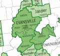 EvansvilleMSA-Census04.gif 480 × 450; 39 KB
-
 Geo Map of Median Income by County in Indiana.png 1,008 × 882; 309 KB
-
 INDemPrimaryCounties08.png 683 × 1,020; 38 KB
-
 Indiana (SWI).PNG 416 × 368; 9 KB
-
 Indiana counties and cities with domestic partnerships.svg 266 × 420; 57 KB
-

-
 Indiana Counties April 1, 1813.GIF 536 × 810; 9 KB
-
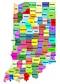 Indiana Counties.jpg 4,579 × 6,401; 1.15 MB
-
 Indiana county map (cropped).png 552 × 812; 124 KB
-
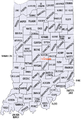
 Indiana county map.png 732 × 865; 97 KB
-
 Indiana population map.png 600 × 600; 155 KB
-
 INDOT districts.png 388 × 464; 128 KB
-
 Location of battles fought in Indiana.jpg 320 × 508; 166 KB
-
 Map of Indiana Counties.jpg 334 × 550; 119 KB
-
 Metro Indy.PNG 196 × 217; 5 KB
-
 NRHP Indiana Map.svg 765 × 990; 9.67 MB
-
 Southern Indiana tiered.JPG 411 × 612; 48 KB
-
 Southwest Indiana Townships.PNG 901 × 833; 313 KB
-
 Wikinews Indiana Map.png 587 × 865; 47 KB


.PNG)


.png)


