Category:Maps of counties of Idaho
Jump to navigation
Jump to search
States of the United States: Alabama · Alaska · Arizona · Arkansas · California · Colorado · Connecticut · Delaware · Florida · Georgia · Hawaii · Idaho · Illinois · Indiana · Iowa · Kansas · Kentucky · Louisiana · Maine · Maryland · Massachusetts · Michigan · Minnesota · Mississippi · Missouri · Montana · Nebraska · Nevada · New Hampshire · New Jersey · New Mexico · New York · North Carolina · North Dakota · Ohio · Oklahoma · Oregon · Pennsylvania · Rhode Island · South Carolina · South Dakota · Tennessee · Texas · Utah · Vermont · Virginia · Washington · West Virginia · Wisconsin · Wyoming
Counties of Idaho: Ada · Adams · Bannock · Bear Lake · Benewah · Bingham · Blaine · Boise · Bonner · Bonneville · Boundary · Butte · Camas · Canyon · Caribou · Cassia · Clark · Clearwater · Custer · Elmore · Franklin · Fremont · Gem · Gooding · Idaho · Jefferson · Jerome · Kootenai · Latah · Lemhi · Lewis · Lincoln · Madison · Minidoka · Nez Perce · Oneida · Owyhee · Payette · Power · Shoshone · Teton · Twin Falls · Valley · Washington
Subcategories
This category has the following 46 subcategories, out of 46 total.
*
A
- Maps of Adams County, Idaho (8 F)
B
- Maps of Bear Lake County, Idaho (14 F)
- Maps of Benewah County, Idaho (13 F)
- Maps of Bingham County, Idaho (26 F)
- Maps of Blaine County, Idaho (15 F)
- Maps of Boise County, Idaho (17 F)
- Maps of Bonner County, Idaho (25 F)
- Maps of Bonneville County, Idaho (21 F)
- Maps of Butte County, Idaho (5 F)
C
- Maps of Camas County, Idaho (4 F)
- Maps of Canyon County, Idaho (21 F)
- Maps of Cassia County, Idaho (16 F)
- Maps of Clark County, Idaho (6 F)
- Maps of Clearwater County, Idaho (13 F)
- Maps of Custer County, Idaho (11 F)
E
- Maps of Elmore County, Idaho (7 F)
F
- Maps of Fremont County, Idaho (24 F)
G
- Maps of Gem County, Idaho (4 F)
- Maps of Gooding County, Idaho (14 F)
I
J
- Maps of Jefferson County, Idaho (21 F)
- Maps of Jerome County, Idaho (11 F)
K
- Maps of Kootenai County, Idaho (40 F)
L
- Maps of Latah County, Idaho (30 F)
- Maps of Lemhi County, Idaho (7 F)
M
- Maps of Madison County, Idaho (10 F)
N
- Maps of Nez Perce County, Idaho (14 F)
O
- Maps of Oneida County, Idaho (3 F)
P
S
T
- Maps of Teton County, Idaho (9 F)
V
- Maps of Valley County, Idaho (12 F)
W
Media in category "Maps of counties of Idaho"
The following 10 files are in this category, out of 10 total.
-
 Blank map subdivisions Idaho.svg 109 × 176; 29 KB
-

-
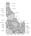
 Idaho counties map.png 584 × 865; 71 KB
-
 Idaho Gubernatorial Election Results by County, 2010.svg 197 × 308; 42 KB
-
 Idaho map counties.svg 860 × 1,000; 2.04 MB
-
 LINCOLN (WASHINGTON e IDAHO).png 587 × 307; 21 KB
-
 Lincoln in WA and ID.png 450 × 316; 11 KB
-
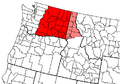
 Map of Idaho highlighting Magic Valley.png 197 × 300; 23 KB
-
 Pullman-Moscow Combined Statistical Area.svg 3,228 × 2,416; 498 KB
-
 Spokane-Coeur d'Alene Combined Statistical Area.svg 3,228 × 2,416; 498 KB


.png)


