Category:Maps of Cuyahoga County, Ohio
Jump to navigation
Jump to search
Wikimedia category | |||||
| Upload media | |||||
| Instance of | |||||
|---|---|---|---|---|---|
| Category combines topics | |||||
| Cuyahoga County | |||||
county in Ohio, United States | |||||
| Instance of | |||||
| Named after | |||||
| Location | Ohio | ||||
| Capital | |||||
| Headquarters location | |||||
| Inception |
| ||||
| Population |
| ||||
| Area |
| ||||
| official website | |||||
 | |||||
Cuyahoga County is in Ohio in the United States. Its county seat is Cleveland.
Subcategories
This category has the following 7 subcategories, out of 7 total.
C
E
L
O
V
Media in category "Maps of Cuyahoga County, Ohio"
The following 26 files are in this category, out of 26 total.
-
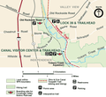
Canalvc.png 500 × 459; 73 KB
-
Cleveland 1970.jpg 1,385 × 847; 354 KB
-
Cleveland Defense Area.png 819 × 651; 39 KB
-
Cleveland Rapid Map 10-2015 SVG.svg 1,683 × 738; 164 KB
-
Cleveland Rapid map.svg 864 × 489; 441 KB
-
Cleveland RTA Rapid Transit map.svg 940 × 400; 181 KB
-
Cleveland Senate Athletic League All-Time Members Map.png 832 × 684; 34 KB
-
Cleveland Senate Athletic League Map 2015.png 832 × 684; 24 KB
-
Cuyahoga County Council Districts 2011 Blank.svg 1,110 × 850; 44 KB
-
Cuyahoga County Council Districts 2011.svg 1,110 × 850; 49 KB
-
Cuyahoga County.png 1,887 × 1,507; 33 KB
-
Euclid creek watershed.jpg 911 × 1,006; 448 KB
-
Flooded areas- Cuyahoga River, mile 18.6 to ... 40.25. LOC gm70002190.jpg 7,972 × 5,708; 7.36 MB
-
Flooded areas- Cuyahoga River, mile 18.6 to ... 40.25. LOC gm70002190.tif 7,972 × 5,708; 130.19 MB
-
GCRTA 1913-2015.gif 988 × 461; 4.01 MB
-
Lakewood Ohio US street map.svg 956 × 833; 1.29 MB
-
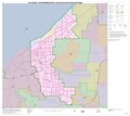
OH10 109.PNG 635 × 379; 29 KB
-
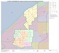
OH11 109.PNG 635 × 380; 27 KB
-
Ohio's 11th congressional district in Cleveland (since 2023).svg 866 × 800; 6.49 MB
-
Persistent Poverty Cleveland.png 2,134 × 1,214; 677 KB
