Category:Maps of counties of California
Jump to navigation
Jump to search
States of the United States: Alabama · Alaska · Arizona · Arkansas · California · Colorado · Connecticut · Delaware · Florida · Georgia · Hawaii · Idaho · Illinois · Indiana · Iowa · Kansas · Kentucky · Louisiana · Maine · Maryland · Massachusetts · Michigan · Minnesota · Mississippi · Missouri · Montana · Nebraska · Nevada · New Hampshire · New Jersey · New Mexico · New York · North Carolina · North Dakota · Ohio · Oklahoma · Oregon · Pennsylvania · Rhode Island · South Carolina · South Dakota · Tennessee · Texas · Utah · Vermont · Virginia · Washington · West Virginia · Wisconsin · Wyoming
| NO WIKIDATA ID FOUND! Search for Maps of counties of California on Wikidata | |
| Upload media |
English: Maps of the 58 Counties of California

Counties of California: Alameda · Alpine · Amador · Butte · Calaveras · Colusa · Contra Costa · Del Norte · El Dorado · Fresno · Glenn · Humboldt · Imperial · Inyo · Kern · Kings · Lake · Lassen · Los Angeles · Madera · Marin · Mariposa · Mendocino · Merced · Modoc · Mono · Monterey · Napa · Nevada · Orange · Placer · Plumas · Riverside · Sacramento · San Benito · San Bernardino · San Diego · San Joaquin · San Luis Obispo · San Mateo · Santa Barbara · Santa Clara · Santa Cruz · Shasta · Sierra · Siskiyou · Solano · Sonoma · Stanislaus · Sutter · Tehama · Trinity · Tulare · Tuolumne · Ventura · Yolo · Yuba – Consolidated city-county: San Francisco
Subcategories
This category has the following 62 subcategories, out of 62 total.
Media in category "Maps of counties of California"
The following 38 files are in this category, out of 38 total.
-
 California map showing counties (source).xcf 957 × 1,107; 363 KB
-
 Blank California Map.svg 621 × 733; 254 KB
-
 Blank map subdivisions California.svg 147 × 250; 42 KB
-
 CA county outine map with names.gif 942 × 1,081; 53 KB
-
 CA-FIPS.png 928 × 1,158; 246 KB
-
 California 4way secession proposal.svg 621 × 733; 259 KB
-
 California counties 300.png 272 × 326; 23 KB
-
 California Counties by Median Household Income.png 800 × 944; 94 KB
-
 California Counties by Per Capita Income.png 800 × 944; 100 KB
-
 California counties map1.gif 942 × 1,081; 76 KB
-
 California counties outline map.svg 512 × 857; 669 KB
-
 California counties shift 2000-2004.svg 810 × 810; 51 KB
-
 California counties shift 2004-2008.svg 810 × 810; 51 KB
-
 California counties trend 0004.svg 810 × 810; 51 KB
-
 California counties trend 2004-2008.svg 810 × 810; 51 KB
-
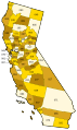
 California Counties.gif 1,146 × 1,426; 70 KB
-
 California County Boundaries.pdf 852 × 1,312, 478 pages; 12.02 MB
-
 California county map (labeled and colored).png 650 × 800; 106 KB
-
 California county map (labeled and colored).svg 621 × 733; 372 KB
-
 California county map (labeled).svg 621 × 733; 644 KB
-
 California county map legend.svg 700 × 918; 718 KB
-
 California County Map Showing Broadband Access, 2011.svg 512 × 857; 674 KB
-
 California County Map Showing Broadband Access.png 358 × 599; 63 KB
-
 California county map.svg 512 × 857; 706 KB
-
 California Disaster Areas, 1964.svg 512 × 857; 741 KB
-
 California economic regions map (labeled and colored).svg 621 × 733; 635 KB
-
 California fish and game (20324892778).jpg 1,626 × 1,872; 469 KB
-
 California Map.jpg 1,146 × 1,426; 357 KB
-
 Central California county map.png 247 × 208; 17 KB
-
 Central Coast WV.svg 350 × 350; 834 KB
-
 Comtés Californiens.JPG 436 × 505; 34 KB
-
 Eastern California county map.png 456 × 720; 65 KB
-
 Map of California Counties in 1850.svg 512 × 591; 14 KB
-
 New California counties map.JPG 942 × 1,081; 84 KB
-
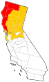
 NorCal Counties Map.jpg 845 × 747; 217 KB
-
 NorCal county map (labeled and colored).png 7,461 × 6,772; 1.38 MB
-
 Southern California ru.png 725 × 417; 143 KB
-
 Vector map of Vista California USA.svg 517 × 500; 438 KB


.png)
.svg)
.svg)


.svg)
.jpg)


.png)

