Category:Maps of counties of Colorado
Jump to navigation
Jump to search
States of the United States: Alabama · Alaska · Arizona · Arkansas · California · Colorado · Connecticut · Delaware · Florida · Georgia · Hawaii · Idaho · Illinois · Indiana · Iowa · Kansas · Kentucky · Louisiana · Maine · Maryland · Massachusetts · Michigan · Minnesota · Mississippi · Missouri · Montana · Nebraska · Nevada · New Hampshire · New Jersey · New Mexico · New York · North Carolina · North Dakota · Ohio · Oklahoma · Oregon · Pennsylvania · Rhode Island · South Carolina · South Dakota · Tennessee · Texas · Utah · Vermont · Virginia · Washington · West Virginia · Wisconsin · Wyoming
Counties of Colorado: Adams · Alamosa · Arapahoe · Archuleta · Baca · Bent · Boulder · Chaffee · Cheyenne · Clear Creek · Conejos · Costilla · Crowley · Custer · Delta · Dolores · Douglas · Eagle · El Paso · Elbert · Fremont · Garfield · Gilpin · Grand · Gunnison · Hinsdale · Huerfano · Jackson · Jefferson · Kiowa · Kit Carson · Lake · La Plata · Larimer · Las Animas · Lincoln · Logan · Mesa · Mineral · Moffat · Montezuma · Montrose · Morgan · Otero · Ouray · Park · Phillips · Pitkin · Prowers · Pueblo · Rio Blanco · Rio Grande · Routt · Saguache · San Juan · San Miguel · Sedgwick · Summit · Teller · Washington · Weld · Yuma
City-counties: Broomfield · Denver
City-counties: Broomfield · Denver
Subcategories
This category has the following 66 subcategories, out of 66 total.
*
A
B
- Maps of Baca County, Colorado (25 F)
- Maps of Broomfield, Colorado (4 F)
C
D
E
- Maps of Elbert County, Colorado (21 F)
F
G
- Maps of Grand County, Colorado (30 F)
H
J
K
- Maps of Kiowa County, Colorado (20 F)
L
M
O
P
- Maps of Park County, Colorado (10 F)
R
S
T
W
Y
Media in category "Maps of counties of Colorado"
The following 8 files are in this category, out of 8 total.
-
 Blank map subdivisions Colorado.svg 133 × 105; 29 KB
-
 Colorado counties until November 15, 2001.svg 3,117 × 2,255; 111 KB
-
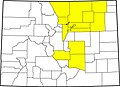 Colorado county map highlighting 14 counties affected by 2013 flooding.jpg 2,000 × 1,447; 536 KB
-
 Colorado Swing Areas.svg 275 × 260; 43 KB
-
 Colorado-counties-map.png 864 × 646; 51 KB
-
 KS-CO-NE county map.svg 160 × 100; 145 KB
-
 Map of Colorado counties, blank.svg 3,117 × 2,255; 188 KB
-
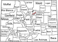 Map of Colorado counties, labelled.svg 6,233 × 4,511; 635 KB


