Category:Maps of Columbiana County, Ohio
Appearance
Wikimedia category | |||||
| Upload media | |||||
| Instance of | |||||
|---|---|---|---|---|---|
| Category combines topics | |||||
| Columbiana County | |||||
county in Ohio, United States | |||||
| Instance of | |||||
| Named after | |||||
| Location | Ohio | ||||
| Capital | |||||
| Headquarters location | |||||
| Inception |
| ||||
| Population |
| ||||
| Area |
| ||||
| official website | |||||
 | |||||
Columbiana County is in Ohio in the United States. Its county seat is Lisbon.
Subcategories
This category has the following 3 subcategories, out of 3 total.
Media in category "Maps of Columbiana County, Ohio"
The following 79 files are in this category, out of 79 total.
-
Columbiana County Ohio Highlight Columbiana.png 1,200 × 600; 72 KB
-
Columbiana County Ohio Highlight East Liverpool.png 1,200 × 600; 72 KB
-
Columbiana County Ohio Highlight East Palestine.png 1,200 × 600; 71 KB
-
Columbiana County Ohio Highlight Hanoverton.png 1,200 × 600; 71 KB
-
Columbiana County Ohio Highlight Leetonia.png 1,200 × 600; 72 KB
-
Columbiana County Ohio Highlight Lisbon.png 1,200 × 600; 72 KB
-
Columbiana County Ohio Highlight New Waterford.png 1,200 × 600; 71 KB
-
Columbiana County Ohio Highlight Rogers.png 1,200 × 600; 74 KB
-
Columbiana County Ohio Highlight Salineville.png 1,200 × 600; 72 KB
-
Columbiana County Ohio Highlight Summitville.png 1,200 × 600; 72 KB
-
Columbiana County Ohio Highlight Washingtonville.png 1,200 × 600; 72 KB
-
Columbiana County Ohio Highlight Wellsville.png 1,200 × 600; 72 KB
-
Columbiana County Ohio incorporated and unincorporated areas Butler highlighted.png 3,229 × 1,536; 518 KB
-
Columbiana County Ohio incorporated and unincorporated areas Calcutta highlighted.png 3,229 × 1,536; 517 KB
-
Columbiana County Ohio incorporated and unincorporated areas Center highlighted.png 3,229 × 1,536; 517 KB
-
Columbiana County Ohio incorporated and unincorporated areas Columbiana highlighted.png 3,259 × 1,536; 543 KB
-
Columbiana County Ohio incorporated and unincorporated areas Damascus highlighted.png 3,227 × 2,463; 654 KB
-
Columbiana County Ohio incorporated and unincorporated areas Elkrun highlighted.png 3,229 × 1,536; 517 KB
-
Columbiana County Ohio incorporated and unincorporated areas Fairfield highlighted.png 3,229 × 1,536; 518 KB
-
Columbiana County Ohio incorporated and unincorporated areas Franklin highlighted.png 3,229 × 1,536; 517 KB
-
Columbiana County Ohio incorporated and unincorporated areas Glenmoor highlighted.png 3,229 × 1,536; 517 KB
-
Columbiana County Ohio incorporated and unincorporated areas Hanover highlighted.png 3,229 × 1,536; 517 KB
-
Columbiana County Ohio incorporated and unincorporated areas Hanoverton highlighted.png 3,229 × 1,536; 517 KB
-
Columbiana County Ohio incorporated and unincorporated areas Homeworth highlighted.png 3,229 × 1,536; 517 KB
-
Columbiana County Ohio incorporated and unincorporated areas Knox highlighted.png 3,229 × 1,536; 517 KB
-
Columbiana County Ohio incorporated and unincorporated areas LaCroft highlighted.png 3,229 × 1,536; 517 KB
-
Columbiana County Ohio incorporated and unincorporated areas Leetonia highlighted.png 3,229 × 1,536; 518 KB
-
Columbiana County Ohio incorporated and unincorporated areas Lisbon highlighted.png 3,229 × 1,536; 517 KB
-
Columbiana County Ohio incorporated and unincorporated areas Liverpool highlighted.png 3,229 × 1,536; 516 KB
-
Columbiana County Ohio incorporated and unincorporated areas Madison highlighted.png 3,229 × 1,536; 518 KB
-
Columbiana County Ohio incorporated and unincorporated areas Middleton highlighted.png 3,229 × 1,536; 517 KB
-
Columbiana County Ohio incorporated and unincorporated areas Negley highlighted.png 3,229 × 1,536; 517 KB
-
Columbiana County Ohio incorporated and unincorporated areas Perry highlighted.png 3,229 × 1,536; 517 KB
-
Columbiana County Ohio incorporated and unincorporated areas Rogers highlighted.png 3,229 × 1,536; 523 KB
-
Columbiana County Ohio incorporated and unincorporated areas Salineville highlighted.png 3,229 × 1,536; 517 KB
-
Columbiana County Ohio incorporated and unincorporated areas St. Clair highlighted.png 3,229 × 1,536; 516 KB
-
Columbiana County Ohio incorporated and unincorporated areas Summitville highlighted.png 3,229 × 1,536; 517 KB
-
Columbiana County Ohio incorporated and unincorporated areas Unity highlighted.png 3,229 × 1,536; 515 KB
-
Columbiana County Ohio incorporated and unincorporated areas Washington highlighted.png 3,229 × 1,536; 517 KB
-
Columbiana County Ohio incorporated and unincorporated areas Wayne highlighted.png 3,229 × 1,536; 517 KB
-
Columbiana County Ohio incorporated and unincorporated areas Wellsville highlighted.png 3,229 × 1,536; 517 KB
-
Columbiana County Ohio incorporated and unincorporated areas West highlighted.png 3,229 × 1,536; 517 KB
-
Map of Ohio highlighting Columbiana County.svg 1,050 × 1,141; 37 KB
-
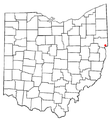
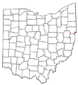
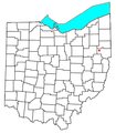
OHMap-doton-Calcutta.png 274 × 300; 10 KB
-
OHMap-doton-Damascus.png 309 × 352; 17 KB
-
OHMap-doton-East Liverpool.png 274 × 300; 10 KB
-
OHMap-doton-East Palestine.png 274 × 300; 10 KB
-
OHMap-doton-East Rochester.png 309 × 352; 17 KB
-
OHMap-doton-Elkton.png 309 × 352; 17 KB
-
OHMap-doton-Fredericktown-Columbiana.png 309 × 352; 17 KB
-
OHMap-doton-Glenmoor.png 274 × 300; 10 KB
-
OHMap-doton-Hanoverton.png 274 × 300; 10 KB
-
OHMap-doton-Kensington.png 309 × 352; 17 KB
-
OHMap-doton-La Croft.png 274 × 300; 10 KB
-
OHMap-doton-Leetonia.png 274 × 300; 10 KB
-
OHMap-doton-Lisbon.png 274 × 300; 10 KB
-
OHMap-doton-Minerva.png 274 × 300; 10 KB
-
OHMap-doton-Negley.png 309 × 352; 17 KB
-
OHMap-doton-New Waterford.png 274 × 300; 10 KB
-
OHMap-doton-North Georgetown.png 309 × 352; 17 KB
-
OHMap-doton-Rogers.png 274 × 300; 10 KB
-
OHMap-doton-Salineville.png 274 × 300; 10 KB
-
OHMap-doton-Summitville.png 274 × 300; 10 KB
-
OHMap-doton-Washingtonville.png 274 × 300; 10 KB
-
OHMap-doton-Wellsville.png 274 × 300; 10 KB
-
OHMap-doton-West Point.png 309 × 352; 17 KB
-
OHMap-doton-Winona.png 309 × 352; 17 KB


