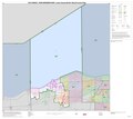
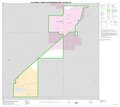
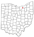
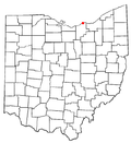
Category:Maps of Lorain County, Ohio
Appearance
Wikimedia category | |||||
| Upload media | |||||
| Instance of | |||||
|---|---|---|---|---|---|
| Category combines topics | |||||
| Lorain County | |||||
county in Ohio, United States | |||||
| Instance of | |||||
| Named after | |||||
| Location | Ohio | ||||
| Capital | |||||
| Inception |
| ||||
| Population |
| ||||
| Area |
| ||||
| official website | |||||
 | |||||
Lorain County is in Ohio in the United States. Its county seat is Elyria.
Subcategories
This category has the following 4 subcategories, out of 4 total.
Media in category "Maps of Lorain County, Ohio"
The following 25 files are in this category, out of 25 total.
-
Amherst Township.png 304 × 316; 21 KB
-
Glacial Geology of Lorain County, Ohio - DPLA - f4973fa96a60bb36dc85f890adae1d79.jpg 1,275 × 1,650; 343 KB
-
Lorain County JVS School Districts Map.png 594 × 625; 20 KB
-
Lorain County.png 274 × 300; 14 KB
-
LorainCountyConference1986-2005.png 260 × 344; 11 KB
-
LorainCountyLeague2019.png 262 × 401; 10 KB
-
Map of Ohio highlighting Lorain County.svg 1,050 × 1,141; 37 KB
-
OHMap-ColumbiaStation.png 274 × 300; 17 KB
-
OHMap-doton-Avon Lake.png 274 × 300; 10 KB
-
OHMap-doton-Avon.png 274 × 300; 10 KB
-
OHMap-doton-Brentwood Lake.png 309 × 352; 17 KB
-
OHMap-doton-Eaton Estates.png 274 × 300; 10 KB
-
OHMap-doton-Grafton.png 274 × 300; 10 KB
-
OHMap-doton-Kipton.png 274 × 300; 10 KB
-
OHMap-doton-Lagrange.png 274 × 300; 10 KB
-
OHMap-doton-North Ridgeville.png 274 × 300; 10 KB
-
OHMap-doton-Oberlin.png 274 × 300; 10 KB
-
OHMap-doton-Rochester.png 274 × 300; 10 KB
-
OHMap-doton-Sheffield Lake.png 274 × 300; 10 KB
-
OHMap-doton-Sheffield.png 274 × 300; 10 KB
-
OHMap-doton-South Amherst.png 274 × 300; 10 KB
-
OHMap-doton-Vermilion.png 274 × 300; 10 KB
-
OHMap-doton-Wellington.png 274 × 300; 10 KB


