Category:Maps of counties of Michigan
Jump to navigation
Jump to search
States of the United States: Alabama · Alaska · Arizona · Arkansas · California · Colorado · Connecticut · Delaware · Florida · Georgia · Hawaii · Idaho · Illinois · Indiana · Iowa · Kansas · Kentucky · Louisiana · Maine · Maryland · Massachusetts · Michigan · Minnesota · Mississippi · Missouri · Montana · Nebraska · Nevada · New Hampshire · New Jersey · New Mexico · New York · North Carolina · North Dakota · Ohio · Oklahoma · Oregon · Pennsylvania · Rhode Island · South Carolina · South Dakota · Tennessee · Texas · Utah · Vermont · Virginia · Washington · West Virginia · Wisconsin · Wyoming
Counties of Michigan: Alcona · Alger · Allegan · Alpena · Antrim · Arenac · Baraga · Barry · Bay · Benzie · Berrien · Branch · Calhoun · Cass · Charlevoix · Cheboygan · Chippewa · Clare · Clinton · Crawford · Delta · Dickinson · Eaton · Emmet · Genesee · Gladwin · Gogebic · Grand Traverse · Gratiot · Hillsdale · Houghton · Huron · Ingham · Ionia · Iosco · Iron · Isabella · Jackson · Kalamazoo · Kalkaska · Kent · Keweenaw · Lake · Lapeer · Leelanau · Lenawee · Livingston · Luce · Mackinac · Macomb · Manistee · Marquette · Mason · Mecosta · Menominee · Midland · Missaukee · Monroe · Montcalm · Montmorency · Muskegon · Newaygo · Oakland · Oceana · Ogemaw · Ontonagon · Osceola · Oscoda · Otsego · Ottawa · Presque Isle · Roscommon · Saginaw · Sanilac · Schoolcraft · Shiawassee · St. Clair · St. Joseph · Tuscola · Van Buren · Washtenaw · Wayne · Wexford
Subcategories
This category has the following 87 subcategories, out of 87 total.
Media in category "Maps of counties of Michigan"
The following 8 files are in this category, out of 8 total.
-
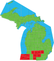
Blank map subdivisions Michigan.svg 138 × 145; 35 KB
-
Etymologies of Michigan counties.png 1,549 × 1,553; 273 KB
-
List of michigan counties.svg 1,050 × 1,200; 103 KB
-
Michigan counties map.gif 720 × 817; 51 KB
-
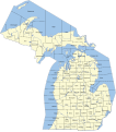
MichiganBlankCounties.png 547 × 626; 47 KB
-
MichiganCabinetCounties.svg 534 × 605; 143 KB
-
MichiganCounties.svg 535 × 606; 113 KB
-
NRHP Michigan Map.svg 990 × 765; 9.23 MB


