Category:Old maps of Leicestershire
Jump to navigation
Jump to search
Ceremonial counties of England: Bedfordshire · Berkshire · Buckinghamshire · Cambridgeshire · Cheshire · Cornwall · Cumbria · Derbyshire · Devon · Dorset · Durham · East Riding of Yorkshire · East Sussex · Essex · Gloucestershire · Greater London · Greater Manchester · Hampshire · Herefordshire · Hertfordshire · Isle of Wight · Kent · Lancashire · Leicestershire · Lincolnshire · Norfolk · North Yorkshire · Northamptonshire · Northumberland · Nottinghamshire · Oxfordshire · Rutland · Shropshire · Somerset · South Yorkshire · Staffordshire · Suffolk · Surrey · Warwickshire · West Midlands · West Sussex · West Yorkshire · Wiltshire · Worcestershire
City-counties: Bristol · City of London
Former historic counties: Cumberland · Huntingdonshire · Middlesex · Sussex · Westmorland · Yorkshire
Other former counties:
City-counties: Bristol · City of London
Former historic counties: Cumberland · Huntingdonshire · Middlesex · Sussex · Westmorland · Yorkshire
Other former counties:
Subcategories
This category has the following 3 subcategories, out of 3 total.
L
Media in category "Old maps of Leicestershire"
The following 16 files are in this category, out of 16 total.
-
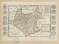 Leicester-Shire - By H. Moll Geographer - btv1b53056770c.jpg 4,128 × 3,088; 1.96 MB
-
 Ordnance Survey Drawings - Burton Overy, Leicestershire (OSD 262).jpg 2,947 × 4,000; 4.07 MB
-
 Ordnance Survey Drawings - Hinckley, Leicestershire (OSD 259).jpg 5,850 × 4,163; 3.7 MB
-
 Ordnance Survey Drawings - Leicester, City of Leicester (OSD 263).jpg 4,000 × 2,806; 3.8 MB
-
 Ordnance Survey Drawings - Nottingham, City of Nottingham (OSD 264).jpg 4,241 × 5,279; 3.91 MB
-
 Ordnance Survey Drawings - Melton Mowbray, Leicestershire (OSD 265).jpg 2,939 × 4,000; 4.22 MB
-
 Ordnance Survey Drawings - Welford (OSD 261).jpg 4,000 × 3,107; 3.63 MB
-
 Ordnance Survey Drawings - Hartshorn (OSD 295).jpg 4,198 × 4,576; 2.99 MB
-

-
 20th Century map of Carlton.PNG 395 × 310; 352 KB
-

-

-
 ANSTED(1866) p8 - Geological Map of the County of Leicester.jpg 4,820 × 4,064; 3.64 MB
-
 Hinckley, Leicestershire.jpg 1,280 × 1,000; 439 KB
-
 OS old series 1 63360 63.jpg 7,856 × 6,367; 12.8 MB
-
 Tugby and Keythorpe ordnance survey 20th century.PNG 853 × 536; 1.19 MB

.jpg)
.jpg)
.jpg)
.jpg)
.jpg)
.jpg)
.jpg)
.jpg)

%27_(11001287506).jpg)

_p8_-_Geological_Map_of_the_County_of_Leicester.jpg)


