Category:Old maps of Devon
Jump to navigation
Jump to search
Ceremonial counties of England: Bedfordshire · Berkshire · Buckinghamshire · Cambridgeshire · Cheshire · Cornwall · Cumbria · Derbyshire · Devon · Dorset · Durham · East Riding of Yorkshire · East Sussex · Essex · Gloucestershire · Greater London · Greater Manchester · Hampshire · Herefordshire · Hertfordshire · Isle of Wight · Kent · Lancashire · Leicestershire · Lincolnshire · Norfolk · North Yorkshire · Northamptonshire · Northumberland · Nottinghamshire · Oxfordshire · Rutland · Shropshire · Somerset · South Yorkshire · Staffordshire · Suffolk · Surrey · Warwickshire · West Midlands · West Sussex · West Yorkshire · Wiltshire · Worcestershire
City-counties: Bristol · City of London
Former historic counties: Cumberland · Huntingdonshire · Middlesex · Sussex · Westmorland · Yorkshire
Other former counties:
City-counties: Bristol · City of London
Former historic counties: Cumberland · Huntingdonshire · Middlesex · Sussex · Westmorland · Yorkshire
Other former counties:
Subcategories
This category has the following 8 subcategories, out of 8 total.
- Old county maps of Devon (18 F)
- Ordnance Survey 1st series 1:10560, Map of Devon (1 P, 994 F)
A
D
- Devon RJD 1914 (5 F)
E
P
T
- Old maps of Tavistock, Devon (4 F)
Media in category "Old maps of Devon"
The following 86 files are in this category, out of 86 total.
-

-
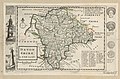 Devon Shire - By H. Moll Geographer - btv1b53056863p.jpg 4,056 × 2,656; 1.58 MB
-
 Ordnance Survey Drawings - Bickleigh (OSD 40-1).jpg 4,000 × 3,782; 5.45 MB
-
 Ordnance Survey Drawings - Exmouth (OSD 39).jpg 5,791 × 3,137; 3.96 MB
-
 Ordnance Survey Drawings - Ashburton (OSD 25).jpg 3,441 × 4,000; 5.22 MB
-
 Ordnance Survey Drawings - Dartmoor (OSD 23).jpg 4,000 × 1,937; 3.16 MB
-
 Ordnance Survey Drawings - Milverton (OSD 44-1).jpg 2,656 × 4,000; 5.05 MB
-
 Ordnance Survey Drawings - Ashburton (OSD 24).jpg 4,000 × 3,358; 4.92 MB
-

-
 Ordnance Survey Drawings - Holsworthy (OSD 29).jpg 4,000 × 2,619; 3.33 MB
-
 Ordnance Survey Drawings - Kingsbridge (OSD 21).jpg 4,000 × 3,836; 5.53 MB
-
 Ordnance Survey Drawings - Modbury (OSD 20).jpg 4,000 × 2,580; 2.75 MB
-
 Ordnance Survey Drawings - Okehampton (OSD 26).jpg 4,000 × 2,128; 2.67 MB
-
 Ordnance Survey Drawings - Barnstaple, Devon (OSD 31).jpg 5,715 × 3,584; 4.96 MB
-
 Ordnance Survey Drawings - Hartland (OSD 30).jpg 5,759 × 3,760; 4.2 MB
-
 Ordnance Survey Drawings - Roborough (OSD 35).jpg 4,000 × 3,982; 4.26 MB
-
 Ordnance Survey Drawings - South Molton (OSD 34).jpg 4,000 × 2,672; 2.88 MB
-
 Ordnance Survey Drawings - Launceston (OSD 28).jpg 4,000 × 2,340; 4.07 MB
-

-

-

-
 The birds of Devon (6140764258).jpg 1,307 × 1,208; 492 KB
-
 The Victoria history of the county of Devon; (1906) (20151252894).jpg 1,702 × 3,127; 1.72 MB
-
 The Victoria history of the county of Devon; (1906) (20764428902).jpg 2,185 × 2,924; 2.82 MB
-
 The Victoria history of the county of Devon; (1906) (20773837685).jpg 2,249 × 3,090; 2.63 MB
-
 The Victoria history of the county of Devon; (1906) (20780801471).jpg 2,178 × 2,950; 2.58 MB
-
 20th Century Little Torrington Map.PNG 451 × 421; 523 KB
-

-

-
-

-
 A chart of the coast of Devonshire from Exmouth to Rame head... - btv1b530106286.jpg 7,301 × 6,709; 5.96 MB
-

-

-
 Admiralty Chart No 28 Salcombe River, Published 1863, Large Corrections 1953.jpg 11,108 × 16,190; 53.04 MB
-
 Admiralty Chart No 442 Lizard Head to Start Point, Published 1900.jpg 13,555 × 11,297; 49.12 MB
-

-

-
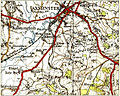 Axminster 177 NPseries.jpg 635 × 508; 218 KB
-
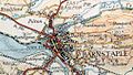 Barnstablemap.jpg 506 × 288; 52 KB
-
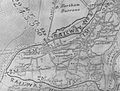 BWHARmap.jpg 928 × 704; 119 KB
-

-
 Barnstablemap 1937.jpg 2,544 × 3,504; 1.67 MB
-
 Bidefordmap 1937.jpg 758 × 702; 929 KB
-
 Halwill Junctionmap 1946.png 960 × 1,667; 2.99 MB
-
 Halwillmap 1946.png 720 × 804; 749 KB
-
 Devon and Cornwall notes and queries (1920) (14593728068).jpg 4,224 × 2,580; 1.2 MB
-
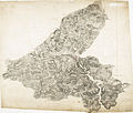
 Devoniae Comitat' Rerumquae.jpg 4,041 × 3,625; 3.97 MB
-
 Devoniae Comitat' Rerumquae.tiff 8,081 × 7,250; 102.77 MB
-

-
 Great torrington map1937.jpg 579 × 229; 129 KB
-
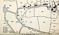
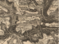
 Hayridge hundred in 1765.jpg 2,112 × 1,123; 1.31 MB
-
 Historical map of Sourton.JPG 487 × 389; 68 KB
-
 L&bmapimage.jpg 902 × 901; 165 KB
-
 Little Torrington 19th Century Map.PNG 841 × 679; 1.41 MB
-
 Map BWHA Railway.jpg 2,054 × 1,664; 915 KB
-
 Map of Blackbury Camp.jpg 1,155 × 774; 359 KB
-
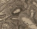
 Map of Devon between Haytor and Teignmouth (ca 1830).jpg 816 × 800; 189 KB
-
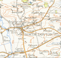 North Tawtonmap 1946.png 1,178 × 1,115; 2.42 MB
-
 Oakford 19th century map.PNG 912 × 680; 1.66 MB
-
 Okehamptonmap 1946.png 1,242 × 1,102; 2.33 MB
-
 Ordnance Survey Drawings - Dartmoor, Devon (OSD 22).jpg 4,961 × 4,206; 4.25 MB
-
 Ordnance Survey Half-inch Sheet 36 South Devon, Published 1925.jpg 12,199 × 9,082; 13.18 MB
-
 Ordnance Survey Lupton House 1869.jpg 2,000 × 1,219; 983 KB
-
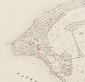 Ordnance Survey map of Devon, 1854, showing the Greenway Estate.jpg 1,344 × 1,287; 297 KB
-
 Ordnance Survey Sheet SX 85 (20 85) Dartmouth, Published 1948.jpg 7,616 × 8,862; 14.9 MB
-
 Ordnance Survey Drawings - Crediton (OSD 36).jpg 5,734 × 3,416; 3.72 MB
-
 Ordnance Survey Drawings - Bovey Tracey (OSD 37).jpg 4,000 × 3,062; 3.72 MB
-
 Ordnance Survey Drawings - Tor Bay (OSD 38).jpg 4,000 × 3,391; 4.96 MB
-
 Ordnance Survey Drawings - Cullompton (OSD 40-2).jpg 4,000 × 3,711; 5.73 MB
-
 Ordnance Survey Drawings - Exeter (OSD 40-3).jpg 4,000 × 3,788; 5.68 MB
-
 Ordnance Survey Drawings - Ottery St. Mary (OSD 40-4).jpg 4,000 × 3,864; 5.6 MB
-
 Ordnance Survey Drawings - Cullompton (OSD 41-2).jpg 2,480 × 4,000; 4.74 MB
-
 Ordnance Survey Drawings - Honiton (OSD 45-1).jpg 4,000 × 3,495; 6.34 MB
-
 Ordnance Survey Drawings - Axminster (OSD 45-2).jpg 4,000 × 3,235; 5.87 MB
-
 Ordnance Survey Drawings - Ottery St. Mary (OSD 45-3).jpg 3,417 × 4,000; 5.33 MB
-
 Ordnance Survey Drawings - Axmouth (OSD 45-4).jpg 4,000 × 3,298; 4.51 MB
-

-
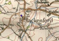 Rackenford.png 283 × 199; 108 KB
-
 Shobrooke Ordnance Survey Map 18th Century.png 606 × 479; 766 KB
-

-

-
 Southamptonia Atlas.tif 8,052 × 7,201; 101.06 MB
-
 Staffordia Atlas.tif 9,013 × 7,023; 95.5 MB
-
 Woodway10-spratt.jpg 848 × 1,004; 160 KB
-
 Woodway9-spratt.jpg 848 × 1,011; 154 KB
%27_(11076282163).jpg)

.jpg)
.jpg)
.jpg)
.jpg)
.jpg)
.jpg)
_cropped_to_show_Greenway.jpg)
.jpg)
.jpg)
.jpg)
.jpg)
.jpg)
.jpg)
.jpg)
.jpg)
.jpg)
.jpg)
%27_(11035803534).jpg)
%27_(11129843693).jpg)
.jpg)
_(20151252894).jpg)
_(20764428902).jpg)
_(20773837685).jpg)
_(20780801471).jpg)

.jpg)
.jpg)
._Illustrated_..._With_map%27_(11179852714).jpg)
%27_(11082328274).jpg)


,_f._10r_-_BL_Royal_MS_18_D_III.png)


_(14593728068).jpg)

.png)


.jpg)


.jpg)


_Dartmouth,_Published_1948.jpg)
.jpg)
.jpg)
.jpg)
.jpg)
.jpg)
.jpg)
.jpg)
.jpg)
.jpg)
.jpg)
.jpg)
,_f._10r_-_BL_Royal_MS_18_D_III_(cropped).png)


_(14779463441).jpg)
_(14780244434).jpg)

