Category:Old maps of Dorset
Jump to navigation
Jump to search
Ceremonial counties of England: Bedfordshire · Berkshire · Buckinghamshire · Cambridgeshire · Cheshire · Cornwall · Cumbria · Derbyshire · Devon · Dorset · Durham · East Riding of Yorkshire · East Sussex · Essex · Gloucestershire · Greater London · Greater Manchester · Hampshire · Herefordshire · Hertfordshire · Isle of Wight · Kent · Lancashire · Leicestershire · Lincolnshire · Norfolk · North Yorkshire · Northamptonshire · Northumberland · Nottinghamshire · Oxfordshire · Rutland · Shropshire · Somerset · South Yorkshire · Staffordshire · Suffolk · Surrey · Warwickshire · West Midlands · West Sussex · West Yorkshire · Wiltshire · Worcestershire
City-counties: Bristol · City of London
Former historic counties: Cumberland · Huntingdonshire · Middlesex · Sussex · Westmorland · Yorkshire
Other former counties:
City-counties: Bristol · City of London
Former historic counties: Cumberland · Huntingdonshire · Middlesex · Sussex · Westmorland · Yorkshire
Other former counties:
Subcategories
This category has the following 3 subcategories, out of 3 total.
- Old county maps of Dorset (17 F)
- Ordnance Survey 1st series 1:10560, Map of Dorset (1 P, 378 F)
D
Media in category "Old maps of Dorset"
The following 33 files are in this category, out of 33 total.
-
 --PD-self--File-Map of Hengistbury Head by Isaac Taylor 1759.jpg 499 × 499; 186 KB
-
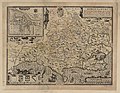 Dorsetshyre... - Jodocus Hondius caelavit - btv1b53056397t (1 of 2).jpg 6,880 × 5,360; 6.65 MB
-
 Dorset Shire - By H. Moll Geographer - btv1b53056183v.jpg 4,000 × 2,600; 1.77 MB
-
 Print, map (BM 1848,0212.5).jpg 1,662 × 2,500; 1.32 MB
-
 Ordnance Survey Drawings - Poole Harbour (OSD 66).jpg 4,000 × 3,056; 4.51 MB
-
 Ordnance Survey Drawings - Beaminster (OSD 54).jpg 5,699 × 3,009; 3.46 MB
-
 Ordnance Survey Drawings - Bridport (OSD 55).jpg 4,000 × 1,487; 1.81 MB
-
 Ordnance Survey Drawings - Ilminster (OSD 46B).jpg 1,048 × 4,000; 1.11 MB
-
 Ordnance Survey Drawings - Cranbourne, Hampshire (OSD 65).jpg 4,000 × 2,647; 3.39 MB
-
 Ordnance Survey Drawings - Shaftesbury (OSD 58).jpg 2,367 × 4,000; 1.55 MB
-
 Ordnance Survey Drawings - Sherborne (OSD 53).jpg 4,000 × 2,703; 4 MB
-

-

-

-

-
 Beaminster tunnel maps.png 850 × 337; 197 KB
-
 Bournemouth area 1759 map.jpg 1,673 × 1,465; 1.3 MB
-

-
 Corfe Castle 1856 OS map.png 384 × 384; 250 KB
-

-
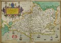
 Dorcestriae Comitatus Vicinarumque Regionum nova veraq' Descriptio…. 1575.jpg 4,765 × 3,372; 4.27 MB
-
 Dorcestriae Comitatus Vicinarumque Regionum nova veraq' Descriptio…. 1575.tif 9,529 × 6,743; 106.4 MB
-
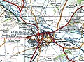 Dorchestermap 1937 (1).jpg 1,126 × 839; 1,023 KB
-
 Dorchestermap 1937.jpg 3,504 × 2,544; 1.51 MB
-
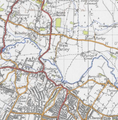 Map excerpt for West Parley.png 527 × 535; 485 KB
-
 Mapperton Civil Parish 1830.JPG 1,286 × 936; 186 KB
-
 OS old series 1 63360 15.jpg 6,264 × 5,010; 7.43 MB
-
 Ordnance Survey Drawings - Weymouth (OSD 56).jpg 4,000 × 2,032; 2.41 MB
-
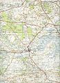
 Ordnance Survey Drawings - Dorchester (OSD 57).jpg 4,000 × 2,672; 3.88 MB
-

-
 Ringwoodmap 1937.jpg 3,504 × 2,544; 1.68 MB
-
 Warehammap 1937.jpg 5,072 × 6,992; 4.85 MB
-
 West Parley Historical Map Excerpt.PNG 541 × 425; 562 KB

.jpg)

.jpg)
.jpg)
.jpg)
.jpg)
.jpg)
.jpg)
.jpg)

s_Jefferys,_Geographer_to_his_Majesty_;_To_John_Baring_of..._-_btv1b53056953n_(04_of_12).jpg)
s_Jefferys,_Geographer_to_his_Majesty_;_To_John_Baring_of..._-_btv1b53056953n_(08_of_12).jpg)

,_f._10r_-_BL_Royal_MS_18_D_III.png)

.png)

.jpg)


.jpg)
.jpg)
,_f._10r_-_BL_Royal_MS_18_D_III_(cropped).png)


.jpg)
.jpg)