Category:Old maps of Staffordshire
Jump to navigation
Jump to search
Ceremonial counties of England: Bedfordshire · Berkshire · Buckinghamshire · Cambridgeshire · Cheshire · Cornwall · Cumbria · Derbyshire · Devon · Dorset · Durham · East Riding of Yorkshire · East Sussex · Essex · Gloucestershire · Greater London · Greater Manchester · Hampshire · Herefordshire · Hertfordshire · Isle of Wight · Kent · Lancashire · Leicestershire · Lincolnshire · Norfolk · North Yorkshire · Northamptonshire · Northumberland · Nottinghamshire · Oxfordshire · Rutland · Shropshire · Somerset · South Yorkshire · Staffordshire · Suffolk · Surrey · Warwickshire · West Midlands · West Sussex · West Yorkshire · Wiltshire · Worcestershire
City-counties: Bristol · City of London
Former historic counties: Cumberland · Huntingdonshire · Middlesex · Sussex · Westmorland · Yorkshire
Other former counties:
City-counties: Bristol · City of London
Former historic counties: Cumberland · Huntingdonshire · Middlesex · Sussex · Westmorland · Yorkshire
Other former counties:
Subcategories
This category has the following 7 subcategories, out of 7 total.
- Old county maps of Staffordshire (10 F)
L
S
- Old maps of Stafford (3 F)
- Staffordshire RJD 1914 (8 F)
W
- Old maps of Wolverhampton (2 F)
Media in category "Old maps of Staffordshire"
The following 43 files are in this category, out of 43 total.
-
 Smethick Alcester & Broom Walsall RJD 89.jpg 2,868 × 1,788; 601 KB
-
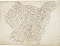
 17th Century map of Staffordshire.jpg 3,456 × 2,592; 4.96 MB
-

-
 Ordnance Survey Drawings - Newport, Telford and Wrekin (OSD 208).jpg 4,000 × 2,384; 4.04 MB
-
 Ordnance Survey Drawings - Ironbridge, Telford and Wrekin (OSD 213).jpg 5,840 × 4,175; 3.86 MB
-
 Ordnance Survey Drawings - Kidderminster, Worcester (OSD 214).jpg 3,016 × 4,000; 4.1 MB
-
 Ordnance Survey Drawings - Lichfield, Staffordshire (OSD 258).jpg 5,783 × 2,853; 3.06 MB
-
 Ordnance Survey Drawings - Market Drayton, Shropshire (OSD 209).jpg 5,133 × 3,908; 3.38 MB
-
 Ordnance Survey Drawings - Woverhampton, Wolverhampton (OSD 212).jpg 3,093 × 4,000; 5.44 MB
-
 Ordnance Survey Drawings - Penkridge, Staffordshire (OSD 211).jpg 4,000 × 3,405; 4.53 MB
-
 Ordnance Survey Drawings - Stafford, Staffordshire (OSD 210).jpg 5,682 × 3,931; 4.66 MB
-
 Ordnance Survey Drawings - Sutton Coldfield (OSD 257).jpg 4,000 × 2,666; 3.52 MB
-

-
 Ordnance Survey Drawings - Betley (OSD 329).jpg 4,036 × 4,209; 3.06 MB
-
 Ordnance Survey Drawings - Sandon (OSD 333).jpg 5,594 × 4,197; 3.06 MB
-
 Ordnance Survey Drawings - Ashbourne (OSD 348).jpg 4,000 × 3,931; 5.18 MB
-
 Ordnance Survey Drawings - Cheadle (OSD 347).jpg 3,854 × 4,192; 2.64 MB
-
 Ordnance Survey Drawings - Longnor (OSD 350).jpg 4,464 × 3,459; 2.37 MB
-
 Ordnance Survey Drawings - Macclesfield (OSD 351).jpg 5,061 × 4,183; 4.04 MB
-
 1911 Britannica - South Staffordshire.png 1,344 × 1,349; 2.15 MB
-

-

-

-
 A new Map of Staffordshire divided into hundreds... - by John Cary, 1806 - btv1b84431896.jpg 8,921 × 10,158; 12.64 MB
-
 County of Stafford divided into hundreds - 1749.jpg 3,114 × 4,096; 3.65 MB
-
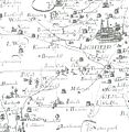
 Offlow Hundred map 1610.jpg 1,897 × 2,347; 4.07 MB
-
 Ordnance Survey Unions, Litchfield - 1830-1840.png 9,938 × 6,752; 142.08 MB
-
 Ordnance Survey Drawings - Tutbury (OSD 325).jpg 4,000 × 2,747; 2.86 MB
-
 Ordnance Survey Drawings - City Of Stoke On Trent (OSD 346).jpg 4,096 × 5,493; 3.8 MB
-

-
 PlotStaffs.jpg 1,041 × 1,068; 130 KB
-
 Sinai park house.gif 827 × 554; 116 KB
-
 Special reports on the mineral resources of Great Britain (1915) (14784619325).jpg 2,578 × 2,536; 505 KB
-
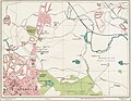
 St Edwards Hospital 1925 map.png 1,042 × 613; 811 KB
-
 Stone (Tittensor & Darlaston) enclosure map - 1855 - 47937-0.jpg 4,716 × 6,000; 2.09 MB
-
 Street Atlas of Birmingham - 1939 - Sheet 02 - West Bromwich (north).jpg 1,000 × 779; 354 KB
-
 Street Atlas of Birmingham - 1939 - Sheet 03 - Hamstead area.jpg 758 × 1,000; 448 KB
-
 Street Atlas of Birmingham - 1939 - Sheet 06 - Smethwick.jpg 1,000 × 773; 520 KB
-
 The Quarterly journal of the Geological Society of London (12894927875).jpg 1,264 × 1,695; 560 KB
-
 Turnhurst Estate Map c1847.png 1,126 × 1,736; 1.05 MB
-
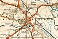 Uttoxeter 1921.JPG 622 × 416; 56 KB
-
 Yates1775MapOfNorthStaffordshire.jpg 750 × 843; 250 KB
-
 Yates1775MapOfNorthStaffordshireSixTownsHighlighted.png 750 × 843; 1.35 MB


.jpg)
.jpg)
.jpg)
.jpg)
.jpg)
.jpg)
.jpg)
.jpg)
.jpg)
.jpg)
.jpg)
.jpg)
.jpg)
.jpg)
.jpg)
.jpg)
.jpg)

)%27_(11243230865).jpg)
.jpg)


.jpg)
.jpg)


_(14784619325).jpg)

_enclosure_map_-_1855_-_47937-0.jpg)
.jpg)


.jpg)


