Category:Old maps of Cambridgeshire
Jump to navigation
Jump to search
Ceremonial counties of England: Bedfordshire · Berkshire · Buckinghamshire · Cambridgeshire · Cheshire · Cornwall · Cumbria · Derbyshire · Devon · Dorset · Durham · East Riding of Yorkshire · East Sussex · Essex · Gloucestershire · Greater London · Greater Manchester · Hampshire · Herefordshire · Hertfordshire · Isle of Wight · Kent · Lancashire · Leicestershire · Lincolnshire · Norfolk · North Yorkshire · Northamptonshire · Northumberland · Nottinghamshire · Oxfordshire · Rutland · Shropshire · Somerset · South Yorkshire · Staffordshire · Suffolk · Surrey · Warwickshire · West Midlands · West Sussex · West Yorkshire · Wiltshire · Worcestershire
City-counties: Bristol · City of London
Former historic counties: Cumberland · Huntingdonshire · Middlesex · Sussex · Westmorland · Yorkshire
Other former counties:
City-counties: Bristol · City of London
Former historic counties: Cumberland · Huntingdonshire · Middlesex · Sussex · Westmorland · Yorkshire
Other former counties:
Subcategories
This category has the following 7 subcategories, out of 7 total.
Media in category "Old maps of Cambridgeshire"
The following 22 files are in this category, out of 22 total.
-
 "A Map of the Great Levell, representing it as it lay drowned." (1662).jpg 4,671 × 4,086; 13.09 MB
-
 "The Map of the Great Levell drained" (1662).jpg 4,666 × 3,648; 12.37 MB
-
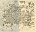
 Cambridge-Shire - By H. Moll Geographer - btv1b530568644.jpg 3,048 × 4,304; 1.95 MB
-

-
 Stilton-Markep Deeping (BM J,11.6).jpg 997 × 1,866; 286 KB
-
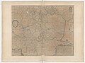
 Ordnance Survey Drawings - Cambridge, Cambridgeshire (OSD 235).jpg 4,000 × 2,195; 2.73 MB
-
 Ordnance Survey Drawings - Littleport, Cambridgeshire (OSD 250).jpg 2,993 × 4,000; 2.74 MB
-
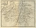
 Ordnance Survey Drawings - March, Cambridgeshire (OSD 249).jpg 2,828 × 4,000; 2.89 MB
-
 Ordnance Survey Drawings - Whittlesey (OSD 270).jpg 3,316 × 4,000; 3.81 MB
-

-
-

-
 A Map of the Great Levell of the Fenns (Jonas Moor).jpg 2,362 × 1,735; 2.95 MB
-
 Bar hill, npe 1948.png 642 × 477; 620 KB
-
 Cambridgeshire (1722).png 4,292 × 5,038; 49.01 MB
-
 EB9 Huntingdon & Cambridge ACB.png 534 × 745; 951 KB
-
 EB9 Huntingdon & Cambridge CSS.png 2,624 × 3,747; 15.15 MB
-
 EB9 Huntingdon & Cambridge RSP.png 2,512 × 3,512; 15.35 MB
-

-
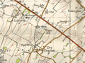
 Ordnance Survey Sheet TL 34 (52 34) Royston, Published c1949.jpg 7,636 × 8,826; 10.89 MB
-

-
 Wentworth 20th century map.png 534 × 530; 510 KB
.jpg)
.jpg)

.jpg)
.jpg)
.jpg)
.jpg)
.jpg)
.jpg)
%27_(11059222605).jpg)
.jpg)

.jpg)

.png)


_Royston,_Published_c1949_cropped_Meldreth_and_Cement_works.jpg)
_Royston,_Published_c1949.jpg)
.jpg)
