Category:Old maps of Lancashire
Jump to navigation
Jump to search
Ceremonial counties of England: Bedfordshire · Berkshire · Buckinghamshire · Cambridgeshire · Cheshire · Cornwall · Cumbria · Derbyshire · Devon · Dorset · Durham · East Riding of Yorkshire · East Sussex · Essex · Gloucestershire · Greater London · Greater Manchester · Hampshire · Herefordshire · Hertfordshire · Isle of Wight · Kent · Lancashire · Leicestershire · Lincolnshire · Norfolk · North Yorkshire · Northamptonshire · Northumberland · Nottinghamshire · Oxfordshire · Rutland · Shropshire · Somerset · South Yorkshire · Staffordshire · Suffolk · Surrey · Warwickshire · West Midlands · West Sussex · West Yorkshire · Wiltshire · Worcestershire
City-counties: Bristol · City of London
Former historic counties: Cumberland · Huntingdonshire · Middlesex · Sussex · Westmorland · Yorkshire
Other former counties:
City-counties: Bristol · City of London
Former historic counties: Cumberland · Huntingdonshire · Middlesex · Sussex · Westmorland · Yorkshire
Other former counties:
Use the appropriate category for maps showing all or a large part of Lancashire. See subcategories for smaller areas:
| If the map shows | Category to use |
|---|---|
| Lancashire on a recently created map | Category:Maps of Lancashire or its subcategories |
| Lancashire on a map created more than 70 years ago | Category:Old maps of Lancashire or its subcategories |
| the history of Lancashire on a recently created map | Category:Maps of the history of Lancashire or its subcategories |
| the history of Lancashire on a map created more than 70 years ago | Category:Old maps of the history of Lancashire or its subcategories |
Subcategories
This category has the following 9 subcategories, out of 9 total.
Media in category "Old maps of Lancashire"
The following 38 files are in this category, out of 38 total.
-

-
 Print, map (BM 1848,0212.9).jpg 1,754 × 2,500; 1.37 MB
-
 Penwortham 1840.png 4,493 × 3,178; 27.97 MB
-

-

-

-

-

-

-
 Penwortham 1888.png 4,493 × 3,178; 19.95 MB
-
 Penwortham 1949.png 4,493 × 3,178; 22.78 MB
-

-

-

-
 544 of '(Our own country. Descriptive, historical, pictorial.)' (11211856754).jpg 1,889 × 1,262; 696 KB
-

-
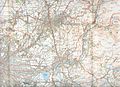
 Admiralty Chart No 1981 Approaches to Preston, Published 1951.jpg 16,136 × 11,045; 55.87 MB
-
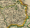
 C1840s Lancashire County Map Chapman & Hall Print Liverpool Lancaster.jpg 4,976 × 6,408; 10.47 MB
-
 Chorleymap1947.jpg 2,544 × 3,504; 1.53 MB
-
 Greater Manchester (ancient).png 764 × 534; 957 KB
-
 HARDWICK(1857) p01.8 - Lancashire.jpg 3,077 × 4,410; 3.08 MB
-
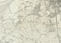
 Hundred of Amounderness.png 588 × 478; 702 KB
-
 Hundred of Blackburn.png 578 × 476; 676 KB
-
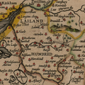 Hundred of Leyland.png 915 × 915; 1.43 MB
-
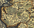
 Hundred of Lonsdale.png 903 × 785; 1.63 MB
-
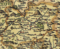
 Hundred of Salford.png 690 × 652; 1.07 MB
-
 Hundred of West Derby.png 702 × 652; 1.06 MB
-
 Lancashire.jpg 3,123 × 2,542; 2.66 MB
-
 North.Lancashire.1610.jpg 1,800 × 1,197; 308 KB
-
 Oldhammap1924.jpg 3,504 × 2,544; 1.84 MB
-
 Padiham map ca1844.jpg 1,101 × 1,078; 95 KB
-
 Padiham OS map 1890.jpg 2,019 × 1,312; 2.35 MB
-
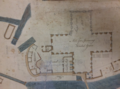 Plan of Dolphinholme Mill.png 844 × 629; 811 KB
-
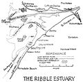 Ribble.Estuary.1917.jpg 1,800 × 1,763; 208 KB
-
 Southportmap1947.jpg 2,544 × 3,504; 1.42 MB
-
 Southwest.Lancashire.1610.jpg 1,265 × 1,800; 276 KB
-
 The antiquities of England and Wales. By Francis Grose, - Fleuron T147669-36.png 1,667 × 1,277; 114 KB
-
 Turnpike roads of Lancashire and Cheshire.jpg 1,630 × 2,537; 813 KB
.jpg)
.jpg)

.jpg)
.jpg)
.jpg)
%27_(11249435396).jpg)
%27_(11290214796).jpg)
%27_(11252253754).jpg)


%27_(11101123283).jpg)
.jpg)
%27_(11007139926).jpg)
%27_(11211856754).jpg)
.jpg)


.png)
_p01.8_-_Lancashire.jpg)


