Category:Old maps of Cumbria
Jump to navigation
Jump to search
Ceremonial counties of England: Bedfordshire · Berkshire · Buckinghamshire · Cambridgeshire · Cheshire · Cornwall · Cumbria · Derbyshire · Devon · Dorset · Durham · East Riding of Yorkshire · East Sussex · Essex · Gloucestershire · Greater London · Greater Manchester · Hampshire · Herefordshire · Hertfordshire · Isle of Wight · Kent · Lancashire · Leicestershire · Lincolnshire · Norfolk · North Yorkshire · Northamptonshire · Northumberland · Nottinghamshire · Oxfordshire · Rutland · Shropshire · Somerset · South Yorkshire · Staffordshire · Suffolk · Surrey · Warwickshire · West Midlands · West Sussex · West Yorkshire · Wiltshire · Worcestershire
City-counties: Bristol · City of London
Former historic counties: Cumberland · Huntingdonshire · Middlesex · Sussex · Westmorland · Yorkshire
Other former counties:
City-counties: Bristol · City of London
Former historic counties: Cumberland · Huntingdonshire · Middlesex · Sussex · Westmorland · Yorkshire
Other former counties:
Subcategories
This category has the following 5 subcategories, out of 5 total.
-
- Old county maps of Cumberland (13 F)
C
- Old maps of Carlisle (10 F)
Media in category "Old maps of Cumbria"
The following 13 files are in this category, out of 13 total.
-
 The Quarterly journal of the Geological Society of London (12734130884).jpg 1,637 × 1,235; 419 KB
-
 20 of 'Ingleton- bygone and present. (With a map and illustrations.)' (11194677156).jpg 4,604 × 4,146; 3.38 MB
-
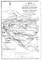 Alston Moor map Sopwith.jpg 535 × 769; 88 KB
-
 Belle Isle1925.jpg 286 × 258; 59 KB
-
 Haile 20th Century Historical Map.PNG 586 × 440; 629 KB
-
-
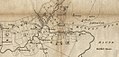
 Hutton Moor End, revised 1898.jpg 2,592 × 1,944; 2.28 MB
-
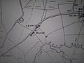
 Hutton Moor End, surveyed 1861, published 1867.jpg 2,592 × 1,944; 2.74 MB
-
 Moor End 1787.jpg 1,047 × 450; 437 KB
-
 Ordnance Survey One-Inch Tourist Map of the Lake District Published 1925.jpg 10,585 × 13,214; 20.97 MB
-
 Railwayjunction00airegoog 0049b.tif 1,093 × 1,732; 835 KB
-
 Railwayjunction00airegoog 0049c.jpg 1,093 × 1,732; 605 KB
-
 The Lake District, One-inch Ordnance Survey Tourist Map.jpg 9,860 × 12,251; 18.68 MB
.jpg)
%27_(11194677156).jpg)


.jpg)


