Category:Old maps of Westmorland
Jump to navigation
Jump to search
Ceremonial counties of England: Bedfordshire · Berkshire · Buckinghamshire · Cambridgeshire · Cheshire · Cornwall · Cumbria · Derbyshire · Devon · Dorset · Durham · East Riding of Yorkshire · East Sussex · Essex · Gloucestershire · Greater London · Greater Manchester · Hampshire · Herefordshire · Hertfordshire · Isle of Wight · Kent · Lancashire · Leicestershire · Lincolnshire · Norfolk · North Yorkshire · Northamptonshire · Northumberland · Nottinghamshire · Oxfordshire · Rutland · Shropshire · Somerset · South Yorkshire · Staffordshire · Suffolk · Surrey · Warwickshire · West Midlands · West Sussex · West Yorkshire · Wiltshire · Worcestershire
City-counties: Bristol · City of London
Former historic counties: Cumberland · Huntingdonshire · Middlesex · Sussex · Westmorland · Yorkshire
Other former counties:
City-counties: Bristol · City of London
Former historic counties: Cumberland · Huntingdonshire · Middlesex · Sussex · Westmorland · Yorkshire
Other former counties:
Subcategories
This category has the following 4 subcategories, out of 4 total.
Media in category "Old maps of Westmorland"
The following 7 files are in this category, out of 7 total.
-
 102 of 'England and Wales Delineated, etc' (11034044004).jpg 1,453 × 2,391; 868 KB
-
 103 of 'England and Wales Delineated, etc' (11033433853).jpg 1,453 × 2,391; 885 KB
-
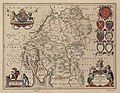 Westmoria Comitatus ; Anglice Westmorland - btv1b53056674s (1 of 2).jpg 6,280 × 4,880; 5.09 MB
-

-

-

-
 Westmorland - By H. Moll Geographer - btv1b530566450.jpg 4,152 × 3,104; 2 MB
.jpg)
.jpg)
.jpg)
%27_(11055931176).jpg)
%27_(11053564786).jpg)

