Category:Old maps of Berkshire
Jump to navigation
Jump to search
Ceremonial counties of England: Bedfordshire · Berkshire · Buckinghamshire · Cambridgeshire · Cheshire · Cornwall · Cumbria · Derbyshire · Devon · Dorset · Durham · East Riding of Yorkshire · East Sussex · Essex · Gloucestershire · Greater London · Greater Manchester · Hampshire · Herefordshire · Hertfordshire · Isle of Wight · Kent · Lancashire · Leicestershire · Lincolnshire · Norfolk · North Yorkshire · Northamptonshire · Northumberland · Nottinghamshire · Oxfordshire · Rutland · Shropshire · Somerset · South Yorkshire · Staffordshire · Suffolk · Surrey · Warwickshire · West Midlands · West Sussex · West Yorkshire · Wiltshire · Worcestershire
City-counties: Bristol · City of London
Former historic counties: Cumberland · Huntingdonshire · Middlesex · Sussex · Westmorland · Yorkshire
Other former counties:
City-counties: Bristol · City of London
Former historic counties: Cumberland · Huntingdonshire · Middlesex · Sussex · Westmorland · Yorkshire
Other former counties:
Subcategories
This category has the following 5 subcategories, out of 5 total.
- Old county maps of Berkshire (24 F)
- Ordnance Survey 1st series 1:10560, Map of Berkshire (1 P, 76 F)
R
W
Media in category "Old maps of Berkshire"
The following 32 files are in this category, out of 32 total.
-
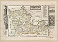
 A Mapp of Barkshire with its Hundreds. (BM 1850,0223.274).jpg 2,500 × 1,915; 1.44 MB
-
 A Mapp of Barkshire with its Hundreds. (BM 1864,1114.33).jpg 2,500 × 1,906; 1.46 MB
-
 Berk Shire - By H. Moll Geographer - btv1b53056293n.jpg 4,000 × 2,912; 1.88 MB
-
 Ordnance Survey Drawings - Odiham (OSD 125).jpg 5,851 × 3,247; 4.55 MB
-
 Ordnance Survey Drawings - Hampshire (OSD 78).jpg 4,000 × 2,669; 4.25 MB
-
 Ordnance Survey Drawings - Reading (OSD 126) (cropped).jpg 4,733 × 2,769; 4.01 MB
-
 Ordnance Survey Drawings - Bampton (OSD 161).jpg 4,000 × 2,585; 3.9 MB
-
 Ordnance Survey Drawings - Wallingford (OSD 157).jpg 3,465 × 4,000; 5.14 MB
-
 Ordnance Survey Drawings - Wantage (OSD 160).jpg 4,000 × 2,598; 3.5 MB
-
 Ordnance Survey Drawings - Lambourn (OSD 159).jpg 4,000 × 2,884; 4.57 MB
-
 Ordnance Survey Drawings - Froxfield (OSD 167).jpg 4,000 × 2,429; 2.93 MB
-
 1817 ordnance survey map.JPG 732 × 490; 112 KB
-
-
 Berkshire (BM 1902,1011.9863).jpg 2,500 × 1,879; 1.27 MB
-

-

-

-
 Bodleian Libraries, The First Sheet of an Actual Survey of Berkshire, 1752.jpg 1,000 × 675; 175 KB
-
 CURTIS(1896) p25 - Hundreds of Hampshire, 1600.jpg 1,518 × 1,496; 584 KB
-
 John Willis map of Sandleford, Berkshire, 1768.jpg 341 × 421; 50 KB
-
 Map of Oxford; Thomas Willis Wellcome L0011739.jpg 1,620 × 1,272; 692 KB
-

-
 Ordnance Survey Drawings - Reading (OSD 126).jpg 5,679 × 3,450; 4.7 MB
-
 Ordnance Survey Drawings - Windsor (OSD 153).jpg 3,682 × 4,000; 5.27 MB
-
 Ordnance Survey One-inch map Maidenhead Windsor and Henley, Published 1912.jpg 12,613 × 8,972; 15.96 MB
-
 Ordnance Survey One-Inch Sheet 114 SW London and Windsor, Published 1934.jpg 13,539 × 9,026; 14.45 MB
-
 Ordnance Survey One-Inch Sheet 114 Windsor, Published 1920.jpg 12,130 × 8,368; 14.07 MB
-
 Ordnance Survey One-Inch Sheet 159 The Chilterns, Published 1945.jpg 8,187 × 9,575; 12.08 MB
-
 Sandleford, as seen on John Rocque's map of Berkshire, 1761.jpg 2,247 × 2,000; 1.88 MB
-

-
 Wessex 2 Silchester pic.jpg 720 × 960; 118 KB
-
 William Chatteris era map of Sandleford farm, park and priory, Berkshire, 1871.jpg 1,766 × 1,729; 1.84 MB
.jpg)
.jpg)

.jpg)
.jpg)
_(cropped).jpg)
.jpg)
.jpg)
.jpg)
.jpg)
.jpg)

%27_(11214352126).jpg)
.jpg)
%27_(11060706254).jpg)
%27_(11059943785).jpg)


_p25_-_Hundreds_of_Hampshire,_1600.jpg)


.jpg)
.jpg)


