Category:Maps of Colorado
Jump to navigation
Jump to search
States of the United States: Alabama · Alaska · Arizona · Arkansas · California · Colorado · Connecticut · Delaware · Florida · Georgia · Hawaii · Idaho · Illinois · Indiana · Iowa · Kansas · Kentucky · Louisiana · Maine · Maryland · Massachusetts · Michigan · Minnesota · Mississippi · Missouri · Montana · Nebraska · Nevada · New Hampshire · New Jersey · New Mexico · New York · North Carolina · North Dakota · Ohio · Oklahoma · Oregon · Pennsylvania · Rhode Island · South Carolina · South Dakota · Tennessee · Texas · Utah · Vermont · Virginia · Washington · West Virginia · Wisconsin · Wyoming – Washington, D.C.
insular area of the United States: American Samoa · Guam · Northern Mariana Islands · Puerto Rico · United States Virgin Islands – United States Minor Outlying Islands: Baker Island · Howland Island · Jarvis Island · Johnston Atoll · Kingman Reef · Midway Atoll · Navassa Island · Palmyra Atoll · Wake Island
insular area of the United States: American Samoa · Guam · Northern Mariana Islands · Puerto Rico · United States Virgin Islands – United States Minor Outlying Islands: Baker Island · Howland Island · Jarvis Island · Johnston Atoll · Kingman Reef · Midway Atoll · Navassa Island · Palmyra Atoll · Wake Island
Wikimedia category | |||||
| Upload media | |||||
| Instance of | |||||
|---|---|---|---|---|---|
| Category combines topics | |||||
| Colorado | |||||
state of the United States of America | |||||
| Pronunciation audio | |||||
| Instance of | |||||
| Part of |
| ||||
| Named after | |||||
| Location |
| ||||
| Located in or next to body of water | |||||
| Capital | |||||
| Legislative body | |||||
| Executive body | |||||
| Highest judicial authority | |||||
| Official language | |||||
| Anthem |
| ||||
| Head of government |
| ||||
| Inception |
| ||||
| Highest point | |||||
| Population |
| ||||
| Area |
| ||||
| Elevation above sea level |
| ||||
| Replaces | |||||
| Different from | |||||
| Maximum temperature record |
| ||||
| Minimum temperature record |
| ||||
| official website | |||||
 | |||||
Subcategories
This category has the following 34 subcategories, out of 34 total.
*
A
B
- Bird's eye view maps of Colorado (104 F)
- Blank maps of Colorado (1 F)
C
D
F
- Flag maps of Colorado (2 F)
G
H
L
M
- Mining maps of Colorado (26 F)
N
O
P
R
S
T
Media in category "Maps of Colorado"
The following 70 files are in this category, out of 70 total.
-
"Explore" wayside at Comanche National Grassland (b38b035cb4de4ee78a487d0be807bdf4).JPG 4,000 × 2,248; 1.52 MB
-
AmDiscoveryMap.jpg 300 × 211; 32 KB
-
Arapahoe Cheyenne Land 1851.jpg 916 × 688; 457 KB
-
Area codes CO.png 425 × 295; 9 KB
-
Aroya, Colorado vicinity map.png 1,002 × 706; 154 KB
-
Bell telephone magazine (1922) (14753929944).jpg 2,416 × 2,000; 896 KB
-
Forest atlas of the national forests of the United States. Battlement folio (IA CAT31290533).pdf 1,831 × 2,131, 46 pages; 10.45 MB
-
Climax Colorado shaded-relief perspective 3.jpg 695 × 600; 103 KB
-
CO - CSP Districts.jpg 946 × 718; 604 KB
-
COLMmap1.png 2,484 × 3,790; 2.63 MB
-
Colorado 15 map.png 709 × 517; 36 KB
-
Colorado Köppen.png 6,000 × 7,650; 478 KB
-
Colorado Level IV ecoregions.pdf 6,652 × 5,260; 2.48 MB
-
Colorado POI.png 722 × 532; 13 KB
-
Colorado population map.png 700 × 400; 109 KB
-
Colorado ref 2001 with trail.jpg 746 × 557; 420 KB
-
Colorado ref 2001.jpg 815 × 603; 265 KB
-
Colorado regions map.png 1,735 × 1,300; 538 KB
-
Colorado SP Sand Creek Massacre Site - NA Identifier 84131113 MAP Section 7 Page 19.png 1,295 × 1,783; 793 KB
-
Colorado wind resource map 50m 800.jpg 1,100 × 850; 764 KB
-
Colorado-counties-zh.png 800 × 579; 97 KB
-
COMap-doton-Carbondale.PNG 300 × 216; 13 KB
-
COMap-doton-SnowmassVillage.PNG 300 × 216; 13 KB
-
COMap-doton-Springfield.PNG 300 × 216; 13 KB
-
COMap-doton-Towaoc.PNG 300 × 216; 13 KB
-
Cripple Creek, Victor Mining District Railroads Map.jpg 800 × 600; 153 KB
-
Geothermal Resources of Colorado 1980.jpg 2,531 × 2,011; 1.77 MB
-
Geothermal resources of Colorado.pdf 7,745 × 6,154; 4.32 MB
-
Gore Creek, Colorado.png 3,266 × 2,572; 58 KB
-
LocMap Great Sand Dunes National Park.png 280 × 183; 31 KB
-
Green River Country BHoU-p24.png 3,346 × 3,533; 211 KB
-
High Rockies SRTM30.JPG 500 × 607; 64 KB
-
Independence Pass USGS map.png 723 × 658; 996 KB
-
Leadville National Fish Hatchery (4857659690).jpg 4,416 × 3,312; 935 KB
-
Map of Air Force Academy Campus, 2012.jpg 1,024 × 803; 201 KB
-
Map of Colorado - DPLA - 034f23ae7a584e213d1e05cfd09847c5.jpg 8,088 × 5,438; 11.51 MB
-
Map of World War II Japanese American internment camps.png 896 × 744; 105 KB
-
Mt Democrat GPS Track.jpg 2,000 × 2,000; 762 KB
-
NASA Worldwind, USGS imagery map, Silver Dollar Island, Colorado.png 300 × 300; 120 KB
-
NFRMPOboundariesMap.jpeg 600 × 457; 51 KB
-
North Colorado.png 1,000 × 724; 108 KB
-
NPS black-canyon-east-portal-campground-map.gif 4,712 × 1,065; 351 KB
-
Ogallala area freshwater ground withdrawals all aquifers.png 1,121 × 1,606; 283 KB
-
Pawnee National Grassland location in Colorado.png 3,500 × 2,533; 3.35 MB
-
Pawnee National Grassland location in Weld County.png 3,500 × 3,169; 667 KB
-
Physiographic provinces of Colorado (26309673473).jpg 2,200 × 1,700; 2.15 MB
-
Population density of Colorado counties (2020).jpg 4,624 × 3,218; 828 KB
-
Project Rulison - Site Map.png 2,803 × 1,946; 457 KB
-
Purgatoire river basin.jpg 1,439 × 869; 262 KB
-
Quandry Peak GPS Track.jpg 2,000 × 777; 526 KB
-
Riogranderiobravo.PNG 131 × 125; 33 KB
-
Map of Rocky Mountain National Park.png 3,247 × 3,691; 3.22 MB
-
San Miguel River watershed.jpg 1,290 × 887; 390 KB
-
Sawtooth GPS Track.jpg 2,000 × 901; 677 KB
-
Southern Ute reservation map.png 1,004 × 400; 20 KB
-
Transportation Technology Center.png 708 × 1,102; 119 KB
-
US Air Force Thunderbirds Colorado Flyover Flight Plan 18 April 2020.jpg 767 × 960; 129 KB
-
Vintage "Colorado" Souvenir Powder Compact by Wadsworth (9440753008).jpg 3,338 × 3,417; 2.82 MB
-
Wattenberg Erdgasfeld 2.jpg 1,922 × 1,934; 384 KB
-
White River National Forest Map.jpg 4,032 × 3,024; 3.79 MB
-
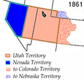
Wpdms utah territory 1861.png 255 × 247; 32 KB
-
WXM87 coverage map.gif 816 × 1,056; 35 KB
-
YoungstownCitySeriesMap.png 752 × 635; 15 KB
