Category:Locator maps of counties of Colorado
Jump to navigation
Jump to search
States of the United States: Alabama · Alaska · Arizona · Arkansas · California · Colorado · Connecticut · Delaware · Florida · Georgia · Hawaii · Idaho · Illinois · Indiana · Iowa · Kansas · Kentucky · Louisiana · Maine · Maryland · Massachusetts · Michigan · Minnesota · Mississippi · Missouri · Montana · Nebraska · Nevada · New Hampshire · New Jersey · New Mexico · New York · North Carolina · North Dakota · Ohio · Oklahoma · Oregon · Pennsylvania · Rhode Island · South Carolina · South Dakota · Tennessee · Texas · Utah · Vermont · Virginia · Washington · West Virginia · Wisconsin · Wyoming
| NO WIKIDATA ID FOUND! Search for Locator maps of counties of Colorado on Wikidata | |
| Upload media |
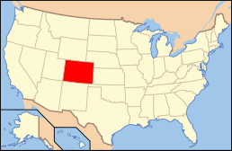
English: Locator maps for counties in Colorado.
Subcategories
This category has only the following subcategory.
Media in category "Locator maps of counties of Colorado"
The following 72 files are in this category, out of 72 total.
-
 ColoradoMapHighlightingConejosCounty.png 800 × 578; 76 KB
-
 Map of Colorado highlighting Adams County.svg 1,558 × 1,128; 64 KB
-
 Map of Colorado highlighting Alamosa County.svg 1,558 × 1,128; 64 KB
-
 Map of Colorado highlighting Arapahoe County.svg 1,558 × 1,128; 64 KB
-
 Map of Colorado highlighting Archuleta County.svg 1,558 × 1,128; 64 KB
-
 Map of Colorado highlighting Baca County.svg 1,558 × 1,128; 64 KB
-
 Map of Colorado highlighting Bent County.svg 1,558 × 1,128; 64 KB
-
 Map of Colorado highlighting Boulder County.svg 1,558 × 1,128; 64 KB
-
 Map of Colorado highlighting Broomfield County.svg 1,558 × 1,128; 64 KB
-
 Map of Colorado highlighting Chaffee County.svg 1,558 × 1,128; 64 KB
-
 Map of Colorado highlighting Cheyenne County.svg 1,558 × 1,128; 64 KB
-
 Map of Colorado highlighting Clear Creek County.svg 1,558 × 1,128; 64 KB
-
 Map of Colorado highlighting Conejos County.svg 1,558 × 1,128; 64 KB
-
 Map of Colorado highlighting Costilla County.svg 1,558 × 1,128; 64 KB
-
 Map of Colorado highlighting Crowley County.svg 1,558 × 1,128; 64 KB
-
 Map of Colorado highlighting Custer County.svg 1,558 × 1,128; 64 KB
-
 Map of Colorado highlighting Delta County.svg 1,558 × 1,128; 64 KB
-
 Map of Colorado highlighting Denver County (colored).svg 6,434 × 4,711; 67 KB
-
 Map of Colorado highlighting Denver County.svg 1,558 × 1,128; 64 KB
-
 Map of Colorado highlighting Dolores County.svg 1,558 × 1,128; 64 KB
-
 Map of Colorado highlighting Douglas County.svg 1,558 × 1,128; 64 KB
-
 Map of Colorado highlighting Eagle County.svg 1,558 × 1,128; 64 KB
-
 Map of Colorado highlighting El Paso County.svg 1,558 × 1,128; 64 KB
-
 Map of Colorado highlighting Elbert County.svg 1,558 × 1,128; 64 KB
-
 Map of Colorado highlighting Fremont County.svg 1,558 × 1,128; 64 KB
-
 Map of Colorado highlighting Garfield County.svg 1,558 × 1,128; 64 KB
-
 Map of Colorado highlighting Gilpin County.svg 1,558 × 1,128; 64 KB
-
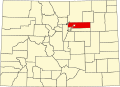
 Map of Colorado highlighting Grand County.svg 1,558 × 1,128; 64 KB
-
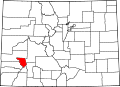
 Map of Colorado highlighting Gunnison County.svg 1,558 × 1,128; 64 KB
-
 Map of Colorado highlighting Hinsdale County.svg 1,558 × 1,128; 64 KB
-
 Map of Colorado highlighting Huerfano County.svg 1,558 × 1,128; 64 KB
-
 Map of Colorado highlighting Jackson County.svg 1,558 × 1,128; 64 KB
-
 Map of Colorado highlighting Jefferson County.svg 1,558 × 1,128; 64 KB
-
 Map of Colorado highlighting Kiowa County.svg 1,558 × 1,128; 64 KB
-
 Map of Colorado highlighting Kit Carson County.svg 1,558 × 1,128; 64 KB
-
 Map of Colorado highlighting La Plata County.svg 1,558 × 1,128; 64 KB
-
 Map of Colorado highlighting Lake County.svg 1,558 × 1,128; 64 KB
-
 Map of Colorado highlighting Larimer County.svg 1,558 × 1,128; 64 KB
-
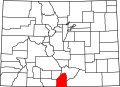
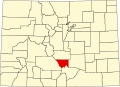
 Map of Colorado highlighting Las Animas County.svg 1,558 × 1,128; 64 KB
-
 Map of Colorado highlighting Lincoln County.svg 1,558 × 1,128; 64 KB
-
 Map of Colorado highlighting Logan County.svg 1,558 × 1,128; 64 KB
-
 Map of Colorado highlighting Mesa County.svg 1,558 × 1,128; 64 KB
-
 Map of Colorado highlighting Mineral County.svg 1,558 × 1,128; 64 KB
-
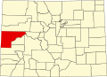
 Map of Colorado highlighting Moffat County.svg 1,558 × 1,128; 64 KB
-
 Map of Colorado highlighting Montezuma County.svg 1,558 × 1,128; 64 KB
-
 Map of Colorado highlighting Montrose County.svg 1,558 × 1,128; 64 KB
-
 Map of Colorado highlighting Morgan County.svg 1,558 × 1,128; 64 KB
-
 Map of Colorado highlighting Otero County.svg 1,558 × 1,128; 64 KB
-
 Map of Colorado highlighting Ouray County.svg 1,558 × 1,128; 64 KB
-
 Map of Colorado highlighting Park County.svg 1,558 × 1,128; 64 KB
-
 Map of Colorado highlighting Phillips County.svg 1,558 × 1,128; 64 KB
-
 Map of Colorado highlighting Pitkin County.svg 1,558 × 1,128; 64 KB
-
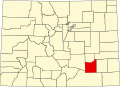
 Map of Colorado highlighting Prowers County.svg 1,558 × 1,128; 64 KB
-
 Map of Colorado highlighting Pueblo County.svg 1,558 × 1,128; 64 KB
-
 Map of Colorado highlighting Rio Blanco County.svg 1,558 × 1,128; 64 KB
-
 Map of Colorado highlighting Rio Grande County.svg 1,558 × 1,128; 64 KB
-
 Map of Colorado highlighting Routt County.svg 1,558 × 1,128; 64 KB
-
 Map of Colorado highlighting Saguache County.svg 1,558 × 1,128; 64 KB
-
 Map of Colorado highlighting San Juan County.svg 1,558 × 1,128; 64 KB
-
 Map of Colorado highlighting San Miguel County.svg 1,558 × 1,128; 64 KB
-
 Map of Colorado highlighting Sedgwick County.svg 1,558 × 1,128; 64 KB
-
 Map of Colorado highlighting Summit County.svg 1,558 × 1,128; 64 KB
-
 Map of Colorado highlighting Teller County.svg 1,558 × 1,128; 64 KB
-
 Map of Colorado highlighting Washington County.svg 1,558 × 1,128; 64 KB
-
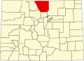
 Map of Colorado highlighting Weld County.svg 1,558 × 1,128; 64 KB
-
 Map of Colorado highlighting Yuma County.svg 1,558 × 1,128; 64 KB
-
-
-

-
-

-


.svg)


