Category:Maps of Weld County, Colorado
Jump to navigation
Jump to search
Counties of Colorado: Adams · Alamosa · Arapahoe · Archuleta · Baca · Bent · Boulder · Chaffee · Cheyenne · Clear Creek · Conejos · Costilla · Crowley · Custer · Delta · Dolores · Douglas · Eagle · El Paso · Elbert · Fremont · Garfield · Gilpin · Grand · Gunnison · Hinsdale · Huerfano · Jackson · Jefferson · Kiowa · Kit Carson · Lake · La Plata · Larimer · Las Animas · Lincoln · Logan · Mesa · Mineral · Moffat · Montezuma · Montrose · Morgan · Otero · Ouray · Park · Phillips · Pitkin · Prowers · Pueblo · Rio Blanco · Rio Grande · Routt · Saguache · San Juan · San Miguel · Sedgwick · Summit · Teller · Washington · Weld · Yuma
City-counties: Broomfield · Denver
City-counties: Broomfield · Denver
| NO WIKIDATA ID FOUND! Search for Maps of Weld County, Colorado on Wikidata | |
| Upload media |
Subcategories
This category has only the following subcategory.
O
Media in category "Maps of Weld County, Colorado"
The following 79 files are in this category, out of 79 total.
-

-
-

-
 Colorado Senate District 1 (2010).png 3,507 × 2,490; 445 KB
-
 Colorado Senate District 13 (2010).png 3,507 × 2,490; 411 KB
-
 Colorado Senate District 23 (2010).png 3,507 × 2,490; 412 KB
-
 COMap-doton-Dacono.PNG 300 × 216; 13 KB
-
 COMap-doton-Eaton.PNG 300 × 216; 13 KB
-
 COMap-doton-Evans.PNG 300 × 216; 13 KB
-
 COMap-doton-Firestone.PNG 300 × 216; 13 KB
-
 COMap-doton-FortLupton.PNG 300 × 216; 13 KB
-
 COMap-doton-Frederick.PNG 300 × 216; 13 KB
-
 COMap-doton-GardenCity.PNG 300 × 216; 13 KB
-
 COMap-doton-Gilcrest.PNG 300 × 216; 13 KB
-
 COMap-doton-Greeley.PNG 300 × 216; 13 KB
-
 COMap-doton-Grover.PNG 300 × 216; 13 KB
-
 COMap-doton-Johnstown.PNG 300 × 216; 13 KB
-
 COMap-doton-Keenesburg.PNG 300 × 216; 13 KB
-
 COMap-doton-Kersey.PNG 300 × 216; 13 KB
-
 COMap-doton-Lochbuie.PNG 300 × 216; 13 KB
-
 COMap-doton-Mead.PNG 300 × 216; 13 KB
-
 COMap-doton-Milliken.PNG 300 × 216; 13 KB
-
 COMap-doton-Platteville.PNG 300 × 216; 13 KB
-
 COMap-doton-Raymer.PNG 300 × 216; 13 KB
-

-

-
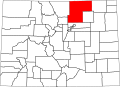
 Map of Colorado highlighting Weld County.svg 1,558 × 1,128; 64 KB
-
 Weld County Colorado Incorporated and Unincorporated areas Erie Highlighted.svg 1,050 × 900; 165 KB
-
 Pawnee National Grassland location in Weld County.png 3,500 × 3,169; 667 KB
-

-
-

-
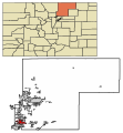
 Weld County Colorado Incorporated and Unincorporated areas Ault Highlighted.svg 1,050 × 900; 166 KB
-

-

-

-
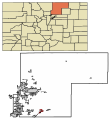
 Weld County Colorado Incorporated and Unincorporated areas Eaton Highlighted.svg 1,050 × 900; 165 KB
-

-
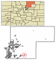
 Weld County Colorado Incorporated and Unincorporated areas Evans Highlighted.svg 1,050 × 900; 165 KB
-

-

-

-

-
-

-

-

-

-

-

-

-

-

-
-

-

-
-

-

-
-

-

-

-

-
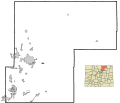
 Weld County Colorado Incorporated and Unincorporated areas Mead Highlighted.svg 1,050 × 900; 165 KB
-

-

-

-
 Weld County Colorado Incorporated and Unincorporated areas Nunn Highlighted.svg 1,050 × 900; 166 KB
-

-

-

-

-

-

-

-

-
-
 Weld County, Colorado until November 15, 2001.svg 3,117 × 2,255; 114 KB


.png)
.png)
.png)


_Highlighted_0863045.svg)


