Category:Maps of New York (state) by year
Jump to navigation
Jump to search
States of the United States: Alabama · Alaska · Arizona · Arkansas · California · Colorado · Connecticut · Delaware · Florida · Georgia · Hawaii · Idaho · Illinois · Indiana · Iowa · Kansas · Kentucky · Louisiana · Maine · Maryland · Massachusetts · Michigan · Minnesota · Mississippi · Missouri · Montana · Nebraska · Nevada · New Hampshire · New Jersey · New Mexico · New York · North Carolina · North Dakota · Ohio · Oklahoma · Oregon · Pennsylvania · Rhode Island · South Carolina · South Dakota · Tennessee · Texas · Utah · Vermont · Virginia · Washington · West Virginia · Wisconsin · Wyoming – Washington, D.C.
Puerto Rico
Puerto Rico
Subcategories
This category has the following 158 subcategories, out of 158 total.
- 1775 maps of New York (state) (11 F)
- 1776 maps of New York (state) (46 F)
- 1778 maps of New York (state) (12 F)
- 1779 maps of New York (state) (13 F)
- 1780 maps of New York (state) (11 F)
- 1781 maps of New York (state) (12 F)
- 1790 maps of New York (state) (empty)
- 1796 maps of New York (state) (12 F)
- 1834 maps of New York (state) (12 F)
- 1848 maps of New York (state) (12 F)
- 1852 maps of New York (state) (13 F)
- 1853 maps of New York (state) (21 F)
- 1854 maps of New York (state) (20 F)
- 1855 maps of New York (state) (19 F)
- 1856 maps of New York (state) (19 F)
- 1857 maps of New York (state) (21 F)
- 1858 maps of New York (state) (19 F)
- 1864 maps of New York (state) (19 F)
- 1872 maps of New York (state) (39 F)
- 1876 maps of New York (state) (88 F)
- 1877 maps of New York (state) (25 F)
- 1976 maps of New York (state) (10 F)
- 1980 maps of New York (state) (11 F)
- 1986 maps of New York (state) (empty)
.
Pages in category "Maps of New York (state) by year"
This category contains only the following page.
Media in category "Maps of New York (state) by year"
This category contains only the following file.
-
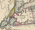 5 boros of NYC in 1814.jpg 2,689 × 2,305; 3.49 MB
