Category:1893 maps of New York (state)
Jump to navigation
Jump to search
States of the United States: California · Florida · Georgia · Idaho · Illinois · Iowa · Kansas · Kentucky · Louisiana · Michigan · Minnesota · Mississippi · Missouri · Montana · New Mexico · New York · North Carolina · North Dakota · Ohio · Oregon · Pennsylvania · South Carolina · South Dakota · Tennessee · Texas · Virginia · Washington · Wisconsin · Wyoming – Washington, D.C.
Subcategories
This category has the following 27 subcategories, out of 27 total.
1
N
S
Media in category "1893 maps of New York (state)"
The following 66 files are in this category, out of 66 total.
-
Annual report of the Regents (1894) (19370567721).jpg 3,124 × 1,864; 1.04 MB
-
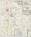
Sanborn Fire Insurance Map from Avoca, Steuben County, New York. LOC sanborn05751 001.jpg 6,450 × 7,650; 3.98 MB
-
Sanborn Fire Insurance Map from Avoca, Steuben County, New York. LOC sanborn05751 001.tif 6,450 × 7,650; 141.17 MB
-
Bulletin - New York State Museum (1893) (20415458296).jpg 3,268 × 3,106; 3.01 MB
-
Bulletin - New York State Museum (1893) (20441764115).jpg 3,018 × 1,882; 1.65 MB
-
Bulletin - New York State Museum (1895) (20253666590).jpg 3,904 × 3,576; 3.91 MB
-
Fort Ann New York USGS topo map 1893.jpg 3,079 × 3,612; 3.72 MB
-
Geneva, N.Y., 1893. LOC 2007630649.jpg 9,841 × 6,378; 8.55 MB
-
Geneva, N.Y., 1893. LOC 2007630649.tif 9,841 × 6,378; 179.57 MB
-
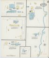
Sanborn Fire Insurance Map from Hammondsport, Steuben County, New York. LOC sanborn05970 002-1.tif 6,450 × 7,650; 141.17 MB
-
Sanborn Fire Insurance Map from Hammondsport, Steuben County, New York. LOC sanborn05970 002-2.tif 6,450 × 7,650; 141.17 MB
-
Sanborn Fire Insurance Map from Hammondsport, Steuben County, New York. LOC sanborn05970 002-3.tif 6,450 × 7,650; 141.17 MB
-
Mohawk, N.Y. LOC 2007625625.jpg 8,321 × 5,887; 9.19 MB
-
Mohawk, N.Y. LOC 2007625625.tif 8,321 × 5,887; 140.15 MB
-
Mount Morris, N.Y. LOC 85693020.jpg 9,680 × 5,511; 10.72 MB
-
Mount Morris, N.Y. LOC 85693020.tif 9,680 × 5,511; 152.63 MB
-
Sanborn Fire Insurance Map from Alfred Center, Allegany County, New York. LOC sanborn05731 001.tif 6,450 × 7,650; 141.17 MB
-
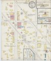
Sanborn Fire Insurance Map from Kanona, Steuben County, New York. LOC sanborn06017 001.jpg 6,450 × 7,650; 3.41 MB
-
Sanborn Fire Insurance Map from Kanona, Steuben County, New York. LOC sanborn06017 001.tif 6,450 × 7,650; 141.17 MB
-
Sanborn Fire Insurance Map from Prattsburgh, Stenben County, New York. LOC sanborn06193 002.tif 6,450 × 7,650; 141.17 MB
-
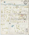
Sanborn Fire Insurance Map from Savona, Steuben County, New York. LOC sanborn06243 001.jpg 6,450 × 7,650; 3.53 MB
-
Sanborn Fire Insurance Map from Savona, Steuben County, New York. LOC sanborn06243 001.tif 6,450 × 7,650; 141.17 MB
-
Sanborn Fire Insurance Map from Union Springs, Cayuga County, New York. LOC sanborn06314 002-1.tif 6,450 × 7,650; 141.17 MB
-
Sanborn Fire Insurance Map from Union Springs, Cayuga County, New York. LOC sanborn06314 002-2.tif 6,450 × 7,650; 141.17 MB
-
Sanborn Fire Insurance Map from Union Springs, Cayuga County, New York. LOC sanborn06314 002-3.tif 6,450 × 7,650; 141.17 MB
-
Westchester, Double Page Plate No. 10 (Map bounded by 15th Ave., City of Yonkers, Mount Vernon Ave.) NYPL2056277.tiff 7,216 × 5,412, 2 pages; 112 MB
-
Westchester, Double Page Plate No. 12 (Map bounded by Pelham, E. 5th St., Rich Ave., East Chester) NYPL2056279.tiff 7,216 × 5,412, 2 pages; 112 MB
-
Westchester, Double Page Plate No. 13 (Map of Towns of Scarsdale, New Rochelle, and Mamaroneck) NYPL2056280.tiff 7,216 × 5,412, 2 pages; 112 MB
-
Westchester, Double Page Plate No. 14 (Map bounded by Pelham Winthrop St., Echo Ave., Long Island Sound) NYPL2056281.tiff 7,216 × 5,412, 2 pages; 112 MB
-
Westchester, Double Page Plate No. 15 (Map bounded by Mamaroneck, Long Island Sound, Liberty Ave.) NYPL2056282.tiff 7,216 × 5,412, 2 pages; 112 MB
-
Westchester, Double Page Plate No. 17 (Map of Towns of White Plains, Harrison, and Rye) NYPL2056284.tiff 7,216 × 5,412, 2 pages; 112 MB
-
Westchester, Double Page Plate No. 18 (Map bounded by Greenburg, North Castle, Harrison, White Plains) NYPL2056285.tiff 7,216 × 5,412, 2 pages; 112 MB
-
Westchester, Double Page Plate No. 19 (Map bounded by Regent St., Connecticut) NYPL2056286.tiff 7,216 × 5,412, 2 pages; 112 MB
-
Westchester, Double Page Plate No. 2 (Map of City and County of new York) NYPL2056269.tiff 5,412 × 7,216, 2 pages; 112 MB
-
Westchester, Double Page Plate No. 20 (Map of town of Greenburg) NYPL2056287.tiff 7,216 × 5,412, 2 pages; 112 MB
-
Westchester, Double Page Plate No. 23 (Map bounded by Towns of Mt.Pleasant and Ossining) NYPL2056290.tiff 7,216 × 5,412, 2 pages; 112 MB
-
Westchester, Double Page Plate No. 24 (Map bounded by Underhill Rd., Hudson River) NYPL2056291.tiff 7,216 × 5,412, 2 pages; 112 MB
-
Westchester, Double Page Plate No. 25 (Map of Town of Cortlandt) NYPL2056292.tiff 7,216 × 5,412, 2 pages; 112 MB
-
Westchester, Double Page Plate No. 26 (Map of village of Peekskill) NYPL2056293.tiff 7,216 × 5,412, 2 pages; 112 MB
-
Westchester, Double Page Plate No. 3 (Map of Towns of Westchester and Pelham) NYPL2056270.tiff 5,412 × 7,216, 2 pages; 112 MB
-
Westchester, Double Page Plate No. 30 (Map of Town of Bedford and Somers) NYPL2056297.tiff 7,216 × 5,412, 2 pages; 112 MB
-
Westchester, Double Page Plate No. 31 (Map of Town of Poundridge, Lewisbord and North Salem) NYPL2056298.tiff 7,216 × 5,412, 2 pages; 112 MB
-
Westchester, Double Page Plate No. 4 (Map of Towns of Yonkers, Mt. Vernon, Eastchester) NYPL2056271.tiff 5,412 × 7,216, 2 pages; 112 MB
-
Westchester, Double Page Plate No. 7 (Map bounded by Wells Ave., Hudson River, Hudson Terrace) NYPL2056274.tiff 5,412 × 7,216, 2 pages; 112 MB
-
Westchester, Plate No. 1 (Map of Westchester County and Surroundings) NYPL2056268.tiff 5,412 × 7,216, 2 pages; 112 MB
-
Westchester, Plate No. 27 (Map of Town of York Town) NYPL2056294.tiff 7,216 × 5,412, 2 pages; 112 MB
-
Westchester, Plate No. 28 (Map of Town of North Castle) NYPL2056295.tiff 7,216 × 5,412, 2 pages; 112 MB
-
Westchester, Plate No. 29 (Map of Town of New Castle, Village of Mt.Kisco, Village of Chappaqua) NYPL2056296.tiff 7,216 × 5,412, 2 pages; 112 MB

