Category:1924 maps of New York (state)
Jump to navigation
Jump to search
States of the United States: Illinois · Iowa · Massachusetts · Michigan · Minnesota · New York · Pennsylvania · Utah · Wisconsin · Wyoming
Media in category "1924 maps of New York (state)"
The following 2 files are in this category, out of 2 total.
-
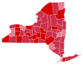 New York Presidential Election Results 1924.svg 744 × 577; 297 KB
-
 Proposed Route of Washington Heights subway with Columbus Avenue shift, 1924.png 3,664 × 1,387; 170 KB
