Category:Maps of North Carolina by year
Jump to navigation
Jump to search
States of the United States: Alabama · Alaska · Arizona · Arkansas · California · Colorado · Connecticut · Delaware · Florida · Georgia · Hawaii · Idaho · Illinois · Indiana · Iowa · Kansas · Kentucky · Louisiana · Maine · Maryland · Massachusetts · Michigan · Minnesota · Mississippi · Missouri · Montana · Nebraska · Nevada · New Hampshire · New Jersey · New Mexico · New York · North Carolina · North Dakota · Ohio · Oklahoma · Oregon · Pennsylvania · Rhode Island · South Carolina · South Dakota · Tennessee · Texas · Utah · Vermont · Virginia · Washington · West Virginia · Wisconsin · Wyoming – Washington, D.C.
Puerto Rico
Puerto Rico
Subcategories
This category has the following 36 subcategories, out of 36 total.
- 1709 maps of North Carolina (empty)
- 1746 maps of North Carolina (1 F)
- 1747 maps of North Carolina (1 F)
- 1775 maps of North Carolina (10 F)
- 1777 maps of North Carolina (2 F)
- 1861 maps of North Carolina (6 F)
- 1862 maps of North Carolina (12 F)
- 1864 maps of North Carolina (19 F)
- 1884 maps of North Carolina (5 F)
- 1897 maps of North Carolina (6 F)
- 1900 maps of North Carolina (1 F)
- 1926 maps of North Carolina (empty)
- 1932 maps of North Carolina (1 F)
- 1938 maps of North Carolina (1 F)
- 1939 maps of North Carolina (1 F)
- 1971 maps of North Carolina (2 F)
- 1975 maps of North Carolina (2 F)
- 1977 maps of North Carolina (2 F)
- 1978 maps of North Carolina (16 F)
- 1979 maps of North Carolina (10 F)
- 1991 maps of North Carolina (2 F)
- 2002 maps of North Carolina (1 F)
Media in category "Maps of North Carolina by year"
This category contains only the following file.
-
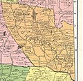 Turnersburg Township in 1917.jpg 1,703 × 1,653; 964 KB
