Category:1829 maps of New York (state)
Jump to navigation
Jump to search
Media in category "1829 maps of New York (state)"
The following 8 files are in this category, out of 8 total.
-
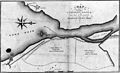 1829 Black Rock Harbour map.jpg 3,662 × 2,227; 1.42 MB
-
 Map of the county of Erie LOC 73693311.jpg 4,655 × 5,638; 4.19 MB
-
 Map of the county of Erie LOC 73693311.tif 4,655 × 5,638; 75.09 MB
-
 Map of the county of Oneida LOC 2013593244.jpg 5,007 × 6,397; 4.47 MB
-
 Map of the county of Oneida LOC 2013593244.tif 5,007 × 6,397; 91.64 MB
-
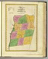
 Rensselaer County 1829 Restored.jpg 3,964 × 5,857; 16.51 MB
-
 Rensselaer County 1829.jpg 5,759 × 7,102; 5.76 MB
-
 Suffolk County 1829.jpg 10,463 × 6,041; 6.69 MB


