Category:1915 maps of New York (state)
Jump to navigation
Jump to search
States of the United States: California · Georgia · Hawaii · Idaho · Illinois · Iowa · Kentucky · Louisiana · Massachusetts · Michigan · Minnesota · Montana · New Jersey · New York · North Carolina · Pennsylvania · South Dakota · Texas · Wisconsin · Wyoming – Washington, D.C.
Puerto Rico
Puerto Rico
Subcategories
This category has the following 4 subcategories, out of 4 total.
Media in category "1915 maps of New York (state)"
The following 7 files are in this category, out of 7 total.
-
 1915 New York and Ottawa Railway map.JPG 649 × 855; 151 KB
-

-
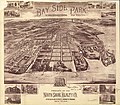 Bay Side Park, 3d ward, borough of Queens, New York City. LOC 76693087.jpg 7,840 × 6,832; 11.79 MB
-
 Bay Side Park, 3d ward, borough of Queens, New York City. LOC 76693087.tif 7,840 × 6,832; 153.24 MB
-
 Jefferson County, New York LOC 2010588914 (cropped on Watertown).jpg 2,057 × 2,415; 724 KB
-
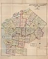 Jefferson County, New York LOC 2010588914.jpg 11,983 × 14,621; 16.99 MB
-
 Jefferson County, New York LOC 2010588914.tif 11,983 × 14,621; 501.26 MB


.jpg)
