Category:1884 maps of New York (state)
Jump to navigation
Jump to search
States of the United States: California · Connecticut · Delaware · Florida · Georgia · Idaho · Iowa · Kansas · Kentucky · Louisiana · Michigan · Minnesota · Missouri · Montana · New Jersey · New York · North Carolina · North Dakota · Ohio · Oregon · Pennsylvania · South Carolina · South Dakota · Tennessee · Texas · Utah · Virginia · Washington · West Virginia · Wisconsin · Wyoming – Washington, D.C.
Subcategories
This category has the following 29 subcategories, out of 29 total.
N
S
Media in category "1884 maps of New York (state)"
The following 53 files are in this category, out of 53 total.
-
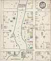
Sanborn Fire Insurance Map from Chester, Orange County, New York. LOC sanborn05835 001.jpg 6,450 × 7,650; 3.89 MB
-
Sanborn Fire Insurance Map from Chester, Orange County, New York. LOC sanborn05835 001.tif 6,450 × 7,650; 141.17 MB
-
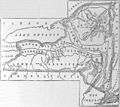
EB9 New York - Geological Map of New York State.jpg 1,804 × 1,606; 412 KB
-
EB9 New York.jpg 5,504 × 3,820; 4.02 MB
-
Glens Falls, N.Y. LOC 75694777.jpg 10,144 × 6,208; 14.68 MB
-
Glens Falls, N.Y. LOC 75694777.tif 10,144 × 6,208; 180.17 MB
-
Map of Long Island showing the Long Island Railroad. LOC 98688699.jpg 6,642 × 2,699; 3.11 MB
-
Map of Long Island showing the Long Island Railroad. LOC 98688699.tif 6,642 × 2,699; 51.29 MB
-
New York Presidential Election Results 1884.svg 744 × 577; 293 KB
-
Oneonta, N.Y. LOC 90684701.jpg 10,360 × 5,248; 12.75 MB
-
Oneonta, N.Y. LOC 90684701.tif 10,360 × 5,248; 155.55 MB
-
Sanborn Fire Insurance Map from Brownville, Jefferson County, New York. LOC sanborn05792 001.tif 6,450 × 7,650; 141.17 MB
-
Sanborn Fire Insurance Map from Chittenango, Madison County, New York. LOC sanborn05836 001.tif 6,450 × 7,650; 141.17 MB
-
Sanborn Fire Insurance Map from Constableville, Lewis County, New York. LOC sanborn05857 001.tif 6,450 × 7,650; 141.17 MB
-
Sanborn Fire Insurance Map from Granville, Washington County, New York. LOC sanborn05956 001.tif 6,450 × 7,650; 141.17 MB
-
Sanborn Fire Insurance Map from Madrid, St. Lawrence County, New York. LOC sanborn06055 001.tif 6,450 × 7,650; 141.17 MB
-
Sanborn Fire Insurance Map from Mannsville, Jefferson County, New York. LOC sanborn06060 001.tif 6,450 × 7,650; 141.17 MB
-
Sanborn Fire Insurance Map from Middleburgh, Schoharie County, New York. LOC sanborn06080 001.tif 6,450 × 7,650; 141.17 MB
-
Sanborn Fire Insurance Map from Middleport, Niagara County, New York. LOC sanborn06081 001.tif 6,450 × 7,650; 141.17 MB
-
Sanborn Fire Insurance Map from Prattsburgh, Stenben County, New York. LOC sanborn06193 001.tif 6,450 × 7,650; 141.17 MB
-
Sanborn Fire Insurance Map from Salem, Washington County, New York. LOC sanborn06236 001.jpg 6,450 × 7,650; 3.73 MB
-
Sanborn Fire Insurance Map from Salem, Washington County, New York. LOC sanborn06236 001.tif 6,450 × 7,650; 141.17 MB
-
Sanborn Fire Insurance Map from Theresa, Jefferson County, New York. LOC sanborn06299 001.tif 6,450 × 7,650; 141.17 MB
-
Sandy Hill, N.Y. LOC 75694873.jpg 9,664 × 5,328; 11.53 MB
-
Sandy Hill, N.Y. LOC 75694873.tif 9,664 × 5,328; 147.31 MB
-
Sanborn Fire Insurance Map from Skaneateles, Onondaga County, New York. LOC sanborn06271 001-1.tif 6,450 × 7,650; 141.17 MB
-
Sanborn Fire Insurance Map from Skaneateles, Onondaga County, New York. LOC sanborn06271 001-2.tif 6,450 × 7,650; 141.17 MB
-
Sanborn Fire Insurance Map from Skaneateles, Onondaga County, New York. LOC sanborn06271 001-3.tif 6,450 × 7,650; 141.17 MB
-
Skaneateles, N.Y. LOC 75694849.jpg 9,568 × 4,384; 7.91 MB
-
Skaneateles, N.Y. LOC 75694849.tif 9,568 × 4,384; 120.01 MB
-
Ticonderoga, N.Y. LOC 75694853.jpg 8,128 × 5,328; 10.72 MB
-
Ticonderoga, N.Y. LOC 75694853.tif 8,128 × 5,328; 123.9 MB


