Category:1980 maps of New York (state)
Jump to navigation
Jump to search
States of the United States: Alabama · Arkansas · California · Connecticut · Delaware · Florida · Georgia · Kentucky · Maryland · Massachusetts · Mississippi · New Jersey · New York · North Carolina · Ohio · Pennsylvania · South Carolina · Tennessee · Texas · Utah · Vermont · Virginia · West Virginia
Media in category "1980 maps of New York (state)"
The following 11 files are in this category, out of 11 total.
-
 Hydrologic unit map-1974, state of New York LOC 98680448.jpg 17,050 × 13,450; 25.36 MB
-
 Hydrologic unit map-1974, state of New York LOC 98680448.tif 17,050 × 13,450; 656.1 MB
-
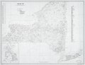
 Hydrologic watershed unit map-1980, State of New York LOC 81693484.jpg 16,083 × 12,510; 22.17 MB
-
 Hydrologic watershed unit map-1980, State of New York LOC 81693484.tif 16,083 × 12,510; 575.63 MB
-
 New York LOC 83692134.jpg 16,400 × 12,556; 20.17 MB
-
 New York LOC 83692134.tif 16,400 × 12,556; 589.14 MB
-
 New York Presidential Election Results 1980.svg 810 × 621; 67 KB
-
 New York-1980. LOC 00557178.jpg 9,581 × 7,369; 9.88 MB
-
 New York-1980. LOC 00557178.tif 9,581 × 7,369; 202 MB
-
 Status of New York soil surveys - October 1, 1980 LOC 81690084.jpg 3,278 × 2,515; 983 KB
-
 Status of New York soil surveys - October 1, 1980 LOC 81690084.tif 3,278 × 2,515; 23.59 MB


