Category:1898 maps of New York (state)
Jump to navigation
Jump to search
States of the United States: Alaska · California · Connecticut · Florida · Georgia · Illinois · Iowa · Kentucky · Louisiana · Maryland · Michigan · Minnesota · Mississippi · Missouri · Montana · New Jersey · New Mexico · New York · North Carolina · North Dakota · Ohio · Oklahoma · Oregon · Pennsylvania · South Carolina · South Dakota · Tennessee · Texas · Virginia · Washington · West Virginia · Wisconsin – Washington, D.C.
Puerto Rico
Puerto Rico
Subcategories
This category has the following 46 subcategories, out of 46 total.
1
N
S
Media in category "1898 maps of New York (state)"
The following 125 files are in this category, out of 125 total.
-
 1898 New York gubernatorial election results map by county.svg 1,050 × 800; 328 KB
-

-
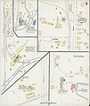
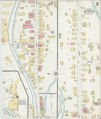
 Sanborn Fire Insurance Map from Antwerp, Jefferson County, New York. LOC sanborn05744 002-1.tif 6,450 × 7,650; 141.17 MB
-

-
 Sanborn Fire Insurance Map from Antwerp, Jefferson County, New York. LOC sanborn05744 002-2.tif 6,450 × 7,650; 141.17 MB
-
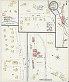
 Sanborn Fire Insurance Map from Avoca, Steuben County, New York. LOC sanborn05751 002-1.jpg 6,450 × 7,650; 3.62 MB
-
 Sanborn Fire Insurance Map from Avoca, Steuben County, New York. LOC sanborn05751 002-1.tif 6,450 × 7,650; 141.17 MB
-
 Sanborn Fire Insurance Map from Avoca, Steuben County, New York. LOC sanborn05751 002-2.jpg 6,450 × 7,650; 3.17 MB
-
 Sanborn Fire Insurance Map from Avoca, Steuben County, New York. LOC sanborn05751 002-2.tif 6,450 × 7,650; 141.17 MB
-
 Bulletin - New York State Museum (1898) (20253667700).jpg 2,670 × 3,158; 2.5 MB
-
 Bulletin - New York State Museum (1898) (20415741016).jpg 3,814 × 2,878; 2.04 MB
-

-

-

-

-

-
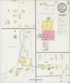
 Sanborn Fire Insurance Map from Chatham, Columbia County, New York. LOC sanborn05828 003-1.tif 6,450 × 7,650; 141.17 MB
-

-
 Sanborn Fire Insurance Map from Chatham, Columbia County, New York. LOC sanborn05828 003-2.tif 6,450 × 7,650; 141.17 MB
-

-
 Sanborn Fire Insurance Map from Chatham, Columbia County, New York. LOC sanborn05828 003-3.tif 6,450 × 7,650; 141.17 MB
-

-
 Sanborn Fire Insurance Map from Chatham, Columbia County, New York. LOC sanborn05828 003-4.tif 6,450 × 7,650; 141.17 MB
-
-
 Sanborn Fire Insurance Map from Chatham, Columbia County, New York. LOC sanborn05828 003-5.tif 6,450 × 7,650; 141.17 MB
-

-
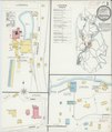
 Sanborn Fire Insurance Map from Cobleskill, Schoharie County, New York. LOC sanborn05848 003-1.tif 6,450 × 7,650; 141.17 MB
-

-
 Sanborn Fire Insurance Map from Cobleskill, Schoharie County, New York. LOC sanborn05848 003-2.tif 6,450 × 7,650; 141.17 MB
-

-
 Sanborn Fire Insurance Map from Cobleskill, Schoharie County, New York. LOC sanborn05848 003-3.tif 6,450 × 7,650; 141.17 MB
-

-
 Sanborn Fire Insurance Map from Cobleskill, Schoharie County, New York. LOC sanborn05848 003-4.tif 6,450 × 7,650; 141.17 MB
-

-
 Sanborn Fire Insurance Map from De Ruyter, Madison County, New York. LOC sanborn05874 003-1.tif 6,450 × 7,650; 141.17 MB
-

-
 Sanborn Fire Insurance Map from De Ruyter, Madison County, New York. LOC sanborn05874 003-2.tif 6,450 × 7,650; 141.17 MB
-
 Depew, N.Y. LOC 81694085.jpg 13,664 × 9,408; 27.84 MB
-
 Depew, N.Y. LOC 81694085.tif 13,664 × 9,408; 367.79 MB
-
 Sanborn Fire Insurance Map from Ghent, Columbia County, New York. LOC sanborn05944 003-1.jpg 6,450 × 7,650; 3.28 MB
-
 Sanborn Fire Insurance Map from Ghent, Columbia County, New York. LOC sanborn05944 003-1.tif 6,450 × 7,650; 141.17 MB
-
 Sanborn Fire Insurance Map from Ghent, Columbia County, New York. LOC sanborn05944 003-2.jpg 6,450 × 7,650; 3.09 MB
-
 Sanborn Fire Insurance Map from Ghent, Columbia County, New York. LOC sanborn05944 003-2.tif 6,450 × 7,650; 141.17 MB
-

-
 Sanborn Fire Insurance Map from Groton, Tompkins County, New York. LOC sanborn05964 003-1.tiff 6,450 × 7,650; 141.17 MB
-

-
 Sanborn Fire Insurance Map from Groton, Tompkins County, New York. LOC sanborn05964 003-2.tiff 6,450 × 7,650; 141.17 MB
-

-
 Sanborn Fire Insurance Map from Groton, Tompkins County, New York. LOC sanborn05964 003-3.tiff 6,450 × 7,650; 141.17 MB
-

-
 Sanborn Fire Insurance Map from Hammondsport, Steuben County, New York. LOC sanborn05970 003-1.tif 6,450 × 7,650; 141.17 MB
-

-
 Sanborn Fire Insurance Map from Hammondsport, Steuben County, New York. LOC sanborn05970 003-2.tif 6,450 × 7,650; 141.17 MB
-

-
 Sanborn Fire Insurance Map from Hammondsport, Steuben County, New York. LOC sanborn05970 003-3.tif 6,450 × 7,650; 141.17 MB
-

-
 Sanborn Fire Insurance Map from Hammondsport, Steuben County, New York. LOC sanborn05970 003-4.tif 6,450 × 7,650; 141.17 MB
-
 Old Forge New York USGS topo map 1898.jpg 2,973 × 3,567; 4.12 MB
-
 Sanborn Fire Insurance Map from Ovid, Seneca County, New York. LOC sanborn06153 002-1.jpg 6,450 × 7,650; 3.24 MB
-
 Sanborn Fire Insurance Map from Ovid, Seneca County, New York. LOC sanborn06153 002-1.tif 6,450 × 7,650; 141.17 MB
-
 Sanborn Fire Insurance Map from Ovid, Seneca County, New York. LOC sanborn06153 002-2.jpg 6,450 × 7,650; 2.88 MB
-
 Sanborn Fire Insurance Map from Ovid, Seneca County, New York. LOC sanborn06153 002-2.tif 6,450 × 7,650; 141.17 MB
-
 Sanborn Fire Insurance Map from Ovid, Seneca County, New York. LOC sanborn06153 002-3.jpg 6,450 × 7,650; 3.06 MB
-
 Sanborn Fire Insurance Map from Ovid, Seneca County, New York. LOC sanborn06153 002-3.tif 6,450 × 7,650; 141.17 MB
-
 Sanborn Fire Insurance Map from Ovid, Seneca County, New York. LOC sanborn06153 002-4.jpg 6,450 × 7,650; 3.01 MB
-
 Sanborn Fire Insurance Map from Ovid, Seneca County, New York. LOC sanborn06153 002-4.tif 6,450 × 7,650; 141.17 MB
-
 Road map of the Albany-Troy district (10139232154).jpg 800 × 752; 200 KB
-

-
 Sanborn Fire Insurance Map from Rosendale, Ulster County, New York. LOC sanborn06223 003-1.tif 6,450 × 7,650; 141.17 MB
-

-
 Sanborn Fire Insurance Map from Rosendale, Ulster County, New York. LOC sanborn06223 003-2.tif 6,450 × 7,650; 141.17 MB
-

-
 Sanborn Fire Insurance Map from Rosendale, Ulster County, New York. LOC sanborn06223 003-3.tif 6,450 × 7,650; 141.17 MB
-

-
 Sanborn Fire Insurance Map from Rosendale, Ulster County, New York. LOC sanborn06223 003-4.tif 6,450 × 7,650; 141.17 MB
-

-
 Sanborn Fire Insurance Map from Rosendale, Ulster County, New York. LOC sanborn06223 003-5.tif 6,450 × 7,650; 141.17 MB
-

-
 Sanborn Fire Insurance Map from Rosendale, Ulster County, New York. LOC sanborn06223 003-6.tif 6,450 × 7,650; 141.17 MB
-

-
 Sanborn Fire Insurance Map from Rosendale, Ulster County, New York. LOC sanborn06223 003-7.tif 6,450 × 7,650; 141.17 MB
-

-
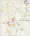
 Sanborn Fire Insurance Map from Conesus, Livingston County, New York. LOC sanborn05855 001.tif 6,450 × 7,650; 141.17 MB
-

-
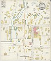
 Sanborn Fire Insurance Map from Dexter, Jefferson County, New York. LOC sanborn05883 001.tif 6,450 × 7,650; 141.17 MB
-

-
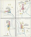
 Sanborn Fire Insurance Map from Edwards, Saint Lawrence County, New York. LOC sanborn05899 001.tif 6,450 × 7,650; 141.17 MB
-
 Sanborn Fire Insurance Map from Gilboa, Schoharie County, New York. LOC sanborn05946 002.jpg 6,450 × 7,650; 3.28 MB
-
 Sanborn Fire Insurance Map from Gilboa, Schoharie County, New York. LOC sanborn05946 002.tif 6,450 × 7,650; 141.17 MB
-
-
 Sanborn Fire Insurance Map from Hermon, Saint Lawrence County, New York. LOC sanborn05982 001.tif 6,450 × 7,650; 141.17 MB
-

-
 Sanborn Fire Insurance Map from Hillsdale, Columbia County, New York. LOC sanborn05987 002.tif 6,450 × 7,650; 141.17 MB
-
 Sanborn Fire Insurance Map from Hobart, Delaware County, New York. LOC sanborn05989 002.jpg 6,450 × 7,650; 3.45 MB
-
 Sanborn Fire Insurance Map from Hobart, Delaware County, New York. LOC sanborn05989 002.tif 6,450 × 7,650; 141.17 MB
-
 Sanborn Fire Insurance Map from Kanona, Steuben County, New York. LOC sanborn06017 002.jpg 6,450 × 7,650; 3.19 MB
-
 Sanborn Fire Insurance Map from Kanona, Steuben County, New York. LOC sanborn06017 002.tif 6,450 × 7,650; 141.17 MB
-
 Sanborn Fire Insurance Map from Parish, Oswego County, New York. LOC sanborn06159 001.jpg 6,450 × 7,650; 3.37 MB
-
 Sanborn Fire Insurance Map from Parish, Oswego County, New York. LOC sanborn06159 001.tif 6,450 × 7,650; 141.17 MB
-

-
 Sanborn Fire Insurance Map from Red Hook, Dutchess County, New York. LOC sanborn06204 002.tif 6,450 × 7,650; 141.17 MB
-

-
 Sanborn Fire Insurance Map from Stanfordville, Dutchess County, New York. LOC sanborn06290 002.tif 6,450 × 7,650; 141.17 MB
-

-
 Sanborn Fire Insurance Map from Unionville, Orange County, New York. LOC sanborn06315 001.tif 6,450 × 7,650; 141.17 MB
-

-
 Sanborn Fire Insurance Map from Skaneateles, Onondaga County, New York. LOC sanborn06271 003-1.tif 6,450 × 7,650; 141.17 MB
-

-
 Sanborn Fire Insurance Map from Skaneateles, Onondaga County, New York. LOC sanborn06271 003-2.tif 6,450 × 7,650; 141.17 MB
-

-
 Sanborn Fire Insurance Map from Skaneateles, Onondaga County, New York. LOC sanborn06271 003-3.tif 6,450 × 7,650; 141.17 MB
-

-
 Sanborn Fire Insurance Map from Skaneateles, Onondaga County, New York. LOC sanborn06271 003-4.tif 6,450 × 7,650; 141.17 MB
-

-
 Sanborn Fire Insurance Map from Skaneateles, Onondaga County, New York. LOC sanborn06271 003-5.tif 6,450 × 7,650; 141.17 MB
-

-
 Sanborn Fire Insurance Map from Skaneateles, Onondaga County, New York. LOC sanborn06271 003-6.tif 6,450 × 7,650; 141.17 MB
-

-
 Sanborn Fire Insurance Map from Skaneateles, Onondaga County, New York. LOC sanborn06271 003-7.tif 6,450 × 7,650; 141.17 MB
-
-
 Sanborn Fire Insurance Map from Skaneateles, Onondaga County, New York. LOC sanborn06271 003-8.tif 6,450 × 7,650; 141.17 MB
-

-
 Sanborn Fire Insurance Map from Skaneateles, Onondaga County, New York. LOC sanborn06271 003-9.tif 6,450 × 7,650; 141.17 MB
-
 Tunison's railroad, distance, and township map of New York from latest surveys. LOC 98688531.jpg 10,344 × 13,333; 29.39 MB
-
 Tunison's railroad, distance, and township map of New York from latest surveys. LOC 98688531.tif 10,344 × 13,333; 394.58 MB


_(20253667700).jpg)
_(20415741016).jpg)


.jpg)


