Category:Aerial photographs of Landkreis Rottal-Inn
Jump to navigation
Jump to search
Urban districts (cities): Amberg · Ansbach · Aschaffenburg · Augsburg · Bamberg · Bayreuth · Coburg · Erlangen · Fürth · Hof · Kaufbeuren · Kempten · Landshut · Memmingen · Munich · Nuremberg · Passau · Regensburg · Rosenheim · Schwabach · Straubing · Weiden in der Oberpfalz · Würzburg
Deutsch: Luftaufnahmen aus dem Landkreis Rottal-Inn.
Subcategories
This category has only the following subcategory.
Media in category "Aerial photographs of Landkreis Rottal-Inn"
The following 8 files are in this category, out of 8 total.
-
 Aerial image of the Eggenfelden airfield.jpg 4,500 × 3,000; 3.99 MB
-
 Aerial image of the Kirchdorf-Inn airfield.jpg 5,000 × 3,500; 7.61 MB
-
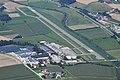
 Aerial image of the Pfarrkirchen airfield.jpg 4,800 × 2,800; 5.27 MB
-
 Aerial image of the Wasserschloss Schönau (view from the south).jpg 3,800 × 3,100; 4.45 MB
-
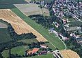
 Diepoltskirchen.JPG 1,583 × 1,181; 226 KB
-
 Innspitz 2.jpeg 3,261 × 2,211; 1.82 MB
-
 Pan-luftbild.jpg 1,000 × 1,333; 884 KB
-
 Zell (Falkenberg) 12.jpg 1,200 × 798; 315 KB


.jpg)


_12.jpg)