Category:Aerial photographs of Landkreis Rosenheim
Jump to navigation
Jump to search
Urban districts (cities): Amberg · Ansbach · Aschaffenburg · Augsburg · Bamberg · Bayreuth · Coburg · Erlangen · Fürth · Hof · Kaufbeuren · Kempten · Landshut · Memmingen · Munich · Nuremberg · Passau · Regensburg · Rosenheim · Schwabach · Straubing · Weiden in der Oberpfalz · Würzburg
Deutsch: Luftaufnahmen aus dem Landkreis Rosenheim.
Subcategories
This category has the following 3 subcategories, out of 3 total.
Media in category "Aerial photographs of Landkreis Rosenheim"
The following 79 files are in this category, out of 79 total.
-
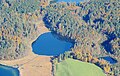
 Aerial image of Blassee (view from the southwest).jpg 3,200 × 2,200; 4.98 MB
-
 Aerial image of Einbessee (view from the south).jpg 3,300 × 2,000; 4.24 MB
-
 Aerial image of Großer Kesselsee (view from the southwest).jpg 3,300 × 2,100; 4.43 MB
-
 Aerial image of Hartsee (view from the south).jpg 3,400 × 2,400; 4.47 MB
-
 Aerial image of Hochmoor am Kesselsee (view from the southwest).jpg 3,700 × 2,300; 6.16 MB
-
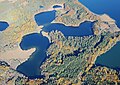
 Aerial image of Hofsee and Katzensee (view from the southwest).jpg 3,700 × 2,300; 4.47 MB
-
 Aerial image of Hofstätter See (view from the south).jpg 4,000 × 1,800; 3.76 MB
-
 Aerial image of Kautsee (view from the south).jpg 3,396 × 2,400; 5.63 MB
-
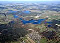
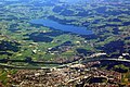
 Aerial image of Lake Simssee (view from the southwest).jpg 5,300 × 3,600; 8.77 MB
-
 Aerial image of Langbürgner See (view from the southwest).jpg 4,200 × 2,300; 5.71 MB
-
 Aerial image of Leitzachwerke (view from the southwest).jpg 3,900 × 2,300; 5.03 MB
-
 Aerial image of Liensee (view from the west).jpg 3,200 × 2,300; 4.5 MB
-
 Aerial image of Pelhamer See (view from the southwest).jpg 3,600 × 2,400; 4.72 MB
-
 Aerial image of Rinssee (view from the south).jpg 3,900 × 2,200; 4.02 MB
-
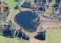
 Aerial image of Schloßsee (view from the southwest).jpg 3,000 × 2,400; 3.98 MB
-
 Aerial image of Siferlinger See (view from the south).jpg 3,600 × 2,400; 4.3 MB
-
 Aerial image of Soyensee (view from the southwest).jpg 3,800 × 2,100; 3.85 MB
-
 Aerial image of Staudhamer See (view from the south).jpg 3,700 × 2,000; 3.84 MB
-
 Aerial image of Stettner See (view from the south).jpg 3,600 × 2,200; 4.55 MB
-
 Aerial image of Thaler See (view from the southwest).jpg 3,300 × 2,400; 4.63 MB
-
 Aerial image of the Antersberg gliding site.jpg 4,200 × 3,200; 4.68 MB
-
 Aerial image of the Bad Endorf-Jolling airfield.jpg 5,200 × 3,600; 6.87 MB
-
 Aerial image of the Bernau prison (view from the south).jpg 5,300 × 3,400; 8.46 MB
-
 Aerial image of the Brannenburg gliding site.jpg 4,500 × 2,900; 5.27 MB
-
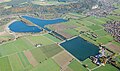
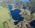
 Aerial image of the Eggstätt-Hemhof Lakes (view from the southwest).jpg 5,000 × 3,600; 8.37 MB
-
 Aerial image of the Eggstätt-Hemhof Lakes.jpg 5,400 × 3,400; 4.52 MB
-
 Aerial image of the Vogtareuth airfield.jpg 4,000 × 2,500; 3.02 MB
-
 Aerial image of Tinninger See (view from the south).jpg 4,700 × 2,700; 5.72 MB
-
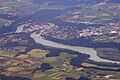
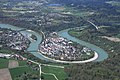 Aerial image of Wasserburg am Inn.jpg 5,568 × 3,712; 7.14 MB
-
 Aerial image of Zillhamer See and Ameranger See (view from the south).jpg 3,700 × 2,400; 4.63 MB
-
 Aerials Bavaria 16.06.2006 09-09-42.jpg 2,048 × 1,536; 2.82 MB
-
 Aerials Bavaria 16.06.2006 09-10-00.jpg 2,048 × 1,536; 2.91 MB
-
 Aerials Bavaria 16.06.2006 09-10-06.jpg 2,048 × 1,476; 2.66 MB
-
 Aerials Bavaria 16.06.2006 11-37-33.jpg 1,949 × 1,461; 1.99 MB
-
 Aerials Bavaria 16.06.2006 11-37-50.jpg 2,048 × 1,536; 2.68 MB
-
 Aerials Bavaria 16.06.2006 11-38-25.jpg 2,048 × 1,536; 2.41 MB
-
 Aerials Bavaria 16.06.2006 11-38-36.jpg 2,048 × 1,536; 2.77 MB
-
 Aerials Bavaria 16.06.2006 11-38-43.jpg 2,048 × 1,536; 3.06 MB
-
 Aerials Bavaria 16.06.2006 11-38-57.jpg 2,048 × 1,536; 2.65 MB
-
 Aerials Bavaria 16.06.2006 11-40-59.jpg 1,726 × 1,423; 1.97 MB
-
 Aerials Bavaria 16.06.2006 11-41-53.jpg 2,048 × 1,536; 2.35 MB
-
 Aerials Bavaria 16.06.2006 11-42-41.jpg 2,048 × 1,536; 2.38 MB
-
 Aerials Bavaria 16.06.2006 11-43-04.jpg 2,048 × 1,536; 2.19 MB
-
 Aerials Bavaria 16.06.2006 11-43-11.jpg 2,048 × 1,536; 2.8 MB
-
 Aerials Bavaria 16.06.2006 11-43-17.jpg 2,048 × 1,536; 2.92 MB
-
 Aerials Bavaria 16.06.2006 11-46-01.jpg 2,048 × 1,288; 2.64 MB
-
 Aerials Bavaria 16.06.2006 11-46-08.jpg 1,787 × 1,339; 1.78 MB
-
 Aerials Bavaria 16.06.2006 11-46-48.jpg 2,048 × 1,536; 3.12 MB
-
 Aerials Bavaria 16.06.2006 11-47-25.jpg 2,048 × 1,536; 2.33 MB
-
 Aerials Bavaria 16.06.2006 11-50-27.jpg 1,961 × 1,471; 2.04 MB
-
 Aerials Bavaria 16.06.2006 11-50-39.jpg 1,929 × 1,536; 1.99 MB
-
 Aschau Hohenaschau, Sterntreter, kontrastverstärkt.jpeg 3,264 × 2,448; 2.87 MB
-
 Aschau Hohenaschau.JPG 3,264 × 2,448; 3.01 MB
-
 Aschau.jpg 3,264 × 2,448; 3.3 MB
-
 Auer Weidmoos 1.jpg 3,840 × 2,160; 5.04 MB
-
 Auer-Weidmoos-2.jpg 3,840 × 2,160; 4.77 MB
-
 Justizvollzugsanstalt Bernau (Luftbild).jpg 1,725 × 1,235; 216 KB
-
 Bernau Chiemsee, Sterntreter, kontrastverstärkt.jpeg 3,264 × 2,448; 1.97 MB
-
 Bernau Chiemsee.JPG 3,264 × 2,448; 1.79 MB
-
 ETH-BIB-Chiemsee, dahinter die Alpen-Weitere-LBS MH02-31-0032.tif 4,961 × 3,281; 46.66 MB
-
 ETH-BIB-Chiemsee, dahinter die Alpen-Weitere-LBS MH02-31-0033.tif 4,961 × 3,262; 46.39 MB
-
 ETH-BIB-Chiemsee, dahinter die Alpen-Weitere-LBS MH02-31-0035.tif 4,961 × 3,249; 46.2 MB
-
 ETH-BIB-Chiemsee, dahinter die Alpen-Weitere-LBS MH02-33-0030.tif 4,920 × 3,284; 46.32 MB
-
 ETH-BIB-Chiemsee, dahinter die Alpen-Weitere-LBS MH02-33-0031.tif 4,922 × 3,281; 46.3 MB
-
 ETH-BIB-Chiemsee, dahinter die Alpen-Weitere-LBS MH02-33-0032.tif 4,919 × 3,288; 46.36 MB
-
 ETH-BIB-Chiemsee, dahinter die Alpen-Weitere-LBS MH02-33-0033.tif 4,923 × 3,283; 46.33 MB
-
 ETH-BIB-Chiemsee, dahinter die Alpen-Weitere-LBS MH02-33-0034.tif 4,924 × 3,282; 46.33 MB
-
 ETH-BIB-Chiemsee-Inlandflüge-LBS MH01-007041.tif 6,183 × 4,549; 80.57 MB
-
 Fischbach (Flintsbach)-Luftaufnahme.jpg 4,288 × 2,848; 4.88 MB
-
 Großkarolinenfeld.JPG 3,888 × 2,592; 4.03 MB
-
 Kiefersfelden, Brandauer, Kontrast.jpeg 995 × 530; 832 KB
-
 Kiefersfelden.jpg 995 × 530; 372 KB
-
 Rosenheim, X, aufgehellt.jpeg 3,000 × 2,000; 1.7 MB
-
 Rosenheim.JPG 3,000 × 2,000; 1,023 KB
-
 Rosenheimer Land.jpg 1,680 × 1,120; 1.5 MB
-
 Simssee Chiemsee.JPG 1,944 × 1,296; 362 KB
-
 Wasserburg Innenstadt Aerial.jpg 872 × 654; 215 KB
-
 Wasserburg.JPG 1,500 × 1,000; 250 KB
-
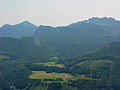
 Wendelstein Luftbild.JPG 1,944 × 1,296; 340 KB
.jpg)
.jpg)
.jpg)
.jpg)
.jpg)
.jpg)
.jpg)
.jpg)
.jpg)
.jpg)
.jpg)
.jpg)
.jpg)
.jpg)
.jpg)
.jpg)
.jpg)
.jpg)
.jpg)
.jpg)


.jpg)

.jpg)


.jpg)

.jpg)


.jpg)


-Luftaufnahme.jpg)


