Category:Aerial photographs of Landkreis Lichtenfels
Jump to navigation
Jump to search
Urban districts (cities): Amberg · Ansbach · Aschaffenburg · Augsburg · Bamberg · Bayreuth · Coburg · Erlangen · Fürth · Hof · Kaufbeuren · Kempten · Landshut · Memmingen · Munich · Nuremberg · Passau · Regensburg · Rosenheim · Schwabach · Straubing · Weiden in der Oberpfalz · Würzburg
Deutsch: Luftaufnahmen aus dem Landkreis Lichtenfels.
Subcategories
This category has only the following subcategory.
Media in category "Aerial photographs of Landkreis Lichtenfels"
The following 145 files are in this category, out of 145 total.
-
 Aerial image of the Lichtenfels airfield.jpg 5,000 × 3,400; 5.45 MB
-
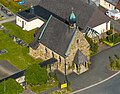
 Altenbanz Kirche Luftbild-20240120-RM-155047.jpg 3,992 × 2,992; 5.53 MB
-
 Altenbanz Kirche Luftbild-20240120-RM-155156.jpg 3,992 × 2,992; 5.51 MB
-
 Altenbanz Luftbild-20240120-RM-155029.jpg 4,939 × 2,779; 5.22 MB
-
 Altenbanz Luftbild-20240120-RM-155205.jpg 4,687 × 3,510; 7.32 MB
-
 Altenbanz Luftbild-20240120-RM-155221.jpg 5,272 × 3,948; 11.04 MB
-
 Arnstein Weismain Luftbild-20210530-RM-155115.jpg 5,464 × 3,640; 11.86 MB
-
 Arnstein Weismain Luftbild-20210530-RM-155141.jpg 5,219 × 3,477; 10.88 MB
-
 BadStaffelstein.jpg 1,728 × 1,152; 196 KB
-
 Banz Kirche Türme-20220304-RM-105302.jpg 5,258 × 3,948; 7.42 MB
-
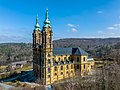
 Basilika Vierzehnheiligen Luftbild-2024-RM-153323.jpg 3,992 × 2,992; 8.7 MB
-
 EbensfeldLuftaufnahme1.jpg 1,037 × 691; 169 KB
-
 Gutshof Nassanger Luftbild-20220807-RM-154619.jpg 3,506 × 2,506; 7.68 MB
-
 Gutshof Nassanger Luftbild-20220807-RM-154851.jpg 5,203 × 3,527; 13.01 MB
-
 Gutshof Nassanger Luftbild-20220807-RM-155138.jpg 4,522 × 3,169; 9.91 MB
-
 Gutshof Nassanger Luftbild-20220807-RM-155224.jpg 3,091 × 2,812; 5.82 MB
-
 Gutshof Nassanger Luftbild-20220807-RM-155256.jpg 3,992 × 2,992; 7.05 MB
-
 Gutshof Nassanger Luftbild-20220807-RM-155522.jpg 4,733 × 3,544; 11.84 MB
-
 Gutshof Nassanger-20220807-RM-160641.jpg 3,888 × 5,184; 11.82 MB
-
 Görau Friedhof Luftbild-20210821-RM-164101.jpg 4,211 × 3,077; 8.62 MB
-
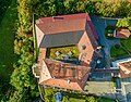
 Görau-St-Heinrich-Kunigunde Luftbild-20210821-RM-164239.jpg 4,464 × 2,974; 8.4 MB
-
 Görauer Anger Luftbild-20210821-RM-163518.jpg 5,464 × 3,640; 16.13 MB
-
 Görauer Anger Luftbild-20210821-RM-163549.jpg 5,092 × 3,640; 12.88 MB
-
 Görauer Anger Luftbild-20210821-RM-170357.jpg 5,186 × 3,455; 10.37 MB
-
 Görauer Anger Luftbild-20210821-RM-170741.jpg 5,464 × 3,640; 9.45 MB
-
 Görauer Anger Luftbild-20210821-RM-170802.jpg 5,464 × 3,640; 9.76 MB
-
 Görauer Anger Luftbild-20210821-RM-170830.jpg 5,464 × 3,640; 13.4 MB
-
 Hausen Main-20220304-RM-112052.jpg 5,177 × 3,877; 9.16 MB
-
 Hausen Wasserkraftwerk Fischtreppe-20220304-RM-112002.jpg 4,779 × 3,579; 10.23 MB
-
 Hausen Wasserkraftwerk Wehr-20220304-RM-111713.jpg 4,657 × 3,559; 8.27 MB
-
 Hausen Wasserkraftwerk Wehr-20220304-RM-111808.jpg 4,572 × 3,948; 9.7 MB
-
 Hausen Wasserkraftwerk Wehr-20220304-RM-111826.jpg 5,102 × 3,821; 7.98 MB
-
 Hausen Wasserkraftwerk-20220304-RM-111445.jpg 5,265 × 3,943; 9.02 MB
-
 Hausen Wasserkraftwerk-20220304-RM-111634.jpg 5,272 × 3,948; 11.56 MB
-
 Hochstadt am Main Bezirksklinik-20240520-RM-161328.jpg 3,774 × 2,673; 7.31 MB
-
 Hochstadt am Main Bezirksklinik-20240520-RM-161430.jpg 3,244 × 2,992; 7.76 MB
-
 Hochstadt am Main Kirche-20240520-RM-161313.jpg 2,692 × 2,697; 4.56 MB
-
 Hochstadt am Main Kirche-20240520-RM-161442.jpg 3,048 × 2,564; 6.77 MB
-
 Hochstadt am Main Luftbild-20240520-RM-161454.jpg 3,807 × 3,639; 8.53 MB
-
 Hochstadt LSG Katzogel Luftbild-20240520-RM-164112.jpg 2,957 × 3,948; 8.99 MB
-
 Hochstadt LSG Katzogel Luftbild-20240520-RM-164126.jpg 4,175 × 3,041; 7.76 MB
-
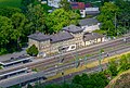 Hochstadt-Marktzeuln Bahnhof Luftbild-20240520-RM-161046.jpg 3,992 × 2,705; 8.43 MB
-
 Hochstadt-Marktzeuln Bahnhof Luftbild-20240520-RM-161752.jpg 4,093 × 3,339; 9.38 MB
-
 Hochstadt-Marktzeuln Bahnhof Luftbild-20240520-RM-162052.jpg 3,634 × 2,668; 7.05 MB
-
 Hochstadt-Marktzeuln Bahnhof Luftbild-20240520-RM-162119.jpg 3,657 × 2,896; 7.69 MB
-
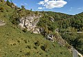
 Kleinziegenfeld Felswand-20210531-RM-175246.jpg 5,464 × 3,640; 14.19 MB
-
 Kleinziegenfeld Luftbild-20210531-RM-174957.jpg 5,464 × 3,640; 11.1 MB
-
 Kleinziegenfeld Luftbild-20210531-RM-180039.jpg 5,464 × 3,640; 11.13 MB
-
 Kleinziegenfeld Luftbild-20210629-RM-162133.jpg 4,786 × 3,125; 6.47 MB
-
 Kleinziegenfeld Luftbild-20210629-RM-162319.jpg 4,832 × 3,219; 8 MB
-
 Kleinziegenfeld Steinbruch Luftbild-20210629-RM-162327.jpg 4,343 × 2,893; 6.37 MB
-
 Kleinziegenfeld Wacholderhang Luftbild-20210629-RM-162240.jpg 4,799 × 3,197; 7.82 MB
-
 Kloster Banz Luftbild Winter-20240120-RM-160244.jpg 5,272 × 3,550; 12.66 MB
-
 Kloster Banz Luftbild Winter-20240120-RM-160254.jpg 5,272 × 3,431; 13.73 MB
-
 Kloster Banz Luftbild Winter-20240120-RM-160353.jpg 4,722 × 3,484; 13.3 MB
-
 Kloster Banz Luftbild Winter-20240120-RM-160426.jpg 5,272 × 3,749; 13.77 MB
-
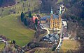
 Kloster Banz Luftbild-20220304-RM-104808.jpg 5,272 × 3,948; 10.48 MB
-
 Kloster Banz Luftbild-20220921-RM-122046.jpg 2,896 × 1,766; 2.48 MB
-
 Kloster Banz Nebel Luftbild-20220921-RM-120256.jpg 5,272 × 3,948; 6.62 MB
-
 Kötteler Grund-20210530-RM-163607.jpg 5,464 × 3,640; 13.6 MB
-
 Lettenreuth Kirche Luftbild-20220807-RM-172313.jpg 3,992 × 2,992; 7.82 MB
-
 Lettenreuth Kirche Luftbild-20220807-RM-172607.jpg 3,992 × 2,992; 6.43 MB
-
 Lettenreuth Kirche Luftbild-20220807-RM-172655.jpg 3,837 × 2,942; 6.75 MB
-
 Lettenreuth Luftbild-20220807-RM-172237.jpg 5,272 × 3,948; 11.42 MB
-
 Lettenreuth Luftbild-20220807-RM-172706.jpg 5,272 × 3,486; 12.12 MB
-
 Marktzeuln Brücke-20220807-RM-171440.jpg 3,992 × 2,992; 6 MB
-
 Marktzeuln Kirche Luftbild-20220807-RM-171003.jpg 3,516 × 2,992; 6.76 MB
-
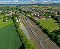
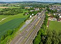
 Marktzeuln Luftbild-20220807-RM-171107.jpg 5,272 × 3,948; 11.5 MB
-
 Marktzeuln Luftbild-20220807-RM-171139.jpg 5,272 × 3,948; 12.36 MB
-
 Marktzeuln Luftbild-20220807-RM-171207.jpg 5,272 × 3,948; 13.13 MB
-
 Marktzeuln Luftbild-20220807-RM-171228.jpg 5,272 × 3,948; 12.6 MB
-
 Marktzeuln Luftbild-20220807-RM-171241.jpg 5,272 × 3,948; 10.5 MB
-
 Marktzeuln Rodach Luftbild-20220807-RM-165407.jpg 5,272 × 3,948; 10.04 MB
-
 Neuensee in Oberfranken, Luftbild-20240520-RM-171335.jpg 3,992 × 2,992; 7.34 MB
-
 Neuensee in Oberfranken, Luftbild-20240520-RM-171400.jpg 5,272 × 3,948; 13.13 MB
-
 Neuensee in Oberfranken, Luftbild-20240520-RM-171407.jpg 5,204 × 3,897; 12.78 MB
-
 Neuensee Kirche Luftbild-20240520-RM-171216.jpg 3,324 × 2,992; 6.07 MB
-
 Neuensee Kirche Luftbild-20240520-RM-171234.jpg 2,719 × 2,261; 2.96 MB
-
 Neuensee Kirche Luftbild-20240520-RM-171258.jpg 3,800 × 2,992; 5.92 MB
-
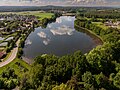 Neuenseer Weiher Luftbild-20240520-RM-165838.jpg 4,515 × 3,381; 10.22 MB
-
 Neuenseer Weiher Luftbild-20240520-RM-165843.jpg 5,272 × 3,414; 11.08 MB
-
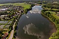 Neuenseer Weiher Luftbild-20240520-RM-165903.jpg 4,515 × 2,978; 7.06 MB
-
 Neuenseer Weiher Luftbild-20240520-RM-170043.jpg 2,774 × 3,948; 6.8 MB
-
 Neuenseer Weiher Luftbild-20240520-RM-170127.jpg 3,992 × 2,992; 7.98 MB
-
 Neuenseer Weiher Luftbild-20240520-RM-171024.jpg 3,287 × 3,948; 7.35 MB
-
 Niesten Burgstall Luftaufnahme-20210629-RM-164936.jpg 5,464 × 3,640; 9.59 MB
-
 Niesten Burgstall Luftaufnahme-20210629-RM-165024.jpg 5,464 × 3,640; 9.46 MB
-
 Niesten Burgstall-20210629-RM-165013.jpg 4,766 × 3,175; 8.34 MB
-
 Niesten Burgstall-20210629-RM-165056.jpg 5,464 × 3,640; 11.18 MB
-
 Niesten Burgstall-20210629-RM-165140.jpg 5,464 × 3,640; 11.53 MB
-
 Niesten Burgstall-20210629-RM-165210.jpg 4,270 × 2,845; 6.9 MB
-
 Niesten Burgstall-20210629-RM-165409.jpg 3,667 × 3,640; 7.66 MB
-
 Niesten Burgstall-20210629-RM-165504.jpg 4,691 × 3,125; 8.5 MB
-
 Obermaintal Bad Staffelstein Hochwasser -20231228-RM-160513.jpg 5,272 × 2,495; 5.1 MB
-
 Obermaintal Bad Staffelstein Hochwasser -20231228-RM-160638.jpg 5,272 × 2,285; 5.78 MB
-
 Püchitz Brücke ABS Nürnberg-Erfurt-20240120-RM-155439.jpg 3,992 × 2,992; 7.97 MB
-
 Püchitz Brücke ABS Nürnberg-Erfurt-20240120-RM-160041.jpg 5,029 × 3,891; 7.81 MB
-
 Redwitz an der Rodach Luftbild -20210620-RM-172959.jpg 4,354 × 3,435; 5.97 MB
-
 Redwitz an der Rodach Luftbild -20210620-RM-173041.jpg 4,413 × 3,297; 6.72 MB
-
 Redwitz an der Rodach Luftbild -20210620-RM-173144.jpg 5,464 × 3,640; 7.71 MB
-
 Rothmannsthal Luftbild-20210531-RM-170310.jpg 4,625 × 2,827; 7.91 MB
-
 Rothmannsthal Luftbild-20210531-RM-170404.jpg 5,422 × 3,612; 8.63 MB
-
 Rothmannsthal Mariä Himmelfahrt Luftbild-20210531-RM-170047.jpg 2,781 × 3,573; 4.62 MB
-
 Rothmannsthal Mariä Himmelfahrt Luftbild-20210531-RM-170126.jpg 4,461 × 3,469; 7.77 MB
-
 Rothmannsthal Mariä Himmelfahrt Luftbild-20210531-RM-170148.jpg 4,461 × 3,371; 6.93 MB
-
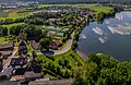
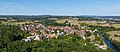
 Schney Luftbild-20231001-RM-163719.jpg 4,441 × 2,624; 7.8 MB
-
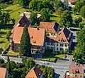
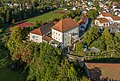 Schney Schloss Luftbild-20231001-RM-163026.jpg 5,272 × 3,567; 13.13 MB
-
 Schney Schloss Luftbild-20231001-RM-163817.jpg 5,062 × 3,948; 19.64 MB
-
 Schney St. Maria Luftbild-20231001-RM-162940.jpg 4,591 × 3,827; 10.83 MB
-
 Schwürbitz Kirche Luftbild-20220807-RM-165545.jpg 3,021 × 2,756; 6.16 MB
-
 Schwürbitz Luftbild-20220807-RM-165655.jpg 5,271 × 2,268; 6.31 MB
-
 Schwürbitz Main-20220807-RM-165355.jpg 5,272 × 3,948; 8.51 MB
-
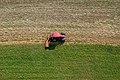 Traktor Mäharbeit Luftbild-20210821-RM-170610.jpg 5,502 × 3,665; 14.42 MB
-
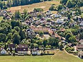
 Trieb (Lichtenfels) Luftbild-20220807-RM-154731.jpg 4,776 × 2,353; 5.36 MB
-
 Trieb (Lichtenfels) Luftbild-20220807-RM-154749.jpg 3,992 × 2,992; 7.79 MB
-
 Trieb (Lichtenfels) Luftbild-20220807-RM-154802.jpg 3,992 × 2,992; 7.45 MB
-
 Trieb Kirche Luftbild-20220807-RM-163632.jpg 3,481 × 2,932; 6.93 MB
-
 Trieb Kirche Luftbild-20220807-RM-163659.jpg 3,992 × 2,992; 8.19 MB
-
 Trieb Luftbild-20220807-RM-163749.jpg 5,272 × 3,948; 11.88 MB
-
 Unnersdorf Main Hochwasser -20231228-RM-160625.jpg 5,272 × 3,948; 9.79 MB
-
 Vierzehnheiligen BadStaffelstein.JPG 4,608 × 3,440; 4.18 MB
-
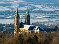
 Vierzehnheiligen Basilika Luftbild-20220304-RM-115017.jpg 4,347 × 3,255; 6.33 MB
-
 Vierzehnheiligen Basilika Luftbild-20220304-RM-115153.jpg 3,914 × 3,086; 6.34 MB
-
 Vierzehnheiligen Basilika Luftbild-20220304-RM-115505.jpg 3,835 × 3,121; 7.02 MB
-
 Vierzehnheiligen Basilika Nordturm Spitze Luftbild-20220304-RM-120137.jpg 2,794 × 3,835; 4.06 MB
-
 Vierzehnheiligen Basilika Nordturm Spitze Luftbild-20220304-RM-120321.jpg 2,957 × 3,948; 4.21 MB
-
 Vierzehnheiligen Basilika Südturm Spitze Luftbild-20220304-RM-115747.jpg 2,957 × 3,948; 3.93 MB
-
 Vierzehnheiligen Basilika Südturm Spitze Luftbild-20220304-RM-115814.jpg 2,957 × 3,948; 3.65 MB
-
 Vierzehnheiligen Figuren Giebel-20240120-RM-152629.jpg 3,600 × 2,992; 2.74 MB
-
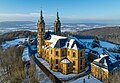
 Vierzehnheiligen Luftbild Winter-2024-RM-152703.jpg 4,789 × 3,586; 8.41 MB
-
 Vierzehnheiligen Luftbild Winter-2024-RM-153055.jpg 3,992 × 2,992; 6.15 MB
-
 Vierzehnheiligen Luftbild Winter-20240120-RM-152340.jpg 3,753 × 3,903; 5.62 MB
-
 Vierzehnheiligen Luftbild Winter-20240120-RM-152531.jpg 5,272 × 3,630; 11.77 MB
-
 Vierzehnheiligen Luftbild.jpg 2,486 × 1,562; 4.97 MB
-
 Wallersberg Felder Luftbild-20210530-RM-153325.jpg 5,299 × 3,530; 22.91 MB
-
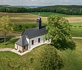 Wallersberg St. Katharina-20210530-RM-153021.jpg 2,855 × 2,426; 4.24 MB
-
 Wallersberg Wacholderhänge Luftbild-20210530-RM-161512.jpg 5,464 × 3,640; 12.93 MB
-
 Wallersberg Wacholderhänge Luftbild-20210530-RM-163842.jpg 4,500 × 3,335; 7.9 MB
-
 Wallersberg Wacholderhänge Luftbild-20210530-RM-163941.jpg 5,464 × 3,640; 12.17 MB
-
 Wallersberg Wacholderhänge Straße-20210530-RM-154950.jpg 5,464 × 2,634; 10.18 MB
-
 Wallersberg Wacholderhänge-20210530-RM-161459.jpg 5,289 × 3,640; 10.4 MB
-
 Wallersberg Wacholderhänge-20210530-RM-161932.jpg 5,464 × 3,640; 11.39 MB
-
 Wallersberg Wacholderhänge-20210530-RM-162038.jpg 4,908 × 3,640; 8.64 MB
-
 Wallersberg Wacholderhänge-20210530-RM-162405.jpg 4,697 × 3,129; 10.15 MB
-
 Zultenberg Luftbild-20210821-RM-171115.jpg 4,828 × 2,900; 7.15 MB


_Luftbild-20220807-RM-154731.jpg)
_Luftbild-20220807-RM-154749.jpg)
_Luftbild-20220807-RM-154802.jpg)


