Category:Aerial photographs of Landkreis Bayreuth
Jump to navigation
Jump to search
Urban districts (cities): Amberg · Ansbach · Aschaffenburg · Augsburg · Bamberg · Bayreuth · Coburg · Erlangen · Fürth · Hof · Kaufbeuren · Kempten · Landshut · Memmingen · Munich · Nuremberg · Passau · Regensburg · Rosenheim · Schwabach · Straubing · Weiden in der Oberpfalz · Würzburg
Deutsch: Luftaufnahmen aus dem Landkreis Bayreuth.
Subcategories
This category has only the following subcategory.
Media in category "Aerial photographs of Landkreis Bayreuth"
The following 133 files are in this category, out of 133 total.
-
 Aerial image of the Bayreuth airfield.jpg 5,200 × 3,000; 5.01 MB
-
 Aerial image of the Castle Rabenstein.jpg 4,000 × 2,600; 4.81 MB
-
 Aerial image of the Pegnitz-Zipser Berg airfield.jpg 4,300 × 2,700; 4 MB
-
 Aerial image of the Rosenthal-Field Plössen airfield.jpg 4,000 × 3,200; 3.74 MB
-
 Aufseß Luftbild-20220320-RM-163008.jpg 4,628 × 3,466; 10.52 MB
-
 Aufseß Luftbild-20220320-RM-163619.jpg 4,602 × 3,446; 11.59 MB
-
 Aufseß Luftbild-20220320-RM-163823.jpg 5,272 × 3,948; 15.92 MB
-
 Aufseß Luftbild-20220320-RM-163904.jpg 5,272 × 3,948; 16.25 MB
-
 Aufseß Luftbild-20220320-RM-164032.jpg 5,272 × 3,948; 17.56 MB
-
 Aufseßtal Luftbild-20220313-RM-162435.jpg 3,740 × 3,942; 9.58 MB
-
 Aufseßtal Luftbild-20220313-RM-162558.jpg 4,931 × 3,693; 13.31 MB
-
 Aufseßtal Luftbild-20220313-RM-162658.jpg 3,618 × 4,831; 16.35 MB
-
 Aufseßtal Luftbild-20220313-RM-162908.jpg 3,568 × 3,401; 10.01 MB
-
 Aufseßtal Luftbild-20220320-RM-163207.jpg 5,272 × 3,521; 16.44 MB
-
 Aufseßtal Luftbild-20220320-RM-163408.jpg 4,017 × 3,008; 8.55 MB
-
 Bad Berneck Dreifaltigkeitskirche (-20220904-RM-155849.jpg 3,196 × 2,992; 5.44 MB
-
 Bad Berneck Turm Altes Schloss-20220904-RM-160135.jpg 3,330 × 2,992; 9.32 MB
-
 Bad Berneck Turm Altes Schloss-20220904-RM-160225.jpg 2,642 × 3,948; 8.16 MB
-

-
 Burg Rabenstein 09102010.JPG 4,592 × 3,056; 7.37 MB
-
 Burgkapelle Stein-20220904-RM-173228.jpg 2,957 × 3,948; 6.66 MB
-
 Burgkapelle Stein-20220904-RM-173240.jpg 3,723 × 2,992; 9.37 MB
-
 Burgkapelle Stein-20220904-RM-173254.jpg 4,888 × 3,723; 12.75 MB
-
 Burgkapelle Stein-20220904-RM-173541.jpg 3,992 × 2,992; 10.14 MB
-
 Burgruine (Hauptburg) Waischenfeld aus der Luft.jpg 3,125 × 2,187; 6.13 MB
-
 Busbach Luftaufnahme-20210524-RM-172804.jpg 3,610 × 2,644; 5.66 MB
-
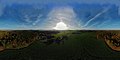 Eckersdorf OT Hardt 360 pano.jpg 9,520 × 4,760; 32.59 MB
-
 Eckersdorf OT Lohe O.jpg 2,349 × 1,762; 3.44 MB
-
 Eckersdorf OT Oberwaiz.jpg 4,600 × 2,843; 7.08 MB
-
 Eckersdorf OT Schanz.JPG 4,000 × 2,250; 7.77 MB
-
 Eckersdorf OT Tröbersdorf.jpg 4,000 × 2,250; 7.66 MB
-
 Felsen Ailsbachtal Schneiderkammer-20210815-RM-103245.jpg 4,641 × 3,640; 9.75 MB
-
 Felsen Ailsbachtal Schneiderkammer-20210815-RM-103253.jpg 4,125 × 3,640; 8.8 MB
-
 Flugplatz Rosenthal-Field-Plössen 001.jpg 6,016 × 3,384; 7.86 MB
-
 Glashütten Kirche Luftbild-20230514-RM-173222.jpg 4,513 × 3,948; 8.49 MB
-
 Glashütten Kirche Luftbild-20230514-RM-173310.jpg 4,717 × 3,902; 9.39 MB
-
 Glashütten Luftbild-20230514-RM-173456.jpg 4,537 × 3,197; 8.41 MB
-
 Glashütten Luftbild-20230514-RM-173547.jpg 4,537 × 3,197; 8.41 MB
-
 Glashütten Luftbild-20230514-RM-173552.jpg 4,761 × 2,836; 7.66 MB
-
 Glashütten Luftbild-20230514-RM-173556.jpg 4,761 × 2,836; 7.26 MB
-
 Hochstahl Kirche Luftbild-20210711-RM-161220.jpg 4,342 × 3,640; 9.28 MB
-
 Hollfeld Kirche Dach-20211010-RM-170044.jpg 2,053 × 2,688; 2.98 MB
-
 Hollfeld Kirche Kreuz-20211010-RM-165926.jpg 2,425 × 3,477; 3.8 MB
-
 Hollfeld Kirche Luftbild-20211010-RM-165255.jpg 5,464 × 3,640; 9.22 MB
-
 Hollfeld Kirche Luftbild-20211010-RM-165322.jpg 3,824 × 3,053; 5.41 MB
-
 Hollfeld Kirche Luftbild-20211010-RM-165355.jpg 3,560 × 3,014; 5.32 MB
-
 Hollfeld Kirche Luftbild-20211010-RM-165417.jpg 5,464 × 3,640; 9.3 MB
-
 Hollfeld Kirche Luftbild-20211010-RM-165636.jpg 2,425 × 2,787; 3.24 MB
-
 Hollfeld Kirche Luftbild-20211010-RM-165648.jpg 2,425 × 2,936; 3.32 MB
-
 Hollfeld Kirche Turmkreuz-20211010-RM-165214.jpg 2,401 × 3,352; 2.87 MB
-
 Hollfeld Kirche Uhr-20211010-RM-165757.jpg 3,907 × 3,445; 3.31 MB
-
 Hollfeld Luftbild-20211010-RM-165444.jpg 5,464 × 3,640; 9.16 MB
-
 Hollfeld Luftbild-20211010-RM-165501.jpg 5,464 × 3,640; 9.62 MB
-
 Hollfeld Luftbild-20211010-RM-170127.jpg 5,464 × 3,640; 10.51 MB
-
 Hollfeld Luftbild-20211010-RM-170136.jpg 4,897 × 3,640; 10.44 MB
-
 Hollfeld Luftbild-20211010-RM-170213.jpg 4,507 × 3,311; 9.38 MB
-
 Hollfeld St. Gangolf Turm-20211010-RM-172544.jpg 5,464 × 3,640; 9.51 MB
-
 Hollfeld St. Gangolf Uhr-20211010-RM-172406.jpg 2,350 × 2,350; 1.9 MB
-
 Hollfeld St. Gangolf Wetterhahn-20211010-RM-172456.jpg 2,425 × 3,216; 3.02 MB
-
 Kirchahorn Kapelle Turmspitze-20210815-RM-110555.jpg 1,892 × 2,251; 2.38 MB
-
 Kirchahorn Kapelle und Kirche-20210815-RM-110623.jpg 4,775 × 3,181; 8.98 MB
-
 Kirchahorn Kapelle-20210815-RM-110439.jpg 4,180 × 3,310; 7.45 MB
-
 Kirchahorn Kirche Luftbild-20210815-RM-105906.jpg 3,778 × 2,913; 6.41 MB
-
 Kirchahorn Kirche Turmuhr-20210815-RM-110837.jpg 2,469 × 2,418; 2.68 MB
-
 Kirchahorn Kirche Wetterfahne-20210815-RM-110911.jpg 2,329 × 2,956; 3.67 MB
-
 Kirchahorn Kirche-20210815-RM-110001.jpg 3,892 × 3,297; 7.65 MB
-
 Kirchahorn Kirche-20210815-RM-110724.jpg 4,552 × 3,640; 9.14 MB
-
 Kirchahorn Luftbild-20210815-RM-110303.jpg 4,306 × 2,869; 7.39 MB
-
 Kirchahorn Luftbild-20210815-RM-111037.jpg 4,875 × 3,248; 8.39 MB
-
 Kirchahorn Luftbild-20210815-RM-111318.jpg 5,464 × 3,640; 14.99 MB
-
 KKB-Kuehlenfels-Waidach.jpg 1,136 × 894; 215 KB
-
 KLaussteinkapelle Kirche Wetterfahne-20210815-RM-103634.jpg 2,196 × 3,296; 4.43 MB
-
 Klaussteinkapelle Sophienhöhle-20210815-RM-102858.jpg 2,568 × 3,608; 6.65 MB
-
 Krögelstein Kirche Luftaufnahme-20210516-RM-154009.jpg 5,464 × 3,640; 8.68 MB
-
 Krögelstein Kirche Luftaufnahme-20210516-RM-154038.jpg 5,464 × 3,640; 7.88 MB
-
 Krögelstein Kirche Luftaufnahme-20210516-RM-154244.jpg 4,917 × 3,291; 7.01 MB
-
 Krögelstein Kirche Luftaufnahme-20210516-RM-154422.jpg 4,686 × 3,152; 9.54 MB
-
 Krögelstein Kirche Luftaufnahme-20210516-RM-154500.jpg 5,464 × 3,640; 10.64 MB
-
 Langenloh Waischenfeld Luftbild-20210815-RM-103713.jpg 5,464 × 3,640; 10.82 MB
-
 Langenloh Waischenfeld Luftbild-20210815-RM-103817.jpg 4,866 × 3,242; 8.18 MB
-
 Limmersdorf Kirche Luftbild-20210808-RM-170907.jpg 3,263 × 3,228; 5.96 MB
-
 Limmersdorf Kirche Luftbild-20210808-RM-170927.jpg 4,284 × 2,946; 6.31 MB
-
 Limmersdorf Kirche Luftbild-20210808-RM-171813.jpg 2,778 × 2,989; 5.45 MB
-
 Limmersdorf Luftbild-20210808-RM-171944.jpg 5,464 × 3,640; 9.72 MB
-
 Limmersdorf Luftbild-20210808-RM-172003.jpg 5,464 × 3,640; 9.74 MB
-
 Limmersdorf Luftbild-20210808-RM-172013.jpg 5,464 × 3,640; 9.68 MB
-
 Loehlitz Mai-Jul12221.jpg 800 × 600; 67 KB
-
 Luftbild Burgruine Waischenfeld.jpg 4,000 × 2,250; 7.42 MB
-
 Luftbild der Burg Pottenstein.jpg 3,338 × 1,998; 6.33 MB
-
 Luftbild-Neideck-Winter.jpg 4,000 × 2,250; 6.62 MB
-
 Luftbild-Rabenstein-Fränk. Schweiz.jpg 4,000 × 2,250; 4 MB
-
 Mistelbach Kirche Luftbild-20230514-RM-163946.jpg 2,991 × 3,593; 5.95 MB
-
 Mistelbach Zeckenmühle Luftbild-20230514-RM-160507.jpg 5,272 × 3,514; 12.89 MB
-
 Mittelaltermarkt Burg Rabenstein, Luftbild (Mai 2024).jpg 2,867 × 1,707; 1.42 MB
-
 Mittelmühle-Luftbild.jpg 3,179 × 2,080; 5.92 MB
-
 Nankendorf Luftbild-20210718-RM-154300.jpg 5,254 × 3,500; 9.79 MB
-
 Nankendorf Luftbild-20210718-RM-154407.jpg 4,705 × 3,468; 8.95 MB
-
 Nankendorf Martinuskirche Luftaufnahme-20210718-RM-153453.jpg 4,133 × 3,640; 9.62 MB
-
 Nankendorf Martinuskirche Luftaufnahme-20210718-RM-153535.jpg 5,213 × 3,473; 11.03 MB
-
 Nankendorf Martinuskirche Turmkreuz Luftaufnahme-20210718-RM-153718.jpg 2,237 × 3,358; 3.55 MB
-
 Nankendorf Martinuskirche Turmkreuz Luftaufnahme-20210718-RM-154014.jpg 2,425 × 3,123; 5 MB
-
 Nankendorf Martinuskirche Turmuhr Luftaufnahme-20210718-RM-154233.jpg 2,035 × 1,755; 788 KB
-
 Oberailsfeld Kirche Luftbild-20210529-RM-172003.jpg 4,078 × 2,717; 6.06 MB
-
 Oberailsfeld Kirche Luftbild-20210529-RM-172411.jpg 4,226 × 3,317; 8.56 MB
-
 Oberailsfeld Luftbild-20210529-RM-172240.jpg 5,423 × 3,613; 11.79 MB
-
 Oberaufseß Schloss Luftbild-20230928-RM-162006.jpg 5,272 × 3,948; 20.1 MB
-
 Oberaufseß Schloss Luftbild-20230928-RM-162346.jpg 5,272 × 3,948; 17.67 MB
-
 Obernsees Barockgarten -20210808-RM-163611.jpg 5,464 × 3,544; 12.39 MB
-
 Obernsees Kirche-20210808-RM-162236.jpg 2,425 × 3,640; 4.64 MB
-
 Obernsees Kirche-20210808-RM-163013.jpg 2,425 × 3,036; 4.27 MB
-
 Plankenfels Luftbild-20210718-RM-160022.jpg 4,642 × 3,577; 10.06 MB
-
 Plankenfels Luftbild-20210718-RM-160146.jpg 4,775 × 3,640; 10.9 MB
-
 Plankenfels Luftbild-20210718-RM-160227.jpg 4,266 × 3,640; 9.83 MB
-
 Plankenfels Luftbild-20210718-RM-160349.jpg 4,908 × 3,640; 11.21 MB
-
 Plankenfels St. Heinrich Luftbild-20210718-RM-161819.jpg 4,759 × 3,186; 8.61 MB
-
 Plankenfels St. Heinrich Turmkreuz-20210718-RM-161631.jpg 2,425 × 3,162; 4.37 MB
-
 Poppendorf Luftbild Kirche-20210815-RM-112751.jpg 5,464 × 3,640; 7.92 MB
-
 Poppendorf Luftbild Kirche-20210815-RM-113059.jpg 4,246 × 3,191; 6.03 MB
-
 Poppendorf Luftbild Kirche-20210815-RM-113140.jpg 4,395 × 2,944; 5.84 MB
-
 Poppendorf Luftbild-20210815-RM-112854.jpg 4,258 × 3,051; 5.53 MB
-
 Poppendorf Luftbild-20210815-RM-112942.jpg 5,253 × 2,599; 5.16 MB
-
 Pottenstein 09102010.JPG 4,592 × 3,056; 6.84 MB
-
 Rabeneck-burg.jpg 2,602 × 1,720; 2.29 MB
-
 Rabenstein Luftbild-20210815-RM-103112.jpg 4,268 × 3,189; 7.01 MB
-
 Ramlesreuth 001.jpg 6,016 × 3,384; 8.1 MB
-
 Schönfeld Kirche Luftbild-20210524-RM-162230.jpg 5,464 × 3,640; 9.6 MB
-
 Schönfeld Kirche-20210524-RM-162129.jpg 3,488 × 3,640; 5.21 MB
-
 Luftbild Tüchersfeld.jpg 4,000 × 2,250; 4.1 MB
-
 Waischenfeld 18062016.jpg 6,016 × 4,016; 11.12 MB
-
 Wonsees Kirche Luftbild-20210516-RM-172747.jpg 3,451 × 2,714; 5.45 MB
-
 Wonsees Kirche Luftbild-20210516-RM-172910.jpg 3,840 × 3,455; 5.98 MB
-
 Wonsees Kirche Luftbild-20210516-RM-173121.jpg 5,464 × 3,640; 12.46 MB
-
 Wonsees Luftbild-20210516-RM-173113.jpg 5,030 × 3,420; 10.49 MB


_Waischenfeld_aus_der_Luft.jpg)


.jpg)


