Category:Aerial photographs of Landkreis Roth
Jump to navigation
Jump to search
Urban districts (cities): Amberg · Ansbach · Aschaffenburg · Augsburg · Bamberg · Bayreuth · Coburg · Erlangen · Fürth · Hof · Kaufbeuren · Kempten · Landshut · Memmingen · Munich · Nuremberg · Passau · Regensburg · Rosenheim · Schwabach · Straubing · Weiden in der Oberpfalz · Würzburg
Deutsch: Luftaufnahmen aus dem Landkreis Roth.
Subcategories
This category has the following 2 subcategories, out of 2 total.
Media in category "Aerial photographs of Landkreis Roth"
The following 12 files are in this category, out of 12 total.
-
 Aerial image of the Greding gliding site.jpg 5,200 × 3,300; 6.41 MB
-
 Aerial image of the Thalmässing-Waizenhofen airfield.jpg 4,000 × 2,200; 2.56 MB
-
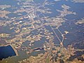 Brombachsee and Rottenbach, Germany.jpg 2,592 × 1,944; 1.72 MB
-
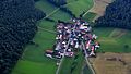 Eppersdorf, Allersberg 001.jpg 6,016 × 3,384; 8.59 MB
-
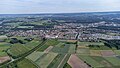
 Grossweingarten 001.jpg 6,016 × 3,384; 8.93 MB
-
 Hilpoltstein (2022).jpg 7,950 × 4,472; 26.97 MB
-
 Hiltpoltstein Luftaufnahme (2020).jpg 4,056 × 3,040; 5.6 MB
-
 Hiltpoltstein Ortskern Luftaufnahme (2020).jpg 4,056 × 3,040; 5.76 MB
-
 Hiltpoltstein Panorama Luftaufnahme (2020).jpg 3,631 × 1,898; 3.54 MB
-
 Luftbild Rothsee.jpg 3,888 × 2,090; 3.44 MB
-
 Schwand bei Nürnberg Luftaufnahme (2020).jpg 4,056 × 3,040; 5.3 MB
-
 Spalt 002.jpg 6,016 × 3,384; 8.78 MB


.jpg)
.jpg)
.jpg)
.jpg)

.jpg)
