Category:1960 U.S. presidential election maps
Jump to navigation
Jump to search
Subcategories
This category has the following 2 subcategories, out of 2 total.
Media in category "1960 U.S. presidential election maps"
The following 15 files are in this category, out of 15 total.
-
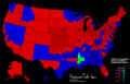
 1960 Dem Primaries.svg 1,020 × 593; 85 KB
-
 1960 Democratic Primaries.png 800 × 465; 79 KB
-
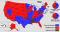 1960 Electoral Map.png 1,182 × 635; 179 KB
-
 1960 Presidential Election in Massachusetts By Municipality.svg 810 × 502; 182 KB
-
-
 1960DemocraticPresidentialPrimaries.png 640 × 550; 65 KB
-
 DemocraticPresidentialCounty1960Colorbrewer.gif 2,800 × 1,700; 217 KB
-
 ElectoralCollege1960-Large.png 1,182 × 635; 112 KB
-
 ElectoralCollege1960.svg 1,020 × 593; 29 KB
-
 Map of USA presidential elections 1960.PNG 280 × 183; 13 KB
-
 New Hampshire Presidential Results 1960 by Municipality.svg 810 × 810; 99 KB
-
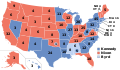
 Republican presidential primary results, 1960.svg 1,020 × 593; 89 KB
-
 RepublicanPresidentialCounty1960Colorbrewer.gif 2,800 × 1,700; 215 KB
-
 Results of the 1960 Democratic National Convention.svg 1,020 × 593; 84 KB
-
 Vermont Presidential Election Results 1960 by Municipality.svg 810 × 810; 106 KB


