Category:2016 U.S. presidential election maps
Jump to navigation
Jump to search
Subcategories
This category has the following 13 subcategories, out of 13 total.
2
C
D
G
R
Media in category "2016 U.S. presidential election maps"
The following 55 files are in this category, out of 55 total.
-
 2016 battleground states.svg 961 × 624; 102 KB
-
 2016 Congressional District Method Results.svg 1,020 × 593; 33 KB
-
 2016 Democratic Party presidential primaries results by state.svg 959 × 593; 38 KB
-
 2016 Electoral Vote Cartogram.svg 440 × 360; 78 KB
-
 2016 Electoral Vote-Cartogram.png 2,000 × 1,700; 408 KB
-
 2016 Presidential Election by State - Clinton.svg 1,020 × 593; 37 KB
-
 2016 Presidential Election by State - Trump.svg 929 × 593; 38 KB
-
 2016 Presidential Election by Vote Distribution Among States.png 800 × 495; 141 KB
-
 2016 Presidential Election by Vote Distribution Among States.svg 959 × 593; 191 KB
-
 2016 presidential election, results by congressional district (popular vote margin).svg 3,772 × 2,265; 2.29 MB
-
 2016 presidential election, results by congressional district.svg 3,726 × 2,160; 2.04 MB
-
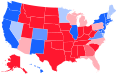
 2016 swing states.png 1,497 × 961; 44 KB
-
 2016 U.S. presidential election margins.svg 1,000 × 593; 55 KB
-

-
-
 2016 US presidential election results-withFaithless.svg 1,020 × 593; 36 KB
-
 2016-Dem-Primaries.svg 975 × 850; 299 KB
-
 2016-election-map (30798493391).jpg 1,545 × 1,103; 112 KB
-
 2016-election-map.svg 1,545 × 1,103; 40 KB
-
 2017 US Electoral College objections map.svg 1,020 × 593; 28 KB
-
 AR President 2016.svg 810 × 709; 14.6 MB
-

-

-
 Cartogram—2016 Electoral Vote.svg 1,272 × 1,002; 146 KB
-
 CO-16-pres-districts.svg 810 × 589; 619 KB
-
 DE President 2016.svg 810 × 810; 3.01 MB
-
 Electoral College 2016.svg 1,020 × 593; 28 KB
-
 Electoral map 2012-2020.svg 959 × 593; 288 KB
-
 ElectoralCollege2016 (Alt. Legend Margins).svg 1,020 × 593; 36 KB
-
 ElectoralCollege2016 - Dan Judy.svg 1,020 × 593; 36 KB
-
 ElectoralCollege2016 - Darcy Richardson.svg 1,020 × 593; 36 KB
-
 ElectoralCollege2016 - Darryl Perry.svg 1,020 × 593; 36 KB
-
 ElectoralCollege2016(projected).svg 1,020 × 593; 29 KB
-
 ElectoralCollege2016.svg 1,020 × 593; 30 KB
-
 Electors 2012 Polidata 2009.svg 1,020 × 593; 115 KB
-
 ElectorScaledU.S.2012-2020.svg 1,463 × 1,117; 39 KB
-
 ElectorScaledUS2016.svg 1,463 × 1,117; 41 KB
-
 IN President 2016.svg 810 × 810; 14.45 MB
-
 IN-16-pres-districts.svg 810 × 810; 544 KB
-
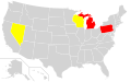
 Log Cabin chapters that endorsed Trump.svg 990 × 627; 1.58 MB
-
 Map of US Voter ID Laws by State.svg 959 × 593; 34 KB
-
 MI-16-pres-districts.svg 810 × 810; 78 KB
-
 Michigan Presidential Results 2016 by Municipality.svg 810 × 810; 3.02 MB
-
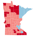 Minnesota County Flips 2016.svg 744 × 744; 285 KB
-
 NelsonCountyVirginia2016PresidentialElection.png 935 × 1,227; 272 KB
-
 Poll closing times (2016).svg 959 × 593; 32 KB
-
 Primaries as of April 24th.jpg 1,296 × 2,304; 942 KB
-
 Proposed Electoral College 2012.svg 1,020 × 593; 115 KB
-

-
 Swing states in 2016 presidential election, by margin.svg 959 × 593; 35 KB
-
 U.S. states (and territories) by election methods, 2016.svg 1,000 × 630; 65 KB
-
 United States presidential election, 2016 Cartogram.png 1,756 × 1,058; 259 KB
-
 US Presidential Recount 2016.svg 959 × 593; 34 KB
-
 District of Columbia Presidential Election Results 2016.svg 163 × 186; 2 KB
-
 District of Columbia presidential election results by ward, 2016.svg 800 × 992; 303 KB


.svg)


.jpg)


.png)
.png)


.svg)


.svg)


.svg)


_by_election_methods,_2016.svg)


