Category:1824 U.S. presidential election maps
Jump to navigation
Jump to search
Media in category "1824 U.S. presidential election maps"
The following 26 files are in this category, out of 26 total.
-
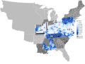
 1824 Presidential Election Results By County According to Adams's Vote Share.svg 800 × 601; 25.14 MB
-
 1824 Presidential Election Results By County According to Clay's Vote Share.svg 800 × 601; 27.18 MB
-

-
-

-
 1824 Presidential Election Results By Electoral District.svg 800 × 601; 19.69 MB
-
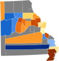
 1825ContingentResults.png 800 × 822; 174 KB
-
 Alabama Presidential Election Results 1824.svg 800 × 1,254; 522 KB
-
 Connecticut Presidential Election Results 1824.svg 810 × 595; 30 KB
-
 Election in House1824-Large.PNG 895 × 635; 61 KB
-
 ElectoralCollege1824-Large.png 868 × 635; 115 KB
-
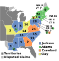 ElectoralCollege1824.svg 577 × 593; 190 KB
-
 House Election of 1825-v2.svg 577 × 593; 170 KB
-
 House Election of 1825.svg 1,020 × 593; 43 KB
-
 Illinois Presidential Election Results 1824.png 800 × 1,442; 71 KB
-
 Maine Presidential Election Results 1824.svg 800 × 1,219; 3.21 MB
-
 Maryland Presidential Election Results 1824.png 1,280 × 686; 87 KB
-
 Massachusetts Presidential Election Results 1824.svg 810 × 502; 27 KB
-
 Mississippi Presidential Election Results 1824.svg 800 × 1,374; 358 KB
-
 Missouri Presidential Election Results 1824.svg 800 × 828; 496 KB
-
 New Jersey Presidential Election Results 1824.svg 800 × 1,517; 560 KB
-
 Ohio Presidential Election Results 1824.svg 810 × 810; 35 KB
-
 Pennsylvania Presidential Election Results 1824.png 1,024 × 597; 129 KB
-
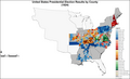
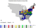 PresidentialCounty1824.gif 2,800 × 2,200; 169 KB
-
 PresidentialCounty1824Colorbrewer.png 2,800 × 1,700; 169 KB
-
 Rhode Island Presidential Election Results 1824.svg 810 × 810; 13 KB


