Category:1800 U.S. presidential election maps
Jump to navigation
Jump to search
Media in category "1800 U.S. presidential election maps"
The following 15 files are in this category, out of 15 total.
-
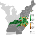
PresidentialCounty1800Colorbrewer.gif 2,800 × 1,700; 64 KB
-
1800 United States presidential election by county.svg 800 × 773; 18.01 MB
-
1800 United States presidential election by electoral districts.svg 800 × 773; 15.16 MB
-
1801ContingentElection.png 1,920 × 1,580; 302 KB
-
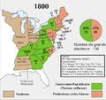
ElectoralCollege1800-fr.png 675 × 636; 56 KB
-
ElectoralCollege1800-Large.png 675 × 636; 61 KB
-
ElectoralCollege1800.svg 542 × 446; 44 KB
-
Elezioni presidenziali USA del 1800.svg 600 × 565; 442 KB
-
Maryland Presidential Election Results 1800.svg 800 × 418; 1.05 MB
-
North Carolina Presidential Election Results 1800.svg 800 × 305; 1.71 MB
-
PresidentialCounty1800.gif 2,800 × 2,200; 109 KB
-
PresidentialCounty1800Colorbrewer.png 1,198 × 1,274; 50 KB
-
Rhode Island Presidential Election Results 1800.png 800 × 1,177; 73 KB
-
Rhode Island Presidential Election Results 1800.svg 810 × 810; 7 KB
-
Virginia Presidential Election Results 1800.svg 800 × 488; 2.23 MB


