Category:Maps of Kern County, California
Jump to navigation
Jump to search
English: Maps of Kern County, California
Counties of California: Alameda · Alpine · Amador · Butte · Calaveras · Colusa · Contra Costa · Del Norte · El Dorado · Fresno · Glenn · Humboldt · Imperial · Inyo · Kern · Kings · Lake · Lassen · Los Angeles · Madera · Marin · Mariposa · Mendocino · Merced · Modoc · Mono · Monterey · Napa · Nevada · Orange · Placer · Plumas · Riverside · Sacramento · San Benito · San Bernardino · San Diego · San Joaquin · San Luis Obispo · San Mateo · Santa Barbara · Santa Clara · Santa Cruz · Shasta · Sierra · Siskiyou · Solano · Sonoma · Stanislaus ·Sutter · Tehama · Trinity · Tulare · Tuolumne · Ventura · Yolo · Yuba – Consolidated city-county: San Francisco
Wikimedia category | |||||
| Upload media | |||||
| Instance of | |||||
|---|---|---|---|---|---|
| Category combines topics | |||||
| Kern County | |||||
county in California, United States     | |||||
| Instance of | |||||
| Named after | |||||
| Location | California, Pacific States Region | ||||
| Capital | |||||
| Inception |
| ||||
| Population |
| ||||
| Area |
| ||||
| official website | |||||
 | |||||
- See also wikipedia article (English text): Kern County, California.
Subcategories
This category has the following 3 subcategories, out of 3 total.
B
Media in category "Maps of Kern County, California"
The following 100 files are in this category, out of 100 total.
-
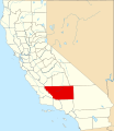 Map of California highlighting Kern County.svg 916 × 1,054; 151 KB
-

-

-
 Baker and West Baker USGS 1947.png 1,357 × 654; 1.1 MB
-
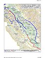
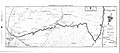 Bakersfield to Little Lake route 1959.jpg 2,793 × 1,240; 807 KB
-
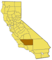 California map showing Kern County.png 200 × 231; 22 KB
-
 California mineral production for 1920, with county maps (1921) (14761907204).jpg 3,104 × 1,796; 649 KB
-
 California State Route 178.svg 1,152 × 640; 80 KB
-
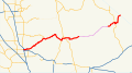
 California State Route 58.svg 1,152 × 640; 409 KB
-
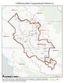
 California US Congressional District 23 (since 2013).tif 2,016 × 998; 2.93 MB
-
 Canebrake Ecological Reserve map.jpg 926 × 556; 143 KB
-

-
 CA 21 certified.pdf 1,275 × 1,650; 1.04 MB
-
 California US Congressional District 21 (since 2013).tif 2,016 × 998; 3.1 MB
-
 CVPSouthernCanalsUSBR.jpg 1,224 × 1,584; 1.58 MB
-
 EdisonLoc.jpg 3,300 × 2,550; 1.13 MB
-
 IDSM Proposed Fixes.jpg 259 × 194; 11 KB
-
 Isabella Recreation Sites.jpg 510 × 475; 36 KB
-

-

-
-

-

-

-

-

-

-

-

-

-

-

-

-

-

-
-

-
-

-

-

-

-

-

-

-

-
-

-

-

-

-

-

-
-

-

-

-

-

-

-

-

-

-

-

-

-

-

-

-

-

-

-

-

-

-

-

-
 Kern County Map, 1877.png 1,652 × 2,032; 2.76 MB
-
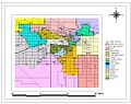
 Kern County, California – Map (cropped).png 4,855 × 2,300; 11.33 MB
-
 Kern County, California – Map.pdf 2,479 × 1,752; 1.86 MB
-
 Kern County, California – Map.png 6,614 × 4,677; 26.29 MB
-
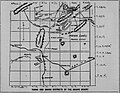
 Kern River Preserve and area map.jpg 924 × 1,164; 245 KB
-
 KernFrontOilField.jpg 3,300 × 2,550; 1.23 MB
-
 KernRiver.jpg 3,300 × 2,550; 796 KB
-
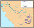 KernRiverMap.png 758 × 610; 92 KB
-
 Los Angeles Aqueduct Map.png 1,357 × 1,900; 4.62 MB
-
 Map and Profile of the Tejon Pass - NARA - 100305651.jpg 11,678 × 7,916; 11.88 MB
-
 Map of central California with Cymric Oil Field.jpg 3,300 × 2,550; 1.12 MB
-
 Map of the Kern Delta, Kern County, California LOC 2012590100.jpg 8,209 × 6,626; 8.91 MB
-
 Midway-Sunset Oil Field map.jpg 2,732 × 2,276; 1.66 MB
-
 MountainViewLoc.jpg 3,300 × 2,550; 1.11 MB
-
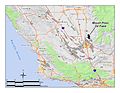 MountPoso.jpg 2,200 × 1,700; 640 KB
-
 Proposed 2003.jpg 1,023 × 806; 186 KB
-

-
 RoundMountain.jpg 3,300 × 2,550; 1.23 MB
-
 SemitropicLoc.jpg 3,300 × 2,550; 1.18 MB
-
 Sierra Highway.svg 576 × 672; 1.77 MB
-
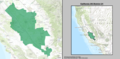
 California SD-16 (2011).svg 1,450 × 1,680; 55 KB
-
 Towns and Mining Districts of the Mojave Desert 1897.jpg 2,538 × 1,973; 1.32 MB
-
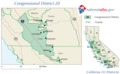 CA-20th.png 650 × 399; 36 KB
_(16049395914).jpg)
_(16670695172).jpg)


_(14761907204).jpg)


_(20583001735).jpg)


.png)


.jpg)


.svg)

