Category:Maps of Ventura County, California
Jump to navigation
Jump to search
Counties of California: Alameda · Alpine · Amador · Butte · Calaveras · Colusa · Contra Costa · Del Norte · El Dorado · Fresno · Glenn · Humboldt · Imperial · Inyo · Kern · Kings · Lake · Lassen · Los Angeles · Madera · Marin · Mariposa · Mendocino · Merced · Modoc · Mono · Monterey · Napa · Nevada · Orange · Placer · Plumas · Riverside · Sacramento · San Benito · San Bernardino · San Diego · San Joaquin · San Luis Obispo · San Mateo · Santa Barbara · Santa Clara · Santa Cruz · Shasta · Sierra · Siskiyou · Solano · Sonoma · Stanislaus ·Sutter · Tehama · Trinity · Tulare · Tuolumne · Ventura · Yolo · Yuba – Consolidated city-county: San Francisco
Wikimedia category | |||||
| Upload media | |||||
| Instance of | |||||
|---|---|---|---|---|---|
| Category combines topics | |||||
| Ventura County | |||||
county in California, United States of America | |||||
| Instance of | |||||
| Named after | |||||
| Location | California, Pacific States Region | ||||
| Capital | |||||
| Inception |
| ||||
| Population |
| ||||
| Area |
| ||||
| official website | |||||
 | |||||
Subcategories
This category has the following 3 subcategories, out of 3 total.
Media in category "Maps of Ventura County, California"
The following 58 files are in this category, out of 58 total.
-
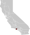
Map of California highlighting Ventura County.svg 916 × 1,054; 151 KB
-
California county map (Ventura County highlighted).svg 621 × 733; 503 KB
-
California County of Ventura.png 891 × 615; 2 KB
-
1905 map of Lyons or Lyons Springs Ventura County California.jpg 958 × 1,229; 376 KB
-
2017 12 11-08.57.46.111-CST.jpg 7,200 × 5,400; 17.28 MB
-
Anacapa Island LCCN2003687597.jpg 9,917 × 7,894; 6.29 MB
-
Anacapa-island-nps-map.PNG 603 × 266; 9 KB
-
Anacapaislandmap.png 700 × 500; 487 KB
-
Border between Los Angeles County and Ventura County.jpg 1,540 × 2,179; 1,018 KB
-
California US Congressional District 25 (since 2013).tif 2,016 × 998; 2.69 MB
-
CA 25 certified.pdf 1,275 × 1,650; 1.07 MB
-
CA-24th.png 659 × 399; 37 KB
-
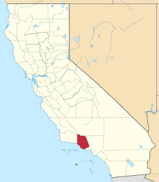
California map showing Ventura County.png 200 × 231; 22 KB
-
California US Congressional District 26 (since 2013).tif 2,016 × 998; 2.59 MB
-
California US Congressional District 26 (since 2013)a.tif 1,045 × 998; 1.34 MB
-
California US Congressional District 26 (since 2013)b.tif 683 × 822; 1,017 KB
-
Cart-Oxnard-de-nos-jours.jpg 400 × 510; 73 KB
-
LocMap Channel Islands National Park.png 280 × 183; 31 KB
-
COSCA-Open-Space-by-Name-2017-06.svg 1,530 × 990; 1.56 MB
-
DickSmithWildernessLocMap.jpg 1,583 × 1,245; 1.56 MB
-
Metrolink system diagram.svg 2,020 × 1,420; 1,007 KB
-
Production and use of petroleum in California (1904) (14741683706).jpg 4,026 × 1,477; 546 KB
-
Santa-barbara-island-nps-map.PNG 485 × 425; 16 KB
-
Southern Pacific LA access.png 1,650 × 950; 1.09 MB
-
Ssfl cdc atsdr figure1.gif 701 × 531; 158 KB
-
California SD-27 (2011).svg 1,450 × 1,680; 55 KB
-
Ventura County districts map.png 1,700 × 1,700; 613 KB
-
Ventura County Region source file.svg 850 × 850; 992 KB
-
Ventura County Region.png 880 × 680; 62 KB
-
Ventura Freeway.svg 1,152 × 640; 235 KB
