Category:Maps of boroughs of Alaska
Jump to navigation
Jump to search
States of the United States: Alabama · Alaska · Arizona · Arkansas · California · Colorado · Connecticut · Delaware · Florida · Georgia · Hawaii · Idaho · Illinois · Indiana · Iowa · Kansas · Kentucky · Louisiana · Maine · Maryland · Massachusetts · Michigan · Minnesota · Mississippi · Missouri · Montana · Nebraska · Nevada · New Hampshire · New Jersey · New Mexico · New York · North Carolina · North Dakota · Ohio · Oklahoma · Oregon · Pennsylvania · Rhode Island · South Carolina · South Dakota · Tennessee · Texas · Utah · Vermont · Virginia · Washington · West Virginia · Wisconsin · Wyoming
| NO WIKIDATA ID FOUND! Search for Maps of boroughs of Alaska on Wikidata | |
| Upload media |
Maps of the Boroughs of Alaska.

Boroughs of Alaska: Aleutians East · Bristol Bay · Denali · Fairbanks North Star · Kenai Peninsula · Ketchikan Gateway · Kodiak Island · Lake and Peninsula · Matanuska-Susitna · North Slope · Northwest Arctic · Petersburg · Skagway · Unorganized · Consolidated city-boroughs: Anchorage · Haines · Juneau · Sitka · Wrangell · Yakutat
Census areas of the Unorganized Borough: Aleutians West · Bethel · Copper River · Dillingham · Hoonah-Angoon · Kusilvak · Nome · Prince of Wales-Hyder · Southeast Fairbanks · Yukon-Koyukuk
Census areas of the Unorganized Borough: Aleutians West · Bethel · Copper River · Dillingham · Hoonah-Angoon · Kusilvak · Nome · Prince of Wales-Hyder · Southeast Fairbanks · Yukon-Koyukuk
Subcategories
This category has the following 21 subcategories, out of 21 total.
Media in category "Maps of boroughs of Alaska"
The following 25 files are in this category, out of 25 total.
-
 Alaska administrative units - ru.svg 1,768 × 975; 179 KB
-
 Alaska blank borough map.svg 463 × 267; 45 KB
-
 Alaska boroughs and census areas 1997-2007.png 720 × 392; 25 KB
-
 Alaska boroughs and census areas 2008-13.svg 885 × 500; 278 KB
-
 Alaska boroughs and census areas 2013-19.svg 816 × 461; 334 KB
-
 Alaska boroughs and census areas 2019.svg 2,563 × 1,344; 1.57 MB
-
 Alaska boroughs and census areas in color.png 356 × 262; 8 KB
-
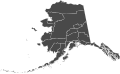
 Alaska boroughs and census areas map.png 816 × 461; 77 KB
-
 Alaska boroughs and census areas, blank.svg 800 × 488; 1.67 MB
-
-
 Alaska boroughs timeline.gif 1,000 × 545; 154 KB
-
 Alaska Counties.jpg 1,584 × 1,224; 345 KB
-
 Alaska divided for stubs revised.png 955 × 541; 45 KB
-
 Blank map subdivisions Alaska.svg 257 × 168; 32 KB
-
 Fictional Alaska 2016.png 6,900 × 4,275; 961 KB
-
 Interior Alaska Stub.png 800 × 423; 62 KB
-
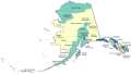
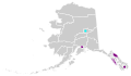
 Map of Alaska highlighting Skagway-Yakutat-Angoon Census Area.svg 1,470 × 777; 399 KB
-
 Map of Alaska.png 300 × 186; 5 KB
-

-
 Northern Alaska locator map.png 800 × 423; 63 KB
-
 Population density of Alaska boroughs and census areas (2020).png 5,666 × 3,846; 956 KB
-
 Southcentral Alaska Stub.png 800 × 423; 63 KB
-
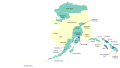
 Southeast Alaska Map.png 800 × 423; 75 KB
-
 Southwest Alaska Stub.png 800 × 423; 64 KB
-
 Stout02.png 500 × 272; 58 KB


.png)


