Category:Maps of Hoonah-Angoon Census Area, Alaska
Jump to navigation
Jump to search
Boroughs of Alaska: Aleutians East · Bristol Bay · Denali · Fairbanks North Star · Kenai Peninsula · Ketchikan Gateway · Kodiak Island · Lake and Peninsula · Matanuska-Susitna · North Slope · Northwest Arctic · Petersburg · Skagway · Unorganized · Consolidated city-boroughs: Anchorage · Haines · Juneau · Sitka · Wrangell · Yakutat
Census areas of the Unorganized Borough: Aleutians West · Bethel · Copper River · Dillingham · Hoonah-Angoon · Kusilvak · Nome · Prince of Wales-Hyder · Southeast Fairbanks · Yukon-Koyukuk
Census areas of the Unorganized Borough: Aleutians West · Bethel · Copper River · Dillingham · Hoonah-Angoon · Kusilvak · Nome · Prince of Wales-Hyder · Southeast Fairbanks · Yukon-Koyukuk
| NO WIKIDATA ID FOUND! Search for Maps of Hoonah-Angoon Census Area, Alaska on Wikidata | |
| Upload media |
Media in category "Maps of Hoonah-Angoon Census Area, Alaska"
The following 8 files are in this category, out of 8 total.
-
 AKMap-doton-CubeCove.PNG 300 × 186; 7 KB
-
 AKMap-doton-ElfinCove.PNG 300 × 186; 7 KB
-
 AKMap-doton-GameCreek.PNG 300 × 186; 7 KB
-
 AKMap-doton-Gustavus.PNG 300 × 186; 7 KB
-
 AKMap-doton-Pelican.PNG 300 × 186; 7 KB
-
 AKMap-doton-WhitestoneLoggingCamp.PNG 300 × 186; 7 KB
-
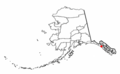
 Map of Alaska highlighting Hoonah-Angoon Census Area.svg 1,470 × 777; 644 KB
-
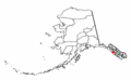
 Map of Alaska highlighting Skagway-Hoonah-Angoon Census Area.svg 1,470 × 777; 644 KB


