Category:Maps of Cornwall
Jump to navigation
Jump to search
Ceremonial counties of England: Bedfordshire · Berkshire · Buckinghamshire · Cambridgeshire · Cheshire · Cornwall · Cumbria · Derbyshire · Devon · Dorset · Durham · East Riding of Yorkshire · East Sussex · Essex · Gloucestershire · Greater London · Greater Manchester · Hampshire · Herefordshire · Hertfordshire · Isle of Wight · Kent · Lancashire · Leicestershire · Lincolnshire · Merseyside · Norfolk · North Yorkshire · Northamptonshire · Northumberland · Nottinghamshire · Oxfordshire · Rutland · Shropshire · Somerset · South Yorkshire · Staffordshire · Suffolk · Surrey · Tyne and Wear · Warwickshire · West Midlands · West Sussex · West Yorkshire · Wiltshire · Worcestershire
City-counties: Bristol · City of London
Former historic counties: Cumberland · Huntingdonshire · Middlesex · Sussex · Westmorland · Yorkshire
Other former counties: Cleveland · Humberside · Isle of Ely ·
City-counties: Bristol · City of London
Former historic counties: Cumberland · Huntingdonshire · Middlesex · Sussex · Westmorland · Yorkshire
Other former counties: Cleveland · Humberside · Isle of Ely ·
Wikimedia category | |||||
| Upload media | |||||
| Instance of | |||||
|---|---|---|---|---|---|
| Category combines topics | |||||
| Cornwall | |||||
historic county of England; Celtic nation | |||||
| Instance of | |||||
| Part of | |||||
| Location |
| ||||
| Capital | |||||
| Heritage designation | |||||
| Population |
| ||||
| Area |
| ||||
| Different from | |||||
| official website | |||||
 | |||||
Subcategories
This category has the following 12 subcategories, out of 12 total.
!
*
D
E
G
- Geological maps of Cornwall (14 F)
L
M
- Maps of Camborne (1 F)
- Maps of hundreds of Cornwall (35 F)
O
T
Media in category "Maps of Cornwall"
The following 90 files are in this category, out of 90 total.
-
Flag-map of Cornwall.svg 1,000 × 950; 12 KB
-
2018-01-01-00 00 2018-01-01-23 59 CORINE Land Cover Corine Land Cover (25).jpg 1,024 × 528; 173 KB
-
Aberplymm Mappa.png 258 × 174; 35 KB
-
Algal bloom 20040615.jpg 2,800 × 2,200; 374 KB
-
AONB within Cornwall map.svg 1,224 × 1,187; 1.36 MB
-
Arwenack Falmouth Cornwall Map.PNG 263 × 234; 10 KB
-
BassettSeatsMap.jpg 983 × 854; 164 KB
-
Bude canal.gif 1,400 × 2,026; 95 KB
-
Celtic countries.svg 547 × 979; 242 KB
-
CelticNationsMap.jpg 464 × 678; 58 KB
-
Coccoliths in the Celtic Sea-NASA.jpg 1,362 × 1,509; 268 KB
-
Cornish Constituencies 1832-1868.svg 166 × 113; 84 KB
-
Cornish language shift.svg 1,205 × 970; 41 KB
-
Cornish Language Shift.svg 1,263 × 1,003; 131 KB
-
Cornish National Identity 2011 Census.png 18,793 × 17,495; 9.44 MB
-
Cornish Riviera.jpg 2,849 × 2,250; 1.4 MB
-
Cornwal1832Map.png 2,000 × 1,643; 302 KB
-
Cornwall AONB locator map.svg 1,648 × 2,000; 1.07 MB
-
Cornwall Community Network Areas.svg 1,000 × 950; 191 KB
-
Cornwall map mural on side of Threemilestone Social Club, Cornwall - June 2022.jpg 3,797 × 2,881; 2.41 MB
-
Cornwall map small.png 331 × 315; 27 KB
-
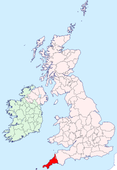
Cornwall outline map with UK (1974 - 2009).png 1,351 × 1,069; 149 KB
-
Cornwall outline map with UK (2009).png 1,351 × 1,069; 80 KB
-
Cornwall outline map with UK.png 1,351 × 1,069; 121 KB
-
Cornwall UK district map (blank).svg 1,425 × 1,048; 1.1 MB
-
Cornwall UK district map (numbered).svg 1,425 × 1,048; 1.1 MB
-
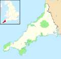
Cornwall UK location map placenames.png 1,425 × 1,048; 345 KB
-
Cornwall UK location map.svg 1,425 × 1,048; 1.66 MB
-
Cornwall white.svg 1,000 × 950; 26 KB
-
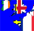
Cornwall-Flagmap.svg 749 × 547; 848 KB
-
Cornwall-NASA-250.jpg 609 × 612; 91 KB
-
CornwallConstituencies2010.gif 1,200 × 1,116; 35 KB
-
CornwallKernowMappa.png 952 × 698; 167 KB
-
CornwallKernowMappa.svg 1,120 × 840; 1.71 MB
-
CornwallMap2.png 700 × 526; 43 KB
-
CornwallMapOfParishesOnTheLizard.gif 1,000 × 925; 31 KB
-
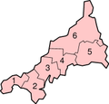
CornwallNumbered.png 200 × 191; 12 KB
-
CornwallScillyNumbered.png 300 × 208; 13 KB
-
Degibna Information Board.jpg 3,024 × 4,032; 4.27 MB
-
Devon and Cornwall UK PCC election 2024.svg 877 × 598; 1.61 MB
-
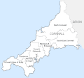
Divisions of Cornwall.png 682 × 532; 78 KB
-
Dowrgleudh Kesunyans Lyskerrys ha Logh.gif 1,458 × 2,166; 130 KB
-
Bretagnes.png 1,043 × 929; 30 KB
-
Godrevy Cornwall map.png 1,266 × 973; 63 KB
-
Godrevy Island map.png 418 × 357; 8 KB
-
Happy Easter (10 years of IPlymouth competitions).jpg 2,437 × 1,772; 1.28 MB
-
Cornwall Hundreds.svg 1,000 × 729; 1.53 MB
-
Isles of Scilly OS map.png 840 × 563; 59 KB
-
Kernow Hundreds.png 821 × 532; 52 KB
-
Kernow lb.png 380 × 304; 27 KB
-
Map of Celtic Nations (alternate).svg 675 × 1,300; 90 KB
-
Map of Celtic Nations-flag shades.svg 675 × 1,300; 173 KB
-
Map of Celtic Nations.svg 675 × 1,300; 97 KB
-
Map of Cornwall.png 1,058 × 945; 81 KB
-
MapOfRiverCamelCornwallUK.jpg 1,000 × 924; 106 KB
-
Mappa an Mor Keltek.png 431 × 719; 24 KB
-
MapRiversSoutheastCornwallUK.gif 600 × 630; 30 KB
-
Medieval Deaneries of Cornwall.png 736 × 532; 34 KB
-
Mounts Bay lifeboat stations.png 1,507 × 1,130; 192 KB
-
NNRs within Cornwall map.svg 1,224 × 1,187; 1.13 MB
-
Ordnance Survey 1-250000 - SS.jpg 4,000 × 4,000; 4.77 MB
-
Ordnance Survey 1-250000 - SW.jpg 4,000 × 4,000; 2.5 MB
-
Ordnance Survey 1-250000 - SX.jpg 4,000 × 4,000; 5.25 MB
-
Porthcurno Valley map (August 2020).jpg 3,024 × 4,032; 2.46 MB
-
River Inny map.png 1,510 × 881; 402 KB
-
River Kensey map.png 1,517 × 837; 218 KB
-
River Lynher map.png 1,343 × 1,508; 831 KB
-
River Ottery map.png 1,518 × 859; 334 KB
-
River Tamar map.png 1,503 × 1,882; 2.08 MB
-
River Tiddy map.png 929 × 1,508; 310 KB
-
Rumps Point, naufragi del Maria Asumpta 1995 05 30.png 1,252 × 921; 448 KB
-
Sancreed Beacon Information Board.jpg 3,024 × 4,032; 3.08 MB
-
Shires of Cornwall.png 682 × 532; 21 KB
-
SketchMapOfSlaughterbridgeCornwallUk.jpg 2,244 × 1,179; 177 KB
-
South east Cornish Rivers Kernoweg.gif 571 × 600; 62 KB
-
South West England route map.png 451 × 323; 69 KB
-
Southcroftylocatormap.png 300 × 268; 59 KB
-
Southwest Cornwall UK location map.svg 1,425 × 871; 662 KB
-
Southwest Cornwall.png 1,247 × 766; 863 KB
-
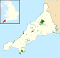
SSSIs within Cornwall map.svg 1,224 × 1,187; 1.78 MB
-
St. Michael’s Mount map 01.jpg 3,496 × 2,017; 1.48 MB
-
StAustellCornwallNewParishes.gif 839 × 1,200; 42 KB
-
Steuziadur ar c'herneveureg.png 2,560 × 2,033; 257 KB
-
Stivesbaymap.gif 450 × 424; 13 KB
-
The Carracks map.png 368 × 353; 11 KB
-
West Cornwall with Scilly.png 1,064 × 636; 279 KB
-
WestcountryCheddar-Counties.svg 611 × 787; 148 KB
-
White Downs information board (01).jpg 3,024 × 4,032; 5.47 MB
-
White Downs information board (02).jpg 3,024 × 4,032; 4.79 MB


