Category:Maps of Greater Manchester
Appearance
Wikimedia category | |||||
| Upload media | |||||
| Instance of | |||||
|---|---|---|---|---|---|
| Category combines topics | |||||
| Greater Manchester | |||||
metropolitan county in North West England | |||||
| Instance of |
| ||||
| Location | North West England, England | ||||
| Head of government |
| ||||
| Inception |
| ||||
| Population |
| ||||
| Area |
| ||||
| Different from | |||||
 | |||||
Subcategories
This category has the following 9 subcategories, out of 9 total.
Media in category "Maps of Greater Manchester"
The following 70 files are in this category, out of 70 total.
-
Greater Manchester UK locator map 2010.svg 1,108 × 1,345; 302 KB
-
African Greater Manchester 2011 census.png 23,870 × 17,493; 17.72 MB
-
Arab Greater Manchester 2011 census.png 23,790 × 17,435; 17.49 MB
-
Ashton Canal Map.png 982 × 1,254; 1.86 MB
-
Asian Greater Manchester 2011 census.png 23,790 × 17,434; 27.75 MB
-
Bangladeshi Greater Manchester 2011 census.png 23,870 × 17,493; 27.11 MB
-
Black Greater Manchester 2011 census.png 23,790 × 17,434; 25.56 MB
-
Bridgewater Canal map.png 1,582 × 1,072; 2.14 MB
-
British Greater Manchester 2011 census.png 23,791 × 17,434; 24.65 MB
-
Buddhism Greater Manchester 2011 census.png 23,870 × 17,493; 28.77 MB
-
Caribbean Greater Manchester 2011 census.png 23,948 × 17,551; 27.44 MB
-
Chinese Greater Manchester 2011 census.png 23,949 × 17,551; 28.05 MB
-
Christianity Greater Manchester 2011 census.png 23,790 × 17,435; 26.88 MB
-
England Greater Manchester numbered.svg 414 × 308; 9 KB
-
England Greater Manchester.svg 414 × 308; 8 KB
-
England Police Forces (Greater Manchester).svg 1,108 × 1,345; 312 KB
-
EnglandGreaterManchester Numbered.PNG 200 × 151; 13 KB
-
EnglandGreaterManchester.PNG 200 × 247; 17 KB
-
EnglandPoliceGreaterManchester.png 2,165 × 2,670; 87 KB
-
GMBUA2011.png 1,200 × 1,000; 378 KB
-
Greater Manchester & Warrington population density map, 2011 census.png 4,727 × 3,324; 14.96 MB
-
Greater Manchester 2011 Census Kurdish ethnicity.svg 1,425 × 993; 864 KB
-
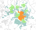
Greater Manchester Boroughs and Conurbation.png 1,280 × 893; 118 KB
-
Greater Manchester County (2).png 3,358 × 2,443; 620 KB
-
Greater Manchester County (3) - no key.png 3,358 × 2,443; 674 KB
-
Greater Manchester County (3).png 3,358 × 2,443; 713 KB
-
Greater Manchester County - no key - greyscale.png 3,358 × 2,443; 340 KB
-
Greater Manchester County - reduced colour.png 3,358 × 2,443; 674 KB
-
Greater Manchester County numbered.png 3,358 × 2,443; 627 KB
-
Greater Manchester County.png 3,358 × 2,443; 687 KB
-
Greater Manchester County.svg 691 × 503; 838 KB
-
Greater Manchester Lieutenancy area.png 1,821 × 3,089; 995 KB
-
Greater Manchester numbered districts.svg 1,425 × 993; 684 KB
-
Greater Manchester outline map with England, G-Man.png 800 × 558; 337 KB
-
Greater Manchester outline map.png 1,280 × 893; 623 KB
-
Greater Manchester UK constituency map (blank).svg 1,425 × 993; 1.03 MB
-
Greater Manchester UK district map (blank).svg 1,425 × 993; 860 KB
-
Greater Manchester UK location map 2.svg 1,425 × 993; 1.73 MB
-
Greater Manchester UK location map.svg 1,425 × 993; 1.49 MB
-
Greater Manchester UK parish map (blank).svg 1,425 × 993; 963 KB
-
Greater Manchester UK relief location map.jpg 1,999 × 1,393; 332 KB
-
Greater Manchester UK ward map (blank).svg 1,425 × 993; 1.79 MB
-
Greater Manchester Urban Area 2001.png 800 × 558; 428 KB
-
Greater Manchester Urban Area 2001.svg 1,425 × 993; 1.97 MB
-
Greater Manchester with former districts.png 3,550 × 2,474; 789 KB
-
GreaterManchesterEnglishCounties1974.png 2,165 × 2,670; 94 KB
-
Hinduism Greater Manchester 2011 census.png 23,870 × 17,493; 27.85 MB
-
Indian Greater Manchester 2011 census.png 23,790 × 17,435; 27.94 MB
-
Irish Greater Manchester 2011 census.png 23,790 × 17,435; 28.27 MB
-
LiverpoolManchesterMegalopolis2011.png 1,217 × 850; 1.86 MB
-
Location map Manchester.jpg 2,043 × 1,931; 1.31 MB
-
M61 motorway junctions map.svg 409 × 500; 1.93 MB
-
Manchester City Region.png 2,766 × 2,053; 423 KB
-
Manchester Congestion Charge.png 2,000 × 1,394; 1.13 MB
-
Manchester OSM 01.png 776 × 863; 1.26 MB
-
Manchester OSM 02.png 776 × 863; 1.68 MB
-
Manchester Ship Canal Landsat.jpg 605 × 441; 462 KB
-
Manchester Telephone Exchange names, 1965.jpg 2,362 × 1,604; 3.5 MB
-
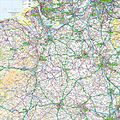
Ordnance Survey 1-250000 - SD.jpg 4,000 × 4,000; 7.12 MB
-
Ordnance Survey 1-250000 - SE.jpg 4,000 × 4,000; 8.57 MB
-
Ordnance Survey 1-250000 - SJ.jpg 4,000 × 4,000; 9.38 MB
-
Ordnance Survey Quarter-inch sheet 10 North Wales and Lancashire, published 1957.jpg 9,689 × 8,871; 8.96 MB
-
Parishes of Greater Manchester.png 800 × 558; 489 KB
-
Salford hundred map.png 2,000 × 1,966; 449 KB
-
Salfordshire.png 680 × 534; 417 KB
-
Turnpikes of greater manchester.svg 7,744 × 7,695; 54 KB
-
WiganBUA.png 1,618 × 850; 1.82 MB
-
Worsley Braided Interchange map.svg 620 × 731; 98 KB
-
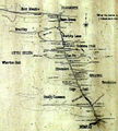
Worsley mine tunnel map.jpg 866 × 959; 205 KB
-
WP-GM-LOGO3.png 1,280 × 893; 426 KB


