Category:Maps of Bristol
Jump to navigation
Jump to search
Wikimedia category | |||||
| Upload media | |||||
| Instance of | |||||
|---|---|---|---|---|---|
| Category combines topics | |||||
| Bristol | |||||
city in South West England, United Kingdom    | |||||
| Instance of |
| ||||
| Location |
| ||||
| Located in or next to body of water | |||||
| Official language | |||||
| Head of government |
| ||||
| Inception |
| ||||
| Significant event |
| ||||
| Population |
| ||||
| Area |
| ||||
| Elevation above sea level |
| ||||
| Different from | |||||
| official website | |||||
 | |||||
Subcategories
This category has the following 7 subcategories, out of 7 total.
Media in category "Maps of Bristol"
The following 106 files are in this category, out of 106 total.
-
 99Bristol outline map with UK.png 702 × 780; 170 KB
-
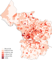
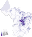 African Bristol 2011 census.png 15,277 × 17,428; 10.68 MB
-
 Arab Bristol 2011 census.png 15,327 × 17,487; 10.83 MB
-
 Asian Bristol 2011 census.png 15,378 × 17,544; 10.9 MB
-
 Avon 1974 Numbered.png 200 × 175; 4 KB
-
 Avon UK constituency map (blank).svg 1,425 × 1,241; 1.13 MB
-
 Avon UK district map (blank).svg 1,425 × 1,241; 1,003 KB
-
 Avon UK parish map (blank).svg 1,425 × 1,241; 1.91 MB
-
 Avon UK ward map (blank).svg 1,425 × 1,241; 1.85 MB
-
 Bangladeshi Bristol 2011 census.png 15,327 × 17,487; 10.75 MB
-
 Black Bristol 2011 census.png 15,328 × 17,487; 10.26 MB
-
 Bristol ag csb map.png 538 × 372; 78 KB
-
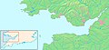
 Bristol channel detailed map.png 600 × 276; 47 KB
-
 Bristol East, Bristol UK constituency map.svg 1,138 × 1,266; 597 KB
-
 Bristol in England (special marker).svg 816 × 991; 1.32 MB
-
 Bristol in England.svg 816 × 991; 1.32 MB
-
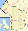
 Bristol in the UK.png 325 × 485; 40 KB
-
 Bristol North West, Bristol UK constituency map.svg 1,138 × 1,266; 597 KB
-
 Bristol outline map with UK.png 540 × 600; 170 KB
-
 Bristol outline.png 702 × 780; 65 KB
-
 Bristol rivers roads.png 702 × 780; 142 KB
-
 Bristol Shipyards - Abels.png 1,026 × 471; 98 KB
-
 Bristol Shipyards - Francis Baylie 2.png 1,026 × 471; 78 KB
-
 Bristol Shipyards - Greens 2.PNG 1,026 × 471; 79 KB
-
 Bristol Shipyards - Hilhouse.png 1,026 × 471; 81 KB
-
 Bristol Shipyards with William Patterson shown.png 920 × 423; 98 KB
-
 Bristol South, Bristol UK constituency map.svg 1,138 × 1,266; 597 KB
-
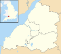
 Bristol UK constituency map (blank).svg 1,138 × 1,266; 597 KB
-
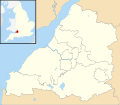
 Bristol UK district map (blank).svg 1,138 × 1,266; 488 KB
-
 Bristol UK location map.svg 1,138 × 1,266; 683 KB
-
 Bristol UK locator map 2010.svg 1,108 × 1,345; 302 KB
-
 Bristol UK relief location map.jpg 2,007 × 2,233; 252 KB
-
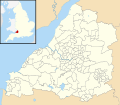
 Bristol UK ward map (blank).svg 1,138 × 1,266; 709 KB
-
 Bristol UK ward map 2016 (blank).svg 1,138 × 1,266; 827 KB
-
 Bristol UK ward map 2016 ashley.png 1,138 × 1,266; 230 KB
-
 Bristol UK ward map 2016 avonmouth lawrence weston.png 1,138 × 1,266; 230 KB
-
 Bristol UK ward map 2016 bedminster.png 1,138 × 1,266; 230 KB
-
 Bristol UK ward map 2016 bishopston ashley down.png 1,138 × 1,266; 230 KB
-
 Bristol UK ward map 2016 bishopsworth.png 1,138 × 1,266; 230 KB
-
 Bristol UK ward map 2016 brislington east.png 1,138 × 1,266; 229 KB
-
 Bristol UK ward map 2016 brislington west.png 1,138 × 1,266; 229 KB
-
 Bristol UK ward map 2016 central.png 1,138 × 1,266; 230 KB
-
 Bristol UK ward map 2016 clifton clifton down.png 1,138 × 1,266; 230 KB
-
 Bristol UK ward map 2016 clifton down.png 1,138 × 1,266; 230 KB
-
 Bristol UK ward map 2016 clifton.png 1,138 × 1,266; 230 KB
-
 Bristol UK ward map 2016 cotham.png 1,138 × 1,266; 230 KB
-
 Bristol UK ward map 2016 easton.png 1,138 × 1,266; 230 KB
-
 Bristol UK ward map 2016 eastville.png 1,138 × 1,266; 230 KB
-
 Bristol UK ward map 2016 filwood.png 1,138 × 1,266; 230 KB
-
 Bristol UK ward map 2016 frome vale.png 1,138 × 1,266; 230 KB
-
 Bristol UK ward map 2016 hartcliffe withywood.png 1,138 × 1,266; 229 KB
-
 Bristol UK ward map 2016 henbury brentry.png 1,138 × 1,266; 230 KB
-
 Bristol UK ward map 2016 hengrove whitchurch park.png 1,138 × 1,266; 230 KB
-
 Bristol UK ward map 2016 hillfields.png 1,138 × 1,266; 230 KB
-
 Bristol UK ward map 2016 horfield.png 1,138 × 1,266; 230 KB
-
 Bristol UK ward map 2016 hotwells.png 1,138 × 1,266; 230 KB
-
 Bristol UK ward map 2016 knowle.png 1,138 × 1,266; 230 KB
-
 Bristol UK ward map 2016 lawrence hill.png 1,138 × 1,266; 230 KB
-
 Bristol UK ward map 2016 lockleaze.png 1,138 × 1,266; 230 KB
-
 Bristol UK ward map 2016 redland.png 1,138 × 1,266; 230 KB
-
 Bristol UK ward map 2016 southmead.png 1,138 × 1,266; 230 KB
-
 Bristol UK ward map 2016 southville.png 1,138 × 1,266; 230 KB
-
 Bristol UK ward map 2016 st george central.png 1,138 × 1,266; 230 KB
-
 Bristol UK ward map 2016 st george troopers hill.png 1,138 × 1,266; 230 KB
-
 Bristol UK ward map 2016 st george west.png 1,138 × 1,266; 230 KB
-
 Bristol UK ward map 2016 stockwood.png 1,138 × 1,266; 230 KB
-
 Bristol UK ward map 2016 stoke bishop.png 1,138 × 1,266; 230 KB
-
 Bristol UK ward map 2016 westbury henleaze.png 1,138 × 1,266; 230 KB
-
 Bristol UK ward map 2016 windmill hill.png 1,138 × 1,266; 230 KB
-
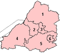
 Bristol wards numbered.png 702 × 780; 163 KB
-
 Bristol wards.png 400 × 444; 75 KB
-
 Bristol West, Bristol UK constituency map.svg 1,138 × 1,266; 597 KB
-
 Bristol-channel-clean-HE.jpg 600 × 276; 167 KB
-
 Bristol-channel-clean.jpg 600 × 276; 139 KB
-
 BristolEastConstituency.svg 200 × 174; 56 KB
-
 BristolNorthWestConstituency.svg 200 × 174; 56 KB
-
 BristolSouthConstituency.svg 200 × 174; 56 KB
-
 BristolWestConstituency.svg 200 × 174; 56 KB
-
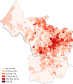
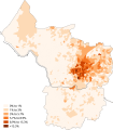
 British Bristol 2011 census.png 15,378 × 17,544; 9.84 MB
-
 Buddhism Bristol 2011 census.png 15,429 × 17,602; 11.04 MB
-
 Caribbean Bristol 2011 census.png 15,329 × 17,487; 10.73 MB
-
 Chinese Bristol 2011 census.png 15,277 × 17,428; 10.73 MB
-
 Christianity Bristol 2011 census.png 15,327 × 17,487; 10.77 MB
-

-
 Edward Colston statue location map.svg 1,024 × 1,024; 2.27 MB
-
 EnglandBristol.png 197 × 244; 32 KB
-
 FiltonBradleyStoke2007Constituency.svg 216 × 189; 118 KB
-
 Fockynggrove map.jpg 3,508 × 2,481; 2.93 MB
-
 Greater bristol basic.png 720 × 566; 44 KB
-
 Greater bristol outline.png 708 × 557; 116 KB
-
 Greater bristol small.png 567 × 323; 69 KB
-
 Greater bristol transport.png 720 × 566; 115 KB
-
 Greater bristol urban.png 720 × 566; 51 KB
-
 Greater bristol with everything.png 720 × 566; 139 KB
-
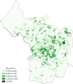
 Hinduism Bristol 2011 census.png 15,378 × 17,544; 10.89 MB
-
 Indian Bristol 2011 census.png 15,278 × 17,429; 10.86 MB
-
 Irish Bristol 2011 census.png 15,277 × 17,428; 10.99 MB
-
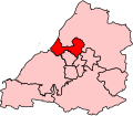
 KingswoodConstituency.svg 200 × 174; 56 KB
-
 Map ashton court.png 599 × 366; 79 KB
-
 Map blaise castle.png 567 × 323; 70 KB
-
 Map bristol downs.png 567 × 323; 70 KB
-
 Map uwe bristol.png 567 × 323; 73 KB
-
 Ordnance Survey 1-250000 - ST.jpg 4,000 × 4,000; 8.92 MB
-
 Sea Mills Garden Suburb, Bristol, 1920 Plan.jpg 709 × 1,043; 638 KB
-
 Ward test map.svg 880 × 1,004; 183 KB
-
 West of England Combined Authority UK map.svg 1,425 × 1,241; 1,003 KB


.svg)


.svg)
.svg)
.svg)
.svg)
.svg)
.svg)
.svg)
.svg)